1980s Maps of Josephine County, Oregon
Explore 49 historic maps of Josephine County from the 1980s. These maps offer a rare glimpse into what life looked like during the 1980s — showing old roads, neighborhoods, homes, and landmarks that have changed or disappeared over time.
Whether you're researching your family's past, planning a metal detecting trip, or studying how Josephine County's landscape evolved across the 1980s, these high-resolution maps are a powerful tool for exploring the history of this region.
- Focus on a specific era: All maps on this page are from the 1980s, giving you a focused view of this time period.
- See what’s changed: Compare century-old streets, trails, and buildings to today's modern landscape using overlays and satellite layers.
- Research with precision: Use these maps for genealogy, historical research, land use analysis, or educational projects.
- View, download, or print: Maps are fully viewable online in high resolution, and can be downloaded or printed for your own records.
Start exploring Josephine County's history through authentic maps from the 1980s. This is your window into the past.
Josephine County, OR maps
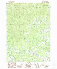
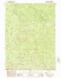
(49)- 1980 Map of Figurehead Mtn, 1981 Print
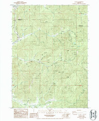
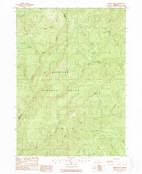
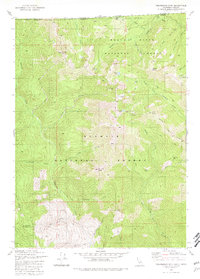 1980 Figurehead Mtn1981 Print · USGSThe high Siskiyou backcountry at the turn of the 1980s is captured here, showing where Oregon and California meet among three national forests. Researchers can trace the remote Baileys Cabin (Site), the Mohawk Mine Gulch, and the Bee Flat Trail.2 unique versions available
 - 1981 Map of Deadman Point
 1981 Deadman Point1981 Print · USGSIn the early 1980s, the Siskiyou County backcountry was a landscape of deep timber and active mineral claims along the Oregon border. Trace the history of remote mountain extraction through sites like the Classic Hill Mine, Huey Mine, and the West Branch FS Station.3 unique versions available
 - 1982 Map of Broken Rib Mtn
 1982 Broken Rib Mtn1982 Print · USGSThe Oregon-California borderlands are captured here in the early eighties, showcasing a wilderness of high peaks and river forks. Researchers can trace the path of the Randolph Collier Tunnel, find the Camp Chicago (Site), and locate remote points like Stevens Camp.2 unique versions available
 - 1982 Map of Polar Bear Mountain
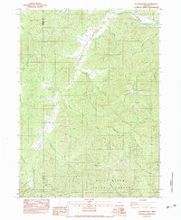
 1982 Polar Bear Mountain1982 Print · USGSThe high Siskiyou mountains straddle the California-Oregon border in the early 1980s, where national forest boundaries meet. Researchers can locate remote mining sites like Orloff Mine and isolated landmarks such as Porters Camp, Sutcliffe Falls, and Polar Bear Mtn.
 - 1982 Map of Shelly Creek Ridge, 1983 Print
 1982 Shelly Creek Ridge1983 Print · USGSThe Oregon and California borderlands come into focus in the early 1980s, where mining history and forest management meet along the Middle Fork Smith River. Researchers can trace the legacy of remote mountain industry at the Holiday Mine, the Monumental (Site), and along the winding Wimer Road.2 unique versions available
 - 1983 Map of Wimer
 1983 Wimer1983 Print · USGSThe rural Jackson County community of Wimer is documented here in the early eighties as a network of creek-side settlements and irrigation works. Researchers can trace land use through features like the Spring Brook Airport, Vroman Ditch, and the Pleasant Creek Forest Station.
 - 1983 Map of Tallowbox Mtn
 1983 Tallowbox Mtn1983 Print · USGSThe high ridges of the Siskiyous come to life in the early 1980s as mining claims and forest boundaries overlap. Trace old workings at the Bone of Contention Mine and Maid of the Mist Mine or locate high-country landmarks like Jim Mee Peak.
 - 1983 Map of Carberry Creek
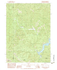 1983 Carberry Creek1983 Print · USGSThe Siskiyou mountain country along the Oregon and California border is documented here in the early 1980s, showcasing a landscape of high ridges and deep mining history. Genealogists and researchers can locate old sites like Steamboat (Site), the Steamboat Mine, and the waters of Applegate Lake.
 - 1983 Map of Applegate
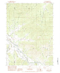 1983 Applegate1983 Print · USGSThe Applegate River valley at the Jackson and Josephine county line reveals a landscape of hydraulic mining and riverside agriculture. Trace the routes of the Laurel Hill Ditch and locate historical sites like the Mountain Lion Mine or Slagle Cem.
 - 1983 Map of King Mountain
 1983 King Mountain1983 Print · USGSThe peaks and drainages of Southern Oregon are recorded here during the early 1980s. Researchers can trace the intersections of three counties while locating features like Onion Spring, Waggoner Gap, and the high point of King Mountain.
 - 1983 Map of Rogue River
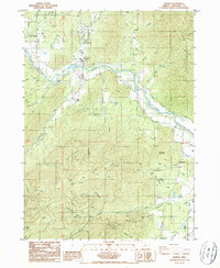
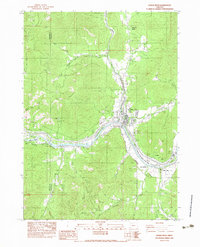 1983 Rogue River1983 Print · USGSThe Rogue River valley in the early eighties shows a landscape shaped by mining and irrigation. Genealogists and historians can trace the river's bend past Fort Birdseye, locate the Shasta Mine, and follow the path of the South Highline Canal.
 - 1983 Map of Happy Camp, 1984 Print
 1983 Happy Camp1984 Print · USGSThe Northern California borderlands and the Klamath River corridor are documented here in the early eighties as a hub of mining and forestry. Researchers can trace historical extraction at the High Plateau Mine and Independence Mine or locate the remote riverside community of Scott Bar.
 - 1986 Map of Merlin
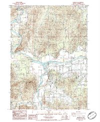
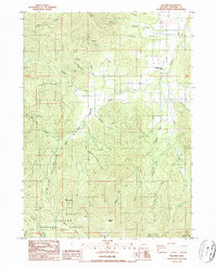
 1986 Merlin1986 Print · USGSJosephine County in the mid-1980s shows a landscape of mountain passes and river valleys during a period of rural development. Researchers can trace the proximity of the Merlin Sanitarium to Merlin or locate industrial sites like the Copper Queen Mine and JOSEPHINE COUNTY AIRPORT.
 - 1986 Map of Wilderville
 1986 Wilderville1986 Print · USGSIn the mid-1980s, the rural valleys of Josephine County centered on the active waters of the Rogue. Researchers can trace the path of the Old Railroad Grade and locate local landmarks such as the Cemetery near Wilderville or the confluence at Applegate River.
 - 1986 Map of Glendale
 1986 Glendale1986 Print · USGSSouthern Oregon's rugged gold-mining and timber country is well-documented in the mid-1980s. Local history researchers can trace old placer operations like Steam Beer Placer, find the Covered Bridge at Sunny Valley, and locate the Cem near Leland.
 - 1986 Map of Sexton Mtn
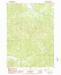
 1986 Sexton Mtn1986 Print · USGSJosephine County in the mid-1980s reveals a high-elevation landscape defined by its mining history and remote settlements. Researchers can trace numerous old workings like the Lucky Queen Mine and Hammersly Mine, or locate former community centers at Winona and Forest Queen.
 - 1986 Map of Oregon Caves
 1986 Oregon Caves1986 Print · USGSThe high Siskiyou Mountains in the mid-1980s reveal a landscape of remote mining claims and protected wilderness. Researchers can trace historic operations like the Gold Dollar Mine and Kester Mine near the Oregon Caves National Monument.
 - 1986 Map of Grants Pass
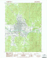 1986 Grants Pass1986 Print · USGSGrants Pass and the Rogue River valley are captured in the mid-1980s, showcasing the transition from industrial mining to a regional residential hub. Researchers can trace the Jewett Mine, explore the County Fairgrounds, or locate the Croxton Pioneer Memorial Park.
 - 1986 Map of Murphy
 1986 Murphy1986 Print · USGSSouthern Oregon's river valleys and mining ridges are detailed here in the mid-1980s, centered on the Applegate River corridor. Genealogists and historians can trace local families near Murphy or locate historic extraction sites like the Oregon Bonanza Mine and Humdinger Mine.
 - 1986 Map of Kerby Peak
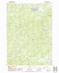
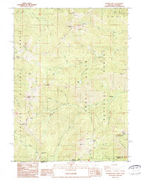
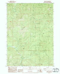 1986 Kerby Peak1986 Print · USGSJosephine County in the mid-eighties was a landscape of deep timber and mountain mining within the Siskiyou National Forest. Researchers can trace old operations like Paradise Mine No 1 or locate the Cedar FS Station and Grayback Campground.
 - 1986 Map of Golden
 1986 Golden1986 Print · USGSJosephine County and the border of Douglas County are documented here in the mid-1980s. Researchers can trace historical mining operations at the Greenback Mine, locate the Cemetery near Placer, and explore old settlements like Golden and Wolf.
 - 1986 Map of Murphy Mtn
 1986 Murphy Mtn1986 Print · USGSJosephine County in the mid-1980s reveals a landscape of industrial history and winding waterways. Researchers can trace the Old Railroad Grade near Cheney Creek and locate landmarks like the Applegate Fish Hatchery Park and Marble Mountain.
 - 1986 Map of Williams
 1986 Williams1986 Print · USGSThe northern reaches of the Siskiyou and Rogue River national forests are documented here during the mid-eighties, centered on the community of Williams. Local history researchers can trace the footprint of the Red Rose Mine, find the Jones Marble Quarry, and locate Caves Camp (Site) along the mountain forks.
 - 1987 Map of Grayback Mountain
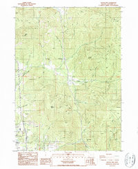
 1987 Grayback Mountain1987 Print · USGSThe Oregon-California borderlands are captured here in the late twentieth century, showing a remote mountain landscape shaped by mining and forestry. Researchers can locate legacy sites like Browntown (Site), the Mountain View Mine, and isolated cabins including Kendall Cabin.
 - 1989 Map of Hobson Horn
 1989 Hobson Horn1989 Print · USGSThe Siskiyou National Forest wilderness is captured in the late eighties as it straddles the Josephine and Curry county line. Researchers can trace remote landmarks such as Buck Camp (Site), the summit of Hobson Horn, and Montana Spring.
Showing maps 1-25 of 49
Top cities of Josephine County
Frequently asked questions
- What are the different types of historical maps available for Josephine County?
- What is the oldest map of Josephine County?
- Where can I purchase historical maps of Josephine County for my home or office?
- Where can I download high-res historical maps of Josephine County?
- Are there historical topographic maps available for Josephine County?
- Is there historical aerial imagery available for Josephine County?
- Where are historical maps of Josephine County sourced from?