Old Maps of Eugene, Oregon for Hiking & Exploration
Hike through history with 38 historic maps of Eugene. Explore old trails, ghost towns, and forgotten backroads — perfect for outdoor adventurers and local explorers.
- Rediscover forgotten places: Map out old mining camps, roads, and footpaths that no longer exist on modern maps.
- Layer with modern tools: Combine with LiDAR or satellite views to plan hikes through historical terrain.
- Made for exploration: Popular among hikers, overlanders, and local history lovers.
Use these maps to find adventure and explore the hidden past of Eugene.
Eugene, OR maps
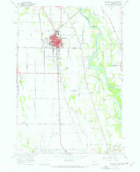
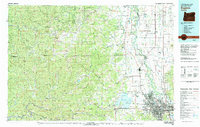
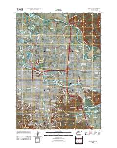
(38)- 1910 Map of Eugene
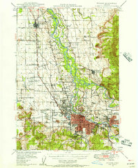
 1910 Eugene1910 Print · USGSThe upper Willamette Valley comes to life in the years before the Great War, centered on the growing campus of the University of Oregon. Genealogists can trace family footprints across dozens of local school districts like Santa Clara and Deadman, or follow the early tracks of the Oregon Electric RR.2 unique versions available
 - 1921 Map of Cottage Grove
 1921 Cottage Grove1921 Print · USGSSouthern Lane County comes alive in this post-World War I survey, showing the valley floor before modern development. Genealogists can locate family homesteads near old schoolhouses like Green Door School or trace the early rail stops at Saginaw and Latham.3 unique versions available
 - 1940 Map of Eugene
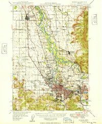
 1940 Eugene1940 Print · USGSThe Willamette Valley at the end of the Great Depression shows a landscape of growing towns and busy rail corridors. Genealogists can locate family-named landmarks like Gillespie Butte School and the I O O F Cemetery.2 unique versions available
 - 1946 Map of Eugene, 1957 Print
 1946 Eugene1957 Print · USGSThe Willamette Valley was a bustling corridor of rail and river commerce just after the war. Researchers can trace the development of Eugene and Springfield, locate family landmarks like the I O O F Cemetery, and follow the path of the Oregon Electric Railroad.2 unique versions available
 - 1949 Map of Eugene
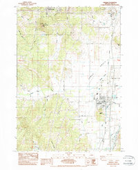
 1949 Eugene1949 Print · USGSThe southern Willamette Valley thrived at mid-century as a rail and aviation hub connecting Junction City and Springfield. Researchers can trace old property lines through local landmarks like Lone Pine Sch and the I O O F Cemetery.
 - 1953 Map of Salem
 1953 Salem1953 Print · USGSMid-century Oregon comes to life through this detailed survey of the Willamette Valley and the adjacent Pacific coastline. Researchers can trace the rail lines of the Southern Pacific RR, visit rural hubs like Fairview School, or locate coastal landmarks like the Yaquina Head Lighthouse.
 - 1954 Map of Salem
 1954 Salem1954 Print · USGSMid-century Western Oregon is centered on the productive Willamette River valley as its cities and infrastructure expand toward the mountains. Genealogists and historians can trace the rail lines of the Southern Pacific RR and Oregon Electric Ry through towns like Dallas, Independence, and Brownsville.
 - 1957 Map of Cottage Grove, 1960 Print
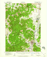 1957 Cottage Grove1960 Print · USGSCottage Grove and the southern Willamette Valley are captured here in the late fifties as timber and rail still drove the local economy. Genealogists and historians can locate numerous rural schoolhouses like Silk Creek School and trace the Southern Pacific line through Saginaw and Latham.2 unique versions available
 - 1958 Map of Roseburg, 1960 Print
 1958 Roseburg1960 Print · USGSThe timber valleys and high volcanic peaks of Southern Oregon are captured here in the late fifties. Researchers can trace the Southern Pacific rail line through historic settlements like Cottage Grove, Yoncalla, and Oakridge near the Cascade Range crest.4 unique versions available
 - 1959 Map of Roseburg
 1959 Roseburg1959 Print · USGSThe Umpqua and Willamette valleys meet the high Cascades in this late-fifties study of Southern Oregon's timber and rail corridors. Genealogists and researchers can trace the Southern Pacific RR through historic towns like Roseburg, Yoncalla, and Cottage Grove.
 - 1960 Map of Salem, 1968 Print
 1960 Salem1968 Print · USGSThe Willamette Valley and the surrounding mountain ranges are shown here in the 1960s during a period of significant reservoir construction. Genealogists and historians can trace rail lines like the Oregon Electric and find communities from Lincoln City on the coast to Sweet Home and Mill City in the foothills.2 unique versions available
 - 1962 Map of Salem
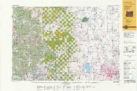
 1962 Salem1962 Print · USGSThe Willamette Valley and the surrounding Oregon ranges are captured here in the early sixties, showing the vital growth of the state's primary agricultural and academic corridor. Researchers can trace the mid-century footprints of Oregon State University and the University of Oregon, alongside rural landmarks like Camp Adair and Black Butte Mine.
 - 1963 Map of Salem
 1963 Salem1963 Print · USGSMid-century Oregon comes into focus as the Willamette Valley’s timber and agricultural industries meet the growing campuses of Oregon State University and the University of Oregon. Researchers can trace old rail lines like the Oregon Electric Railway and locate family plots at Siletz Cem or Dallas Cem.
 - 1967 Map of Eugene East
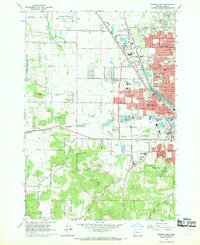
 1967 Eugene East1967 Print · USGSMid-century development transforms the Willamette Valley as the university and suburbs expand across the river plain. Researchers can locate specific sites from the University of Oregon, Autzen Stadium, and the Lane County Fairgrounds.3 unique versions available
 - 1967 Map of Junction City, 1968 Print
 1967 Junction City1968 Print · USGSJunction City and the surrounding Willamette Valley are captured in the late sixties as a vital hub of rail and river commerce. Researchers can trace family history through sites like Milliorn Cem, the Mahlon Sweet Airport, and the rural Wyatt Sch.3 unique versions available
 - 1967 Map of Eugene West, 1969 Print
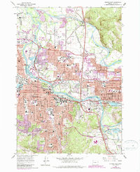
 1967 Eugene West1969 Print · USGSThe western edges of Eugene were rapidly transforming in the late sixties as residential subdivisions began to fill the space between the railroad lines. Researchers can trace mid-century landmarks like the Mahlon Sweet Airport, the Balboa Park Drag Strip, and the historic Oak Hill Cemetery.3 unique versions available
 - 1975 Map of Eugene East, 1979 Print
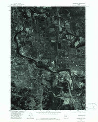 1975 Eugene East1979 Print · USGSMid-seventies Lane County comes into focus in this detailed orthophoto showing the urban development of the upper Willamette Valley. Genealogists and local historians can trace the 1970s footprints of Eugene and Springfield along the Willamette River.
 - 1975 Map of Eugene West, 1980 Print
 1975 Eugene West1980 Print · USGSWestern Lane County is shown mid-growth in the 1970s as urban sprawl begins to meet the valley's agricultural roots. Researchers can trace the layout of Eugene and Santa Clara or study the elevation near Murray Hill.
 - 1979 Map of Cottage Grove
 1979 Cottage Grove1979 Print · USGSThe Oregon timber and rail corridors of the late seventies are documented here, centered on the Coast Fork Willamette River and the growing hub of Cottage Grove. Researchers can trace the path of the Southern Pacific railroad as it connects small stations like Divide, Saginaw, and Yoncalla.2 unique versions available
 - 1980 Map of Eugene
 1980 Eugene1980 Print · USGSThe southern Willamette Valley and Coast Range are captured in the early eighties as the urban centers of Eugene and Springfield expanded. Researchers can trace the legacy of family estates and regional infrastructure through landmarks like Mahlon Sweet Airport, Fern Ridge Lake, and Junction City.
 - 1984 Map of Creswell
 1984 Creswell1984 Print · USGSThe southern Willamette Valley transitions from agricultural flats to the foothills of the Cascades in the early 1980s. Researchers can trace family history at the Moxley Cem, locate rural homesteads along Kuni Rd, and follow the Southern Pacific rail line through Creswell.2 unique versions available
 - 1992 Map of Eugene
 1992 Eugene1992 Print · USGSThe Willamette Valley and Coast Range are captured in the early nineties, showing the growth of Eugene and Springfield. Researchers can trace timber history in the Siuslaw National Forest or locate valley settlements like Junction City and Harrisburg.
 - 2011 Map of Creswell, 2011 Print
 2011 Creswell2011 Print · USGSCovers Eugene, including Creswell, Lane County, and other nearby areas
 - 2011 Map of Eugene East, 2011 Print
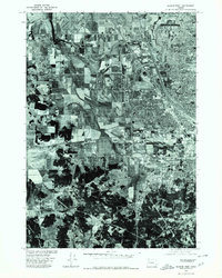
 2011 Eugene East2011 Print · USGSCovers Eugene, including Springfield, Lane County, and other nearby areas
 - 2014 Map of Eugene West, 2014 Print
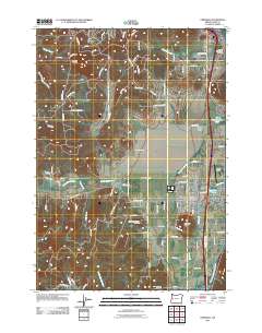
 2014 Eugene West2014 Print · USGSCovers Eugene, including Malabon, Lane County, and other nearby areas
Showing maps 1-25 of 38
Top cities near Eugene
- Springfield historical maps
- Junction City historical maps
- Creswell historical maps
- Veneta historical maps
- Harrisburg historical maps
- Coburg historical maps
See more
Top neighborhoods of Eugene
- Danebo historical maps
- College Hill historical maps
- Santa Clara historical maps
- Bethel historical maps
- North Country Townhouses historical maps
- Chase Commons Safe Sleep Site historical maps
See more
Frequently asked questions
- What are the different types of historical maps available for Eugene?
- What is the oldest map of Eugene?
- Where can I purchase historical maps of Eugene for my home or office?
- Where can I download high-res historical maps of Eugene?
- Are there historical topographic maps available for Eugene?
- Is there historical aerial imagery available for Eugene?
- Where are historical maps of Eugene sourced from?