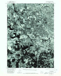
1975 Map of Eugene West
USGS Topo · Published 1980About this map
Santa Clara and the western reaches of Eugene define the urban-to-rural transition of the Willamette Valley in the mid-1970s. This orthophotographic survey provides a visual record of the region’s development, where suburban expansion meets the patterned grids of agriculture. To the northwest, the clear footprint of Mahlon Sweet Airport stands as a focal point for the area's transportation infrastructure. The southern portion of the sheet shifts toward natural elevations, dominated by the rise of Murray Hill. Produced in cooperation with the Soil Conservation Service, this imagery allows for the precise study of land-use patterns, from industrial developments and river drainage systems to the residential growth of Lane County just before the end of the decade.
Find a feature on this map
4 named features on this map. Tap any name to fly to it.
Don’t see what you’re looking for? This feature index may not catch every label — zoom into the map to look around manually.
Map Details
Editions of this 1975 Eugene West Map
This is the sole edition of this map. No revisions or reprints were ever made.
Other maps of this area

1909 · Elmira
USGS Topo · 1:62,500

1910 · Eugene
USGS Topo · 1:62,500

1921 · Cottage Grove
USGS Topo · 1:62,500

1922 · Elmira
USGS Topo · 1:62,500

1940 · Eugene
USGS Topo · 1:62,500

1942 · Elmira
USGS Topo · 1:62,500

1942 · Crow
USGS Topo · 1:62,500

1945 · Crow
USGS Topo · 1:62,500

1946 · Eugene
USGS Topo · 1:62,500

1949 · Eugene
USGS Topo · 1:62,500