Old Maps of Winberry, Oregon for Hiking & Exploration
Hike through history with 11 historic maps of Winberry. Explore old trails, ghost towns, and forgotten backroads — perfect for outdoor adventurers and local explorers.
- Rediscover forgotten places: Map out old mining camps, roads, and footpaths that no longer exist on modern maps.
- Layer with modern tools: Combine with LiDAR or satellite views to plan hikes through historical terrain.
- Made for exploration: Popular among hikers, overlanders, and local history lovers.
Use these maps to find adventure and explore the hidden past of Winberry.
Winberry, OR maps
(11)- 1935 Map of Lowell
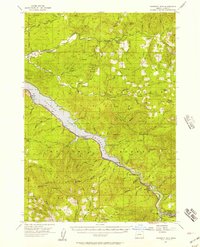
 1935 Lowell1935 Print · USGSIn the mid-1930s, this region of the Willamette foothills was a busy landscape of timber and rail. Researchers can trace rural school districts like Unity Sch, small post offices at Fall Creek PO, and the path of the Southern Pacific railroad.
 - 1942 Map of Lowell
 1942 Lowell1942 Print · USGSThe Willamette River valley and the foothills of the Cascades are captured here before the construction of major dams and reservoirs. Genealogists can trace family locations at the Smithson Homestead, early schools like Unity Sch, and the remote Bohemia Post Office.3 unique versions available
 - 1955 Map of Hardesty Mtn, 1957 Print
 1955 Hardesty Mtn1957 Print · USGSThe Willamette National Forest in the mid-fifties reveals a landscape defined by the newly formed Lookout Point Reservoir and timber operations. Genealogists and historians can trace the rail-side life of Westfir, locate the Westfir HS, or find old forest sites like Black Canyon Camp.3 unique versions available
 - 1958 Map of Roseburg, 1960 Print
 1958 Roseburg1960 Print · USGSThe timber valleys and high volcanic peaks of Southern Oregon are captured here in the late fifties. Researchers can trace the Southern Pacific rail line through historic settlements like Cottage Grove, Yoncalla, and Oakridge near the Cascade Range crest.4 unique versions available
 - 1959 Map of Roseburg
 1959 Roseburg1959 Print · USGSThe Umpqua and Willamette valleys meet the high Cascades in this late-fifties study of Southern Oregon's timber and rail corridors. Genealogists and researchers can trace the Southern Pacific RR through historic towns like Roseburg, Yoncalla, and Cottage Grove.
 - 1983 Map of Oakridge
 1983 Oakridge1983 Print · USGSThe Cascades of Lane County are shown in the early eighties, centered on the timber and rail corridors of the Willamette. Genealogists and historians can trace the Southern Pacific line through Oakridge or find old mining sites like Mayflower Mine.
 - 1986 Map of Fall Creek Lake
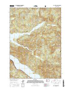
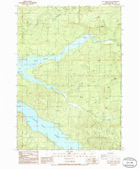 1986 Fall Creek Lake1986 Print · USGSThe western Cascades during the mid-eighties show a landscape defined by timber, power, and recreation. Follow the development of Fall Creek Lake and find local landmarks like Deer Ranch, Nelson, and Landax Landing County Park.
 - 1997 Map of Fall Creek Lake, 2001 Print
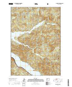
 1997 Fall Creek Lake2001 Print · USGSThe Willamette National Forest landscape of the late nineties centers on the significant reservoirs of the Fall Creek basin. Researchers can trace forest recreation sites and mountain landmarks like Sky Camp, Mount Salem, and the Minnow settlement area.
 - 2017 Map of Fall Creek Lake, 2017 Print
 2017 Fall Creek Lake2017 Print · USGSCovers Winberry, including Lane County, United States, and other nearby areas
 - 2020 Map of Fall Creek Lake, 2020 Print
 2020 Fall Creek Lake2020 Print · USGSCovers Winberry, including Lane County, United States, and other nearby areas
 - 2024 Map of Fall Creek Lake, 2024 Print
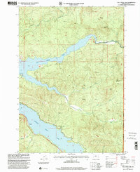
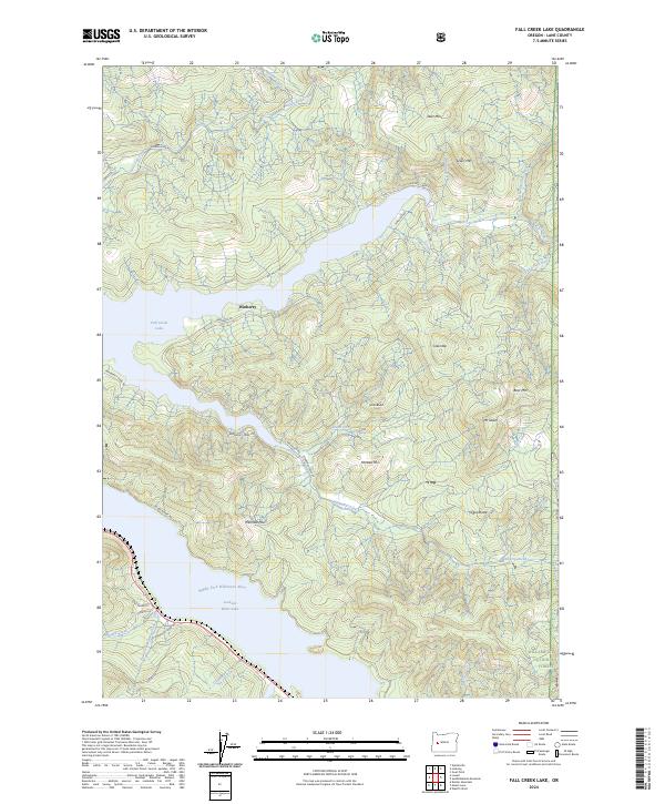 2024 Fall Creek Lake2024 Print · USGSLane County in the 2020s reflects a landscape of major reservoirs and timberlands within the Cascade foothills. Trace the intersections of forestry roads and water bodies from Winberry to landmarks like Fairview Mtn and Fall Creek Lake.
End of results
Showing maps 1-11 of 11
Top cities near Winberry
Frequently asked questions
- What are the different types of historical maps available for Winberry?
- What is the oldest map of Winberry?
- Where can I purchase historical maps of Winberry for my home or office?
- Where can I download high-res historical maps of Winberry?
- Are there historical topographic maps available for Winberry?
- Is there historical aerial imagery available for Winberry?
- Where are historical maps of Winberry sourced from?