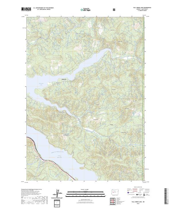
2024 Map of Fall Creek Lake
USGS Topo · Published 2024About this map
Winberry sits as a primary point of reference in this landscape dominated by the managed waters of the Cascade foothills. The area is defined by the significant reservoirs of Fall Creek Lake and Lookout Point Lake, which regulate the Middle Fork Willamette River and its numerous tributaries. These water bodies, along with extensive drainages like Winberry Creek and Little Fall Creek, illustrate a complex hydrological network that has historically shaped local access and industry within the Willamette National Forest.
Find a feature on this map
46 named features on this map. Tap any name to fly to it.
Don’t see what you’re looking for? This feature index may not catch every label — zoom into the map to look around manually.
Map Details
Editions of this 2024 Fall Creek Lake Map
This is the sole edition of this map. No revisions or reprints were ever made.
Other maps of this area

1935 · Lowell
USGS Topo · 1:96,000

1942 · Lowell
USGS Topo · 1:125,000

1950 · Marcola
USGS Topo · 1:62,500

1951 · Leaburg
USGS Topo · 1:62,500

1952 · Marcola
USGS Topo · 1:62,500

1953 · Salem
USGS Topo · 1:250,000

1954 · Salem
USGS Topo · 1:250,000

1955 · Hardesty Mtn
USGS Topo · 1:62,500

1955 · Lowell
USGS Topo · 1:62,500

1958 · Roseburg
USGS Topo · 1:250,000