1920s Maps of Marion County, Oregon
Explore 9 historic maps of Marion County from the 1920s. These maps offer a rare glimpse into what life looked like during the 1920s — showing old roads, neighborhoods, homes, and landmarks that have changed or disappeared over time.
Whether you're researching your family's past, planning a metal detecting trip, or studying how Marion County's landscape evolved across the 1920s, these high-resolution maps are a powerful tool for exploring the history of this region.
- Focus on a specific era: All maps on this page are from the 1920s, giving you a focused view of this time period.
- See what’s changed: Compare century-old streets, trails, and buildings to today's modern landscape using overlays and satellite layers.
- Research with precision: Use these maps for genealogy, historical research, land use analysis, or educational projects.
- View, download, or print: Maps are fully viewable online in high resolution, and can be downloaded or printed for your own records.
Start exploring Marion County's history through authentic maps from the 1920s. This is your window into the past.
Marion County, OR maps
(9)- 1921 Map of Lebanon
 1921 Lebanon1921 Print · USGSLinn County at the dawn of the 1920s reveals a landscape of thriving rural schools and expanding rail lines. Trace family roots and early farmstead locations near Lebanon, Tallman, and the South Santiam River.
 - 1922 Map of Lebanon
 1922 Lebanon1922 Print · USGSLinn County during the early 1920s reveals a landscape of river-fed farms and burgeoning rail towns. Genealogists and historians can locate dozens of country schoolhouses like Cole School and family landmarks such as Ballins Mill and Miller Cemetery.
 - 1923 Map of Mount Angel
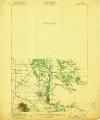
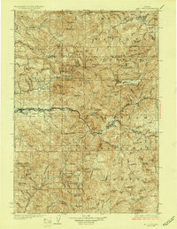
 1923 Mount Angel1923 Print · USGSMarion County in the early twenties is a landscape of thriving rail-towns and rural school districts connected by the Southern Pacific and Oregon Electric. Genealogists can trace early homesteads near Pioneers Cemetery or locate family roots at the US Indian School Chemawa and Belle Passi School.3 unique versions available
 - 1924 Map of Lebanon
 1924 Lebanon1924 Print · USGSLinn County agriculture and rail life are captured here in the early twenties as small communities flourished along the river forks. Researchers can trace the exact locations of many rural schoolhouses like Happy Home School and old mill sites such as Ballins Mill.3 unique versions available
 - 1924 Map of Mc Minnville
 1924 Mc Minnville1924 Print · USGSYamhill County in the mid-twenties shows a thriving landscape of rural schools and river-tied commerce. Researchers can locate family landmarks like Grub College, the Yamhill Locks, and old railroad stops at St Joseph or Whiteson.
 - 1925 Map of Stayton
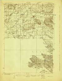
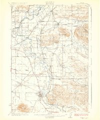
 1925 Stayton1925 Print · USGSMarion County in the mid-1920s reveals a dense network of country schools and state institutions linked by the Southern Pacific railroad. Genealogists and historians can trace the foundations of local communities through landmarks like the State Training School, Victor Point School, and Willard Church.3 unique versions available
 - 1926 Map of Mc Minnville
 1926 Mc Minnville1926 Print · USGSThe mid-Willamette Valley thrived as a rail and river hub in the mid-twenties, centered on the growing town of Mc Minnville. Researchers can trace the era's rural life through dozens of local landmarks, from the Wheatland Ferry to small schoolhouses like Grub College and Zena School.4 unique versions available
 - 1927 Map of Mt. Jefferson, 1956 Print
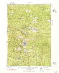 1927 Mt. Jefferson1956 Print · USGSThe Oregon Cascades in the late twenties were defined by high-altitude trails and the early management of the Santiam and Mount Hood forests. Trace the historic Skyline Trail past remote outposts like Lemiti Ranger Sta and the Breitenbush Hot Sprs.2 unique versions available
 - 1929 Map of Mill City
 1929 Mill City1929 Print · USGSThe Oregon Cascades appear here in the late 1920s as a hub of timber, mining, and early forest management. Genealogists and historians can trace the Southern Pacific rail line through Mill City or locate remote sites like the Silver King Mine and Elkhorn School.4 unique versions available
End of results
Showing maps 1-9 of 9
Top cities of Marion County
- Salem historical maps
- Keizer historical maps
- Woodburn historical maps
- Silverton historical maps
- Stayton historical maps
- Mount Angel historical maps
See more
Frequently asked questions
- What are the different types of historical maps available for Marion County?
- What is the oldest map of Marion County?
- Where can I purchase historical maps of Marion County for my home or office?
- Where can I download high-res historical maps of Marion County?
- Are there historical topographic maps available for Marion County?
- Is there historical aerial imagery available for Marion County?
- Where are historical maps of Marion County sourced from?