Old Maps of Marion County, Oregon for Metal Detecting
Plan your next treasure hunt with 327 historic maps of Marion County. Find old homesites, ghost towns, trails, and gathering spots that may be lost to time — perfect for identifying promising metal detecting locations.
- Locate forgotten sites: Uncover places like long-lost settlements, abandoned rail lines, or gathering spots.
- Plan better hunts: Use map overlays combined with LiDAR or satellite views to narrow in on historically rich areas.
- Made for detectorists: Thousands of hobbyists use these maps to discover relics, coins, and hidden history.
Use these historic maps to boost your research and find new opportunities beneath the surface of Marion County.
Marion County, OR maps
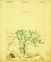
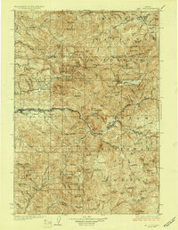
(327)- 1912 Map of Jefferson
 1912 Jefferson1912 Print · USGSThe Willamette Valley at the height of the pre-war rail era shows a landscape of river-bend towns and rural school districts. Genealogists can locate family lands near Millersburg or trace the routes of the Oregon Electric and Corvallis and Eastern railroads.
 - 1913 Map of Wells
 1913 Wells1913 Print · USGSBenton and Polk counties are mapped here before the First World War, showing a Willamette Valley landscape defined by rail-stop settlements and riverside sloughs. Researchers can trace the development of Suver and Granger, or locate the historic State Game Farm and Suver Cem.
 - 1914 Map of Independence
 1914 Independence1914 Print · USGSIn the early twentieth century, the Willamette Valley was a bustling network of river landings and short-line railroads. Trace the routes of the Valley and Siletz RR or locate family sites like Highland School and Buena Vista along the river.
 - 1914 Map of Oregon City
 1914 Oregon City1914 Print · USGSThe Willamette Valley at the start of the twentieth century was a landscape of rapid rail expansion and river-based industry. Researchers can trace early rural life through Wichita School and Lions Mill, or explore the growth of Oswego and Milwaukie.4 unique versions available
 - 1915 Map of Rickreall
 1915 Rickreall1915 Print · USGSPolk County at the start of the Great War reveals a landscape defined by diverging rail lines and early orchards. Genealogists and historians can trace the foundations of Rickreall, locate the old Greenwood School, and follow the Southern Pacific tracks through Gerlinger.
 - 1915 Map of Eola
 1915 Eola1915 Print · USGSThe Willamette Valley at the start of the twentieth century reveals a landscape defined by the growth of Salem and its major state institutions. Researchers can trace early railroad lines like the Oregon Electric Railway and find vanished rural schools including Peanut School and Mountainview School.
 - 1915 Map of Sidney
 1915 Sidney1915 Print · USGSMarion County's riverfront and rail corridors are captured here just before the First World War, showing a landscape of mills and tight-knit rural schools. Researchers can locate stops on the Oregon Electric line and local landmarks like Sidney Mills and Looney Butte.
 - 1916 Map of Tualatin
 1916 Tualatin1916 Print · USGSThe northern Willamette Valley in the mid-1910s is a landscape of orchards and rail spurs, where river ferries still compete with new electric lines. Trace family roots at Champoeg Monument or explore old school sites like Grabel School and St Pauls School.5 unique versions available
 - 1916 Map of Albany
 1916 Albany1916 Print · USGSThe Willamette Valley thrives at a peak of rail and river activity in the early twentieth century. Genealogists and local historians can trace rural school districts like Dixie School, early river crossings such as Fisher Ferry, and the original paths of the Southern Pacific railroad.4 unique versions available
 - 1917 Map of Salem
 1917 Salem1917 Print · USGSThe Willamette Valley at the peak of its rail-and-river era shows a landscape of growing towns and specialized state institutions. Researchers can trace early family-named junctions and rural educational sites like Grabenhorst Corners, Keizer School, and Wigrich Landing.3 unique versions available
 - 1921 Map of Lebanon
 1921 Lebanon1921 Print · USGSLinn County at the dawn of the 1920s reveals a landscape of thriving rural schools and expanding rail lines. Trace family roots and early farmstead locations near Lebanon, Tallman, and the South Santiam River.
 - 1922 Map of Lebanon
 1922 Lebanon1922 Print · USGSLinn County during the early 1920s reveals a landscape of river-fed farms and burgeoning rail towns. Genealogists and historians can locate dozens of country schoolhouses like Cole School and family landmarks such as Ballins Mill and Miller Cemetery.
 - 1923 Map of Mount Angel
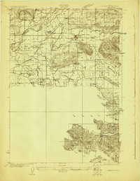
 1923 Mount Angel1923 Print · USGSMarion County in the early twenties is a landscape of thriving rail-towns and rural school districts connected by the Southern Pacific and Oregon Electric. Genealogists can trace early homesteads near Pioneers Cemetery or locate family roots at the US Indian School Chemawa and Belle Passi School.3 unique versions available
 - 1924 Map of Lebanon
 1924 Lebanon1924 Print · USGSLinn County agriculture and rail life are captured here in the early twenties as small communities flourished along the river forks. Researchers can trace the exact locations of many rural schoolhouses like Happy Home School and old mill sites such as Ballins Mill.3 unique versions available
 - 1924 Map of Mc Minnville
 1924 Mc Minnville1924 Print · USGSYamhill County in the mid-twenties shows a thriving landscape of rural schools and river-tied commerce. Researchers can locate family landmarks like Grub College, the Yamhill Locks, and old railroad stops at St Joseph or Whiteson.
 - 1925 Map of Stayton
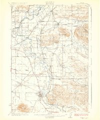
 1925 Stayton1925 Print · USGSMarion County in the mid-1920s reveals a dense network of country schools and state institutions linked by the Southern Pacific railroad. Genealogists and historians can trace the foundations of local communities through landmarks like the State Training School, Victor Point School, and Willard Church.3 unique versions available
 - 1926 Map of Mc Minnville
 1926 Mc Minnville1926 Print · USGSThe mid-Willamette Valley thrived as a rail and river hub in the mid-twenties, centered on the growing town of Mc Minnville. Researchers can trace the era's rural life through dozens of local landmarks, from the Wheatland Ferry to small schoolhouses like Grub College and Zena School.4 unique versions available
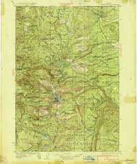
 - 1927 Map of Mt. Jefferson, 1956 Print
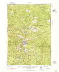 1927 Mt. Jefferson1956 Print · USGSThe Oregon Cascades in the late twenties were defined by high-altitude trails and the early management of the Santiam and Mount Hood forests. Trace the historic Skyline Trail past remote outposts like Lemiti Ranger Sta and the Breitenbush Hot Sprs.2 unique versions available
 - 1929 Map of Mill City
 1929 Mill City1929 Print · USGSThe Oregon Cascades appear here in the late 1920s as a hub of timber, mining, and early forest management. Genealogists and historians can trace the Southern Pacific rail line through Mill City or locate remote sites like the Silver King Mine and Elkhorn School.4 unique versions available
 - 1930 Map of Mt. Jefferson
 1930 Mt. Jefferson1930 Print · USGSThe Oregon Cascades were a frontier of early forest management and tribal lands during the late 1920s. Researchers can locate remote administrative outposts like the Lemiti Ranger Sta, trace the thermal waters of Breitenbush Hot Sprs, and explore the high meadows of Independence Prairie.3 unique versions available
 - 1939 Map of Molalla, 1958 Print
 1939 Molalla1958 Print · USGSBefore the modernization of the Willamette Valley's rural roads, this region centered on Molalla was a patchwork of family timberlands and prairie farms. Genealogists can trace family names and small-scale industry through landmarks like Union Mills, Maplewood Grange, and Jacks Bridge.2 unique versions available
 - 1939 Map of Oregon City, 1958 Print
 1939 Oregon City1958 Print · USGSThe Willamette Valley during the late thirties shows a landscape defined by river industry and competing rail lines. Genealogists and historians can trace family-named sites and rural institutions like the Ten O'clock Church, Linns Mill, and Reed College.
 - 1939 Map of Tualatin, 1958 Print
 1939 Tualatin1958 Print · USGSThe Tualatin Valley and Willamette River corridor are captured here before mid-century growth transformed the region. Genealogists can trace family footprints through dozens of rural landmarks, from Miners Landing and Butteville Sta to Mountainside School.
 - 1940 Map of McMinnville
 1940 McMinnville1940 Print · USGSWillamette Valley life centered on river and rail transit in the 1940s, from the streets of McMinnville to the fertile bottomlands. Local historians can trace early school sites like Grub College and river crossings such as the Wheatland Ferry.3 unique versions available
 - 1940 Map of Tualatin
 1940 Tualatin1940 Print · USGSThe Tualatin Valley comes into sharp focus during the late 1930s, showing the early footprints of Beaverton and Tigard amid a vast network of rail lines. Researchers can trace historic family schoolhouses like Witch Hazel School and locate the original path of Boones Ferry Road near Wilsonville.
Showing maps 1-25 of 327
Top cities of Marion County
- Salem historical maps
- Keizer historical maps
- Woodburn historical maps
- Silverton historical maps
- Stayton historical maps
- Mount Angel historical maps
See more
Frequently asked questions
- What are the different types of historical maps available for Marion County?
- What is the oldest map of Marion County?
- Where can I purchase historical maps of Marion County for my home or office?
- Where can I download high-res historical maps of Marion County?
- Are there historical topographic maps available for Marion County?
- Is there historical aerial imagery available for Marion County?
- Where are historical maps of Marion County sourced from?