Old Maps of Perry, Oregon for Academic Research
Study the evolution of Perry with 9 high-resolution historic maps. Whether you're teaching, researching, or modeling changes in land use, these maps provide essential visual documentation of urban, environmental, and geographic change.
- Analyze long-term change: Track patterns in development, transportation, and natural features.
- Ideal for environmental or urban studies: Support academic projects with primary historical map data.
- Use in the classroom or lab: Educators and researchers rely on these maps to bring historical context to life.
These maps are a powerful tool for teaching, research, and visualizing how Perry has changed over the decades.
Perry, OR maps
(9)- 1953 Map of Pendleton, 1957 Print
 1953 Pendleton1957 Print · USGSNortheastern Oregon and the Columbia River frontier are captured here in the early fifties, a time of massive federal infrastructure projects. Researchers can trace the historic route of The Old Oregon Trail as it passes near the Umatilla Ordnance Depot and the new McNary Dam.4 unique versions available
 - 1956 Map of Pendleton
 1956 Pendleton1956 Print · USGSNortheastern Oregon’s high plateau and timbered peaks appear here in the mid-fifties, during a time of major military and hydroelectric development. Trace the path of The Old Oregon Trail alongside modern landmarks like McNary Dam and the Umatilla Ordnance Depot.
 - 1963 Map of Hilgard, 1966 Print
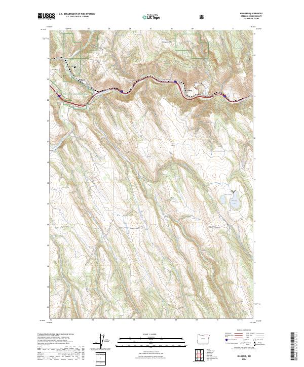
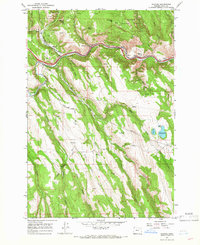 1963 Hilgard1966 Print · USGSThe Grande Ronde River valley in the early 1960s shows a landscape of mountain canyons and essential rail-and-river transport. Researchers can trace the Union Pacific line through Hilgard and Perry or locate the old Hilgard Cem.3 unique versions available
 - 1979 Map of La Grande, 1980 Print
 1979 La Grande1980 Print · USGSNorthwestern Oregon’s mountain corridors are captured here in the late seventies, showing the rail and river networks through the Blue Mountains. Trace the Old Emigrant Road, locate the Aurelia Mine, or explore the Starkey Experimental Forest.2 unique versions available
 - 2011 Map of Hilgard, 2011 Print
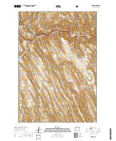
 2011 Hilgard2011 Print · USGSCovers Perry, including Hilgard, Union County, and other nearby areas
 - 2014 Map of Hilgard, 2014 Print
 2014 Hilgard2014 Print · USGSCovers Perry, including Hilgard, Union County, and other nearby areas
 - 2017 Map of Hilgard, 2017 Print
 2017 Hilgard2017 Print · USGSCovers Perry, including Hilgard, Union County, and other nearby areas
 - 2020 Map of Hilgard, 2020 Print
 2020 Hilgard2020 Print · USGSCovers Perry, including Hilgard, Union County, and other nearby areas
 - 2024 Map of Hilgard, 2024 Print
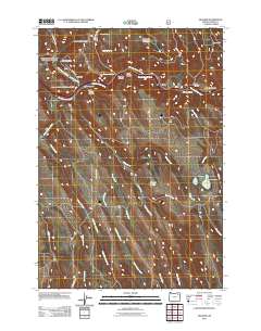
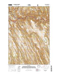
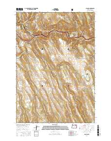
 2024 Hilgard2024 Print · USGSUnion County's river-and-rail corridor is mapped here in 2024, showing the intersection of local settlement and the Whitman National Forest. Trace the path of the Oregon Trail Natl Historic Trl past the Hilgard Cem and the waters of Morgan Lake.
End of results
Showing maps 1-9 of 9
Top cities near Perry
- La Grande historical maps
- Island City historical maps
- Imbler historical maps
- Summerville historical maps
Frequently asked questions
- What are the different types of historical maps available for Perry?
- What is the oldest map of Perry?
- Where can I purchase historical maps of Perry for my home or office?
- Where can I download high-res historical maps of Perry?
- Are there historical topographic maps available for Perry?
- Is there historical aerial imagery available for Perry?
- Where are historical maps of Perry sourced from?