
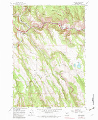
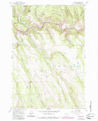
1963 Map of Hilgard
USGS Topo · Published 1966About this map
The Grande Ronde River carves a narrow corridor through the high country of the Whitman National Forest, serving as the primary artery for transportation and settlement in the mid-1960s. The Union Pacific railroad tracks and a Frontage Road parallel the river's winding course, connecting the small communities of Hilgard and Perry. Historical traces of earlier infrastructure are evident in the Old Railroad Grade and numerous pipelines that traverse the rugged canyons. Away from the river valley, the landscape is defined by steep drainages like Whiskey Creek and Little Rock Creek. High-elevation landmarks such as the Airway Beacon on Mahogany Mtn and remote water bodies including Morgan Lake and Hunter Lake illustrate how the terrain was utilized for both navigation and resource management during this era.
Find a feature on this map
38 named features on this map. Tap any name to fly to it.
Don’t see what you’re looking for? This feature index may not catch every label — zoom into the map to look around manually.
Map Details
Editions of this 1963 Hilgard Map
3 editions found
Other maps of this area

1953 · Pendleton
USGS Topo · 1:250,000

1956 · Pendleton
USGS Topo · 1:250,000

1963 · La Grande SE
USGS Topo · 1:24,000

1963 · Summerville
USGS Topo · 1:24,000

1964 · Huron
USGS Topo · 1:24,000

1964 · Drumhill Ridge
USGS Topo · 1:24,000

1964 · Kamela SE
USGS Topo · 1:24,000
1965 · Glass Hill
USGS Topo · 1:24,000

1965 · Little Beaver Creek
USGS Topo · 1:24,000
1965 · La Grande Reservoir
USGS Topo · 1:24,000