
1965 Map of Little Beaver Creek
USGS Topo · Published 1967About this map
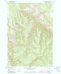
Whitman National Forest land dominates this landscape in the mid-1960s, defined by the sharp vertical relief of the Blue Mountains. The Grande Ronde River flows through the southwestern corner, where the Grande Ronde Guard Sta and River Campground provided critical infrastructure for forest management and recreation. The area is marked by a complex network of named ridges and canyons, including Whitehorse Ridge and Little Beaver Ridge, which separate various drainage basins.
Find a feature on this map
28 named features on this map. Tap any name to fly to it.
Don’t see what you’re looking for? This feature index may not catch every label — zoom into the map to look around manually.
Map Details
Editions of this 1965 Little Beaver Creek Map
2 editions found
Other maps of this area

1953 · Pendleton
USGS Topo · 1:250,000

1956 · Pendleton
USGS Topo · 1:250,000

1963 · Hilgard
USGS Topo · 1:24,000

1964 · Mc Intyre Creek
USGS Topo · 1:24,000

1964 · Kamela SE
USGS Topo · 1:24,000

1965 · Limber Jim Creek
USGS Topo · 1:24,000

1965 · Marley Creek
USGS Topo · 1:24,000

1965 · Anthony Butte
USGS Topo · 1:24,000
1965 · La Grande Reservoir
USGS Topo · 1:24,000

1965 · Fly Valley
USGS Topo · 1:24,000