
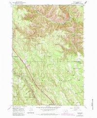
1964 Map of Huron
USGS Topo · Published 1966About this map
Umatilla National Forest and Whitman National Forest dominate this landscape, meeting at a shared boundary that bisects the terrain. The Union Pacific Railroad cuts through the region, following the winding path of Meacham Creek and crossing the heights of Horseshoe Ridge. This transportation corridor was central to the area's development, providing access to remote timber and grazing lands.
Find a feature on this map
46 named features on this map. Tap any name to fly to it.
Don’t see what you’re looking for? This feature index may not catch every label — zoom into the map to look around manually.
Map Details
Editions of this 1964 Huron Map
2 editions found
Other maps of this area

1953 · Pendleton
USGS Topo · 1:250,000

1956 · Pendleton
USGS Topo · 1:250,000

1963 · Meacham Lake
USGS Topo · 1:24,000

1963 · Hilgard
USGS Topo · 1:24,000

1964 · Mc Intyre Creek
USGS Topo · 1:24,000

1964 · Duncan
USGS Topo · 1:24,000

1964 · Thimbleberry Mtn
USGS Topo · 1:24,000

1964 · Drumhill Ridge
USGS Topo · 1:24,000

1964 · Meacham
USGS Topo · 1:24,000

1964 · Kamela SE
USGS Topo · 1:24,000