
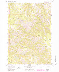
1964 Map of Thimbleberry Mtn
USGS Topo · Published 1966About this map
Umatilla National Forest dominates this mid-1960s topographic study, revealing a landscape defined by sharp ridges and seasonal water sources. High-altitude vigilance is centered at the Goodman Lookout Tower along Goodman Ridge, a critical vantage point for forest management in this era. The terrain is deeply incised by the South Fork Umatilla River and the complex drainage system of Meacham Creek.
Find a feature on this map
39 named features on this map. Tap any name to fly to it.
Don’t see what you’re looking for? This feature index may not catch every label — zoom into the map to look around manually.
Map Details
Editions of this 1964 Thimbleberry Mtn Map
2 editions found
Other maps of this area

1953 · Pendleton
USGS Topo · 1:250,000

1956 · Pendleton
USGS Topo · 1:250,000

1963 · Andies Prairie
USGS Topo · 1:24,000

1963 · Sanderson Spring
USGS Topo · 1:24,000

1963 · Bingham Springs
USGS Topo · 1:24,000

1963 · Summerville
USGS Topo · 1:24,000

1964 · Duncan
USGS Topo · 1:24,000

1964 · Gibbon
USGS Topo · 1:24,000

1964 · Huron
USGS Topo · 1:24,000

1964 · Drumhill Ridge
USGS Topo · 1:24,000