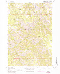
1964 Map of Thimbleberry Mtn
USGS Topo · Published 1984About this map
Umatilla National Forest encompasses this high-elevation landscape, where the headwaters of the South Fork Umatilla River and Meacham Creek carve through steep canyons. The terrain is defined by prominent divides such as Goodman Ridge and McDonald Ridge, which separate the various drainage basins. High points like Thimbleberry Mountain and Black Mountain offered strategic vantage points for fire management, evidenced by the Goodman Lookout Tower. The drainage network is dense with named water sources, including Farley Spring, Dead Horse Spring, and Bear Camp Spring, essential for the region's wildlife and forest operations. Movement through these mountains relied on both early twentieth-century engineering and historic routes, from the ridge-top Skyline Road to the winding Pack Trail that traverses the slopes of Huckleberry Mountain.
Find a feature on this map
43 named features on this map. Tap any name to fly to it.
Don’t see what you’re looking for? This feature index may not catch every label — zoom into the map to look around manually.
Map Details
Editions of this 1964 Thimbleberry Mtn Map
2 editions found
Other maps of this area

1953 · Pendleton
USGS Topo · 1:250,000

1956 · Pendleton
USGS Topo · 1:250,000

1963 · Andies Prairie
USGS Topo · 1:24,000

1963 · Sanderson Spring
USGS Topo · 1:24,000

1963 · Bingham Springs
USGS Topo · 1:24,000

1963 · Summerville
USGS Topo · 1:24,000

1964 · Duncan
USGS Topo · 1:24,000

1964 · Thimbleberry Mtn
USGS Topo · 1:24,000

1964 · Gibbon
USGS Topo · 1:24,000

1964 · Huron
USGS Topo · 1:24,000