Old Maps of Union, Oregon for Academic Research
Study the evolution of Union with 18 high-resolution historic maps. Whether you're teaching, researching, or modeling changes in land use, these maps provide essential visual documentation of urban, environmental, and geographic change.
- Analyze long-term change: Track patterns in development, transportation, and natural features.
- Ideal for environmental or urban studies: Support academic projects with primary historical map data.
- Use in the classroom or lab: Educators and researchers rely on these maps to bring historical context to life.
These maps are a powerful tool for teaching, research, and visualizing how Union has changed over the decades.
Union, OR maps
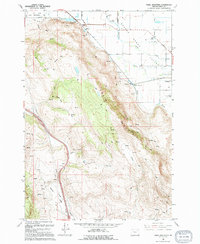
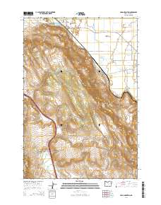
(18)- 1906 Map of Telocaset
 1906 Telocaset1906 Print · USGSEastern Oregon at the peak of its railroad and ranching era features a landscape of thriving valley towns and high forest reserves. Genealogists and local historians can trace early settlements like Union and Cove, or locate long-standing landmarks such as Hot Lake and Medical Springs.3 unique versions available
 - 1955 Map of Grangeville, 1964 Print
 1955 Grangeville1964 Print · USGSThe high country of the Idaho-Oregon border comes alive in the mid-1950s, showing the deep river canyons and mountain peaks. Trace the Union Pacific RR through the valleys or locate settlements like Grangeville, Joseph, and the shoreline of Wallowa Lake.4 unique versions available
 - 1959 Map of Grangeville
 1959 Grangeville1959 Print · USGSThe high alpine peaks and deep river canyons of the Idaho-Oregon borderlands are captured in the late fifties. Researchers can trace the Union Pacific RR through the valleys to settlements like Enterprise, Union, and Grangeville.2 unique versions available
 - 1965 Map of Union, 1967 Print
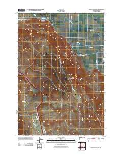
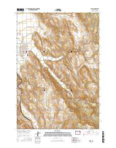
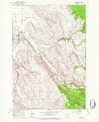 1965 Union1967 Print · USGSUnion and the surrounding valley floor are captured here in the mid-sixties, a period of established ranching and rail activity. Researchers can locate the Eastern Oregon Livestock Exposition Grounds, the Union Pacific line, and the small settlement of Crooks.
 - 1966 Map of Craig Mountain, 1967 Print
 1966 Craig Mountain1967 Print · USGSThe eastern edge of the Grande Ronde Valley was a center for rail transport and irrigation in the mid-1960s. Genealogists and historians can trace old homestead water sources and rail connections near Union, Hot Lake, and the Oregon of Union Railroad.
 - 1986 Map of Enterprise, 1987 Print
 1986 Enterprise1987 Print · USGSThe high peaks and deep valleys of Northeast Oregon are captured in the mid-1980s, showcasing the transition from the Grande Ronde Valley to the wilderness. Researchers can trace the Union Pacific rail corridor through Telocaset or locate historic sites like Cornucopia and Medical Springs.
 - 1994 Map of Union
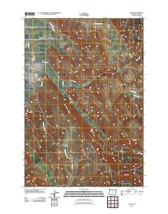
 1994 Union1994 Print · USGSThe community of Union is captured in the mid-1990s as the anchor of the southeastern Grande Ronde Valley. Researchers can trace local landmarks like the Eastern Oregon Livestock Exhibition Grounds, the High Sch, and the winding path of Catherine Creek.
 - 1994 Map of Craig Mountain
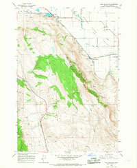
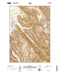
 1994 Craig Mountain1994 Print · USGSThe Grande Ronde Valley meets the steep slopes of Craig Mountain in the 1990s, where geothermal activity and historic rail grades define the terrain. Trace family land near Hot Lake, Union Junction, and the waters of Catherine Creek.
 - 2011 Map of Craig Mountain, 2011 Print
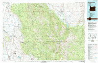
 2011 Craig Mountain2011 Print · USGSCovers Union, including Union County, United States, and other nearby areas
 - 2011 Map of Union, 2011 Print
 2011 Union2011 Print · USGSCovers Union, including Union County, United States, and other nearby areas
 - 2014 Map of Union, 2014 Print
 2014 Union2014 Print · USGSCovers Union, including Union County, United States, and other nearby areas
 - 2014 Map of Craig Mountain, 2014 Print
 2014 Craig Mountain2014 Print · USGSCovers Union, including Union County, United States, and other nearby areas
 - 2017 Map of Union, 2017 Print
 2017 Union2017 Print · USGSCovers Union, including Union County, United States, and other nearby areas
 - 2017 Map of Craig Mountain, 2017 Print
 2017 Craig Mountain2017 Print · USGSCovers Union, including Union County, United States, and other nearby areas
 - 2020 Map of Union, 2020 Print
 2020 Union2020 Print · USGSCovers Union, including Union County, United States, and other nearby areas
 - 2020 Map of Craig Mountain, 2020 Print
 2020 Craig Mountain2020 Print · USGSCovers Union, including Union County, United States, and other nearby areas
 - 2023 Map of Union, 2023 Print
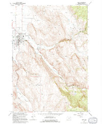
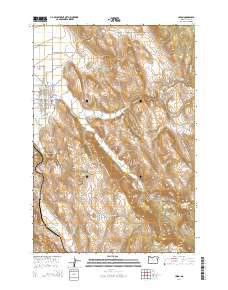
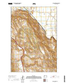
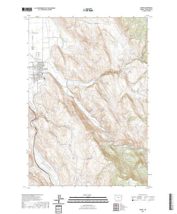 2023 Union2023 Print · USGSThe eastern edge of the Grande Ronde Valley is documented here as it appeared in the early twenty-first century. Genealogists and local historians can trace the town of Union and its surrounding rural landmarks, from Union Cem to the irrigation works of the Catherine Creek Highline Canal.
 - 2024 Map of Craig Mountain, 2024 Print
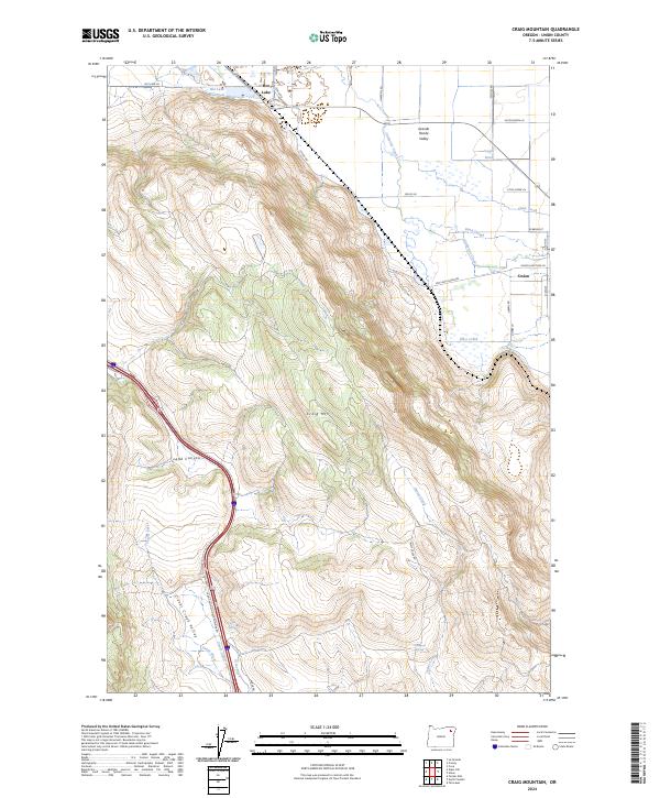 2024 Craig Mountain2024 Print · USGSThe eastern Grande Ronde Valley transition into the Blue Mountains is captured here in recent detail. Researchers can trace historic water rights and land use through features like Grout Ditch, the Hot Lake Reservoir, and the roads leading into Union.
End of results
Showing maps 1-18 of 18
Top cities near Union
- La Grande historical maps
- Island City historical maps
- Cove historical maps
- North Powder historical maps
Frequently asked questions
- What are the different types of historical maps available for Union?
- What is the oldest map of Union?
- Where can I purchase historical maps of Union for my home or office?
- Where can I download high-res historical maps of Union?
- Are there historical topographic maps available for Union?
- Is there historical aerial imagery available for Union?
- Where are historical maps of Union sourced from?