1970s Maps of The Dalles, Oregon
Explore 5 historic maps of The Dalles from the 1970s. These maps offer a rare glimpse into what life looked like during the 1970s — showing old roads, neighborhoods, homes, and landmarks that have changed or disappeared over time.
Whether you're researching your family's past, planning a metal detecting trip, or studying how The Dalles's landscape evolved across the 1970s, these high-resolution maps are a powerful tool for exploring the history of this region.
- Focus on a specific era: All maps on this page are from the 1970s, giving you a focused view of this time period.
- See what’s changed: Compare century-old streets, trails, and buildings to today's modern landscape using overlays and satellite layers.
- Research with precision: Use these maps for genealogy, historical research, land use analysis, or educational projects.
- View, download, or print: Maps are fully viewable online in high resolution, and can be downloaded or printed for your own records.
Start exploring The Dalles's history through authentic maps from the 1970s. This is your window into the past.
The Dalles, OR maps
(5)- 1974 Map of The Dalles North, 1977 Print
 1974 The Dalles North1977 Print · USGSThe Columbia River Gorge in the mid-seventies reveals a thriving intersection of rail, river, and regional industry. Researchers can trace the layout of The Dalles and Smithville or locate family sites at Wish-Ham Cem and the Chenoweth Sch.2 unique versions available
 - 1975 Map of The Dalles North, 1980 Print
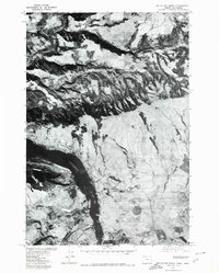 1975 The Dalles North1980 Print · USGSAlong the Columbia River in the mid-1970s, this aerial perspective captures the landscape of the Oregon and Washington border. Researchers can trace the development of river-side settlements like Murdock and Smithville while observing the winding course of the Klickitat River.
 - 1975 Map of The Dalles South, 1980 Print
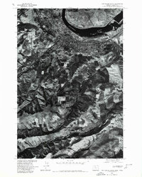 1975 The Dalles South1980 Print · USGSThe Dalles and its surrounding plateaus appear in sharp detail during the mid-1970s in this orthophotographic survey. Genealogists and local historians can trace the riverside development of The Dalles and the rural agricultural patterns along Fivemile Creek.
 - 1977 Map of The Dalles South, 1978 Print
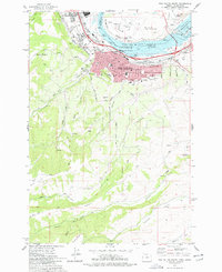 1977 The Dalles South1978 Print · USGSThe mid-Columbia River shoreline comes alive in the late seventies, showing the vital link between the river and the rail-driven economy. Trace the legacy of early residents at Pioneer Cem or GAR Cem and explore the irrigation and elevation changes near Cherry Heights.2 unique versions available
 - 1978 Map of Petersburg
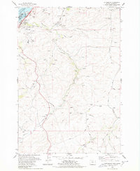 1978 Petersburg1978 Print · USGSNear the Columbia River in the late 1970s, this area shows the intersection of major energy infrastructure and traditional plateau farming. Researchers can trace the Union Pacific corridor, locate the Grave Island Mem (Cem), and find local landmarks in Petersburg and Rice.
End of results
Showing maps 1-5 of 5
Top cities near The Dalles
Frequently asked questions
- What are the different types of historical maps available for The Dalles?
- What is the oldest map of The Dalles?
- Where can I purchase historical maps of The Dalles for my home or office?
- Where can I download high-res historical maps of The Dalles?
- Are there historical topographic maps available for The Dalles?
- Is there historical aerial imagery available for The Dalles?
- Where are historical maps of The Dalles sourced from?