Old Maps of The Dalles, Oregon for Metal Detecting
Plan your next treasure hunt with these historic maps of The Dalles. Find old homesites, ghost towns, trails, and gathering spots that may be lost to time — perfect for identifying promising metal detecting locations.
- Locate forgotten sites: Uncover places like long-lost settlements, abandoned rail lines, or gathering spots.
- Plan better hunts: Use map overlays combined with LiDAR or satellite views to narrow in on historically rich areas.
- Made for detectorists: Thousands of hobbyists use these maps to discover relics, coins, and hidden history.
Use these historic maps to boost your research and find new opportunities beneath the surface of The Dalles.
The Dalles, OR maps
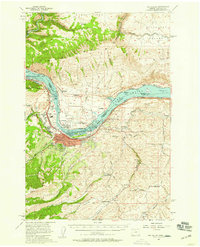
- 1934 Map of The Dalles
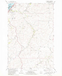
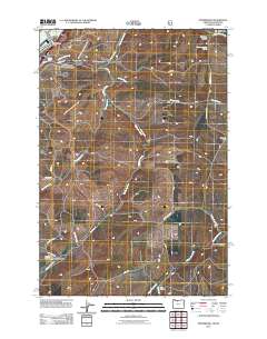
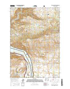
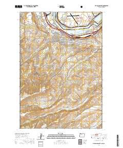
 1934 The Dalles1934 Print · USGSThe Columbia River Gorge in the early thirties reveals a complex network of rapids and river engineering before the completion of major modern dams. Local historians can trace early school districts like Threemile Sch and family landmarks such as Clancy Ranch or Petersburg.4 unique versions available
 - 1953 Map of The Dalles, 1965 Print
 1953 The Dalles1965 Print · USGSThe Columbia River Gorge at mid-century shows a region being transformed by massive hydroelectric dams and a growing highway network. Researchers can trace the development of The Dalles Dam, locate the Maryhill Museum, and find old rail stops in Rufus, Wishram, and Arlington.3 unique versions available
 - 1956 Map of The Dalles
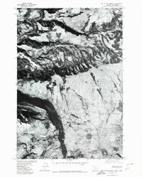
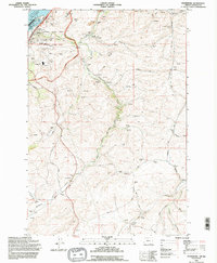
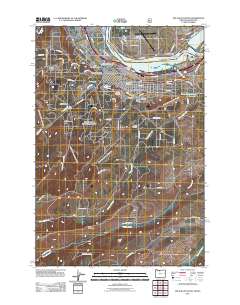
 1956 The Dalles1956 Print · USGSThe Columbia River Gorge and the high Cascades are captured in the mid-1950s, showing a vital corridor of rail and road. Researchers can trace the original path of The Old Oregon Trail or locate historical landmarks like the Maryhill Museum and Mount Hood.
 - 1957 Map of The Dalles
 1957 The Dalles1957 Print · USGSThe Columbia River Gorge and the high plateaus of the mid-1950s come alive on this detailed survey of northern Oregon and southern Washington. Researchers can trace the path of the Oregon Trail and The Old Barlow Road alongside river towns like The Dalles and Wishram.
 - 1957 Map of The Dalles, 1959 Print
 1957 The Dalles1959 Print · USGSThe Dalles and the Columbia River frontier are captured here in the late fifties, just as the new dam transformed the river. Genealogists can locate family schools like Fairfield Sch and Chenoweth School or trace the early footprint of Dallesport.3 unique versions available
 - 1974 Map of The Dalles North, 1977 Print
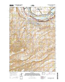
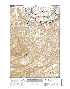
 1974 The Dalles North1977 Print · USGSThe Columbia River Gorge in the mid-seventies reveals a thriving intersection of rail, river, and regional industry. Researchers can trace the layout of The Dalles and Smithville or locate family sites at Wish-Ham Cem and the Chenoweth Sch.2 unique versions available
 - 1975 Map of The Dalles North, 1980 Print
 1975 The Dalles North1980 Print · USGSAlong the Columbia River in the mid-1970s, this aerial perspective captures the landscape of the Oregon and Washington border. Researchers can trace the development of river-side settlements like Murdock and Smithville while observing the winding course of the Klickitat River.
 - 1975 Map of The Dalles South, 1980 Print
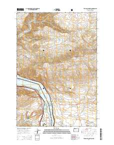
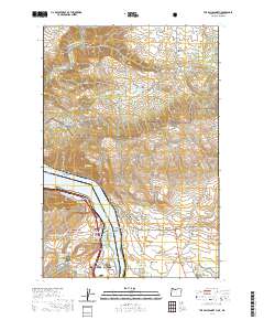
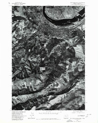 1975 The Dalles South1980 Print · USGSThe Dalles and its surrounding plateaus appear in sharp detail during the mid-1970s in this orthophotographic survey. Genealogists and local historians can trace the riverside development of The Dalles and the rural agricultural patterns along Fivemile Creek.
 - 1977 Map of The Dalles South, 1978 Print
 1977 The Dalles South1978 Print · USGSThe mid-Columbia River shoreline comes alive in the late seventies, showing the vital link between the river and the rail-driven economy. Trace the legacy of early residents at Pioneer Cem or GAR Cem and explore the irrigation and elevation changes near Cherry Heights.2 unique versions available
 - 1978 Map of Petersburg
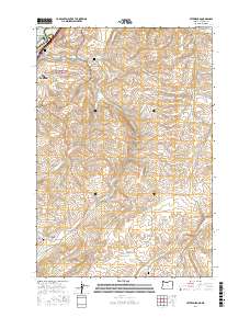
 1978 Petersburg1978 Print · USGSNear the Columbia River in the late 1970s, this area shows the intersection of major energy infrastructure and traditional plateau farming. Researchers can trace the Union Pacific corridor, locate the Grave Island Mem (Cem), and find local landmarks in Petersburg and Rice.
 - 1982 Map of Hood River, 1983 Print
 1982 Hood River1983 Print · USGSThe Columbia River Gorge in the early eighties shows a landscape shaped by massive hydroelectric projects and deep-rooted timber communities. Researchers can trace the rail-and-river network through Cascade Locks and The Dalles Dam, or explore the terrain of Gifford Pinchot National Forest.
 - 1994 Map of The Dalles North, 1995 Print
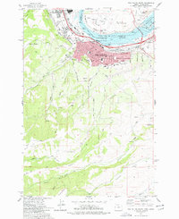
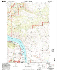 1994 The Dalles North1995 Print · USGSThe Columbia River Gorge was a hub of transit and industry in the mid-nineties, where Washington and Oregon meet. Researchers can trace the river's industrial past through the Aluminum Plant and The Dalles Municipal Airport, or find family sites like Wish-Ham Cem and Lone Pine Cemetery.
 - 1994 Map of Petersburg, 1995 Print
 1994 Petersburg1995 Print · USGSMid-nineties Wasco County is shown here at the intersection of massive Columbia River energy projects and traditional wheat farming. Genealogists and local historians can trace family roots at Eightmile Cem or locate old rail-side landmarks like the Rice Grain Elevator.
 - 1994 Map of The Dalles South, 1995 Print
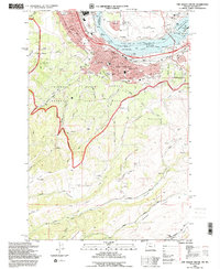 1994 The Dalles South1995 Print · USGSThe Dalles and Dallesport are shown in the mid-1990s as the river economy transitioned into the modern era. Genealogists can locate historic burial sites like GAR Cem and Masonic Cem while tracing the Union Pacific rail corridor.
 - 2011 Map of Petersburg, 2011 Print
 2011 Petersburg2011 Print · USGSCovers The Dalles, including Petersburg, Wasco County, and other nearby areas
 - 2011 Map of The Dalles South, 2011 Print
 2011 The Dalles South2011 Print · USGSCovers The Dalles, including Dallesport, Wasco County, and other nearby areas
 - 2014 Map of Petersburg, 2014 Print
 2014 Petersburg2014 Print · USGSCovers The Dalles, including Petersburg, Wasco County, and other nearby areas
 - 2014 Map of The Dalles North, 2014 Print
 2014 The Dalles North2014 Print · USGSCovers The Dalles, including Chenowith, Murdock, and other nearby areas
 - 2014 Map of The Dalles South, 2014 Print
 2014 The Dalles South2014 Print · USGSCovers The Dalles, including Dallesport, Wasco County, and other nearby areas
 - 2017 Map of The Dalles North, 2017 Print
 2017 The Dalles North2017 Print · USGSCovers The Dalles, including Chenowith, Murdock, and other nearby areas
 - 2017 Map of Petersburg, 2017 Print
 2017 Petersburg2017 Print · USGSCovers The Dalles, including Petersburg, Wasco County, and other nearby areas
 - 2017 Map of The Dalles South, 2017 Print
 2017 The Dalles South2017 Print · USGSCovers The Dalles, including Dallesport, Wasco County, and other nearby areas
 - 2020 Map of The Dalles North, 2020 Print
 2020 The Dalles North2020 Print · USGSCovers The Dalles, including Chenowith, Murdock, and other nearby areas
 - 2020 Map of The Dalles South, 2020 Print
 2020 The Dalles South2020 Print · USGSCovers The Dalles, including Dallesport, Wasco County, and other nearby areas
 - 2020 Map of Petersburg, 2020 Print
 2020 Petersburg2020 Print · USGSCovers The Dalles, including Petersburg, Wasco County, and other nearby areas
Showing maps 1-25
Top cities near The Dalles
Frequently asked questions
- What are the different types of historical maps available for The Dalles?
- What is the oldest map of The Dalles?
- Where can I purchase historical maps of The Dalles for my home or office?
- Where can I download high-res historical maps of The Dalles?
- Are there historical topographic maps available for The Dalles?
- Is there historical aerial imagery available for The Dalles?
- Where are historical maps of The Dalles sourced from?