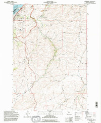
1994 Map of Petersburg
USGS Topo · Published 1995About this map
The Dalles Dam and the Lake Celilo reservoir anchor the northwestern corner of this landscape, marking a point of intense industrial and hydrological development along the Columbia River. The map documents the complex energy infrastructure of the mid-1990s, including the Celilo Converter Sta and the Big Eddy Substation, which stand in contrast to the rural agricultural character of the surrounding uplands. Local history is etched into the terrain through sites like Viewpoint Grave Island Mem (Cem) and the Eightmile Cem. Further inland, the small settlements of Petersburg and Rice are linked by a network of historic thoroughfares such as the Old Dufur Road and Ward Road. The drainage patterns of Fifteenmile Creek and Eightmile Creek define the geography, where numerous storage bins and grain elevators alongside the Union Pacific tracks reflect the region's enduring reliance on dryland farming and river-corridor transport.
Find a feature on this map
46 named features on this map. Tap any name to fly to it.
Don’t see what you’re looking for? This feature index may not catch every label — zoom into the map to look around manually.
Map Details
Editions of this 1994 Petersburg Map
This is the sole edition of this map. No revisions or reprints were ever made.
Other maps of this area

1930 · Dufur
USGS Topo · 1:125,000

1934 · Dufur
USGS Topo · 1:125,000

1934 · The Dalles
USGS Topo · 1:125,000

1953 · The Dalles
USGS Topo · 1:250,000

1956 · The Dalles
USGS Topo · 1:250,000

1957 · The Dalles
USGS Topo · 1:250,000

1957 · The Dalles
USGS Topo · 1:62,500

1957 · Wishram
USGS Topo · 1:62,500

1962 · Summit Ridge
USGS Topo · 1:24,000

1962 · Dufur East
USGS Topo · 1:24,000