2020s Maps of Boggs Township, Pennsylvania
Explore 4 historic maps of Boggs Township from the 2020s. These maps offer a rare glimpse into what life looked like during the 2020s — showing old roads, neighborhoods, homes, and landmarks that have changed or disappeared over time.
Whether you're researching your family's past, planning a metal detecting trip, or studying how Boggs Township's landscape evolved across the 2020s, these high-resolution maps are a powerful tool for exploring the history of this region.
- Focus on a specific era: All maps on this page are from the 2020s, giving you a focused view of this time period.
- See what’s changed: Compare century-old streets, trails, and buildings to today's modern landscape using overlays and satellite layers.
- Research with precision: Use these maps for genealogy, historical research, land use analysis, or educational projects.
- View, download, or print: Maps are fully viewable online in high resolution, and can be downloaded or printed for your own records.
Start exploring Boggs Township's history through authentic maps from the 2020s. This is your window into the past.
Boggs Township, PA maps
(4)- 2023 Map of Rural Valley, 2023 Print
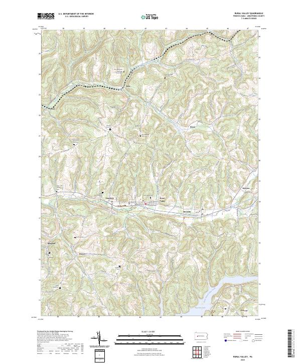 2023 Rural Valley2023 Print · USGSArmstrong County’s rural valleys and high ridges are captured here in the 2020s, showing a landscape shaped by historical paths and small-town resilience. Genealogists can trace family ties through numerous sites like Rural Valley Cem, the Harkleroad Cem, or the Great Shamokin Path Trail.
 - 2023 Map of Templeton, 2023 Print
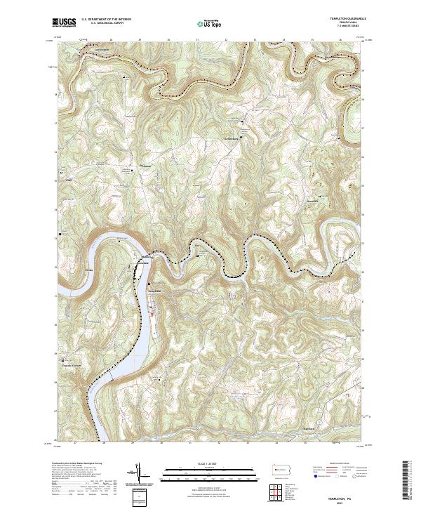 2023 Templeton2023 Print · USGSThe river valleys of Armstrong County come into focus in the 2020s, showing the enduring layout of the Pennsylvania countryside. Researchers can trace family history through a dense network of burial sites, including Stewardson Furnace Cem, Tidal Cem, and Walthour Cem.
 - 2023 Map of Mosgrove, 2023 Print
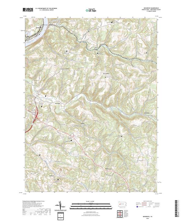 2023 Mosgrove2023 Print · USGSThe hill country of Armstrong County is seen here in recent detail, where winding creek valleys meet a dense network of country roads. Genealogists can trace family roots through numerous rural landmarks like Mount Union Davis Cem, Blanket Hill, and Pine Furnace.
 - 2023 Map of Distant, 2023 Print
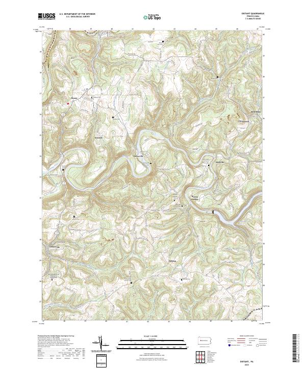 2023 Distant2023 Print · USGSThe rural border of Armstrong and Clarion counties is captured here in the contemporary era, showing a landscape of small crossroads settlements and creek-side villages. Genealogists and historians can locate numerous family and church burial sites, including the Milliron Family Cem, McCrea Furnace, and Putneyville.
End of results
Showing maps 1-4 of 4
Top cities near Boggs Township
- Kittanning historical maps
- Ford City historical maps
- North Buffalo Township historical maps
- Limestone Township historical maps
- West Kittanning historical maps
- Mahoning historical maps
See more
Top neighborhoods of Boggs Township
Frequently asked questions
- What are the different types of historical maps available for Boggs Township?
- What is the oldest map of Boggs Township?
- Where can I purchase historical maps of Boggs Township for my home or office?
- Where can I download high-res historical maps of Boggs Township?
- Are there historical topographic maps available for Boggs Township?
- Is there historical aerial imagery available for Boggs Township?
- Where are historical maps of Boggs Township sourced from?