2020s Maps of Doylestown Township, Pennsylvania
Explore 2 historic maps of Doylestown Township from the 2020s. These maps offer a rare glimpse into what life looked like during the 2020s — showing old roads, neighborhoods, homes, and landmarks that have changed or disappeared over time.
Whether you're researching your family's past, planning a metal detecting trip, or studying how Doylestown Township's landscape evolved across the 2020s, these high-resolution maps are a powerful tool for exploring the history of this region.
- Focus on a specific era: All maps on this page are from the 2020s, giving you a focused view of this time period.
- See what’s changed: Compare century-old streets, trails, and buildings to today's modern landscape using overlays and satellite layers.
- Research with precision: Use these maps for genealogy, historical research, land use analysis, or educational projects.
- View, download, or print: Maps are fully viewable online in high resolution, and can be downloaded or printed for your own records.
Start exploring Doylestown Township's history through authentic maps from the 2020s. This is your window into the past.
Doylestown Township, PA maps
(2)- 2023 Map of Buckingham, 2023 Print
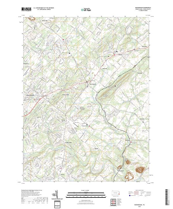 2023 Buckingham2023 Print · USGSBucks County community life and quiet country lanes are captured here in the early twenty-first century. Genealogists can trace family roots through sites like Buckingham Friends Cem and the Gilead African Methodist Episcopal Church Cem.
 - 2023 Map of Doylestown, 2023 Print
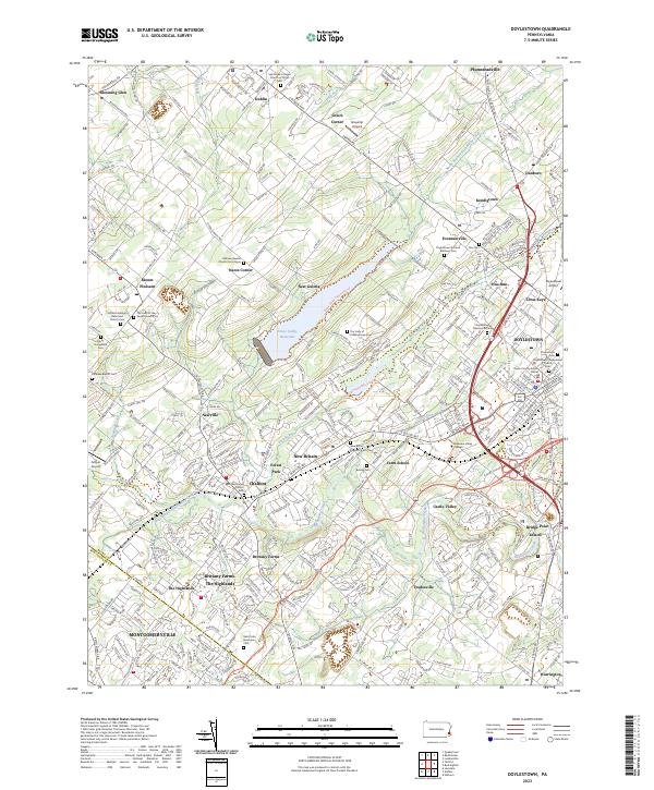 2023 Doylestown2023 Print · USGSBucks County and the outskirts of Montgomery County are shown here in the 2020s, centered on the borough of DOYLESTOWN. Researchers can trace local lineage through the New Britain Baptist Church Cem or Beulah Cem.
End of results
Showing maps 1-2 of 2
Top cities near Doylestown Township
- Philadelphia historical maps
- Bensalem Township historical maps
- Abington Township historical maps
- Middletown Township historical maps
- Cheltenham Township historical maps
- Norristown historical maps
See more
Top neighborhoods of Doylestown Township
- Tradesville historical maps
- Edison historical maps
- Poole's Corner historical maps
- Castle Valley historical maps
- Bridge Point historical maps
- Pine Run historical maps
Frequently asked questions
- What are the different types of historical maps available for Doylestown Township?
- What is the oldest map of Doylestown Township?
- Where can I purchase historical maps of Doylestown Township for my home or office?
- Where can I download high-res historical maps of Doylestown Township?
- Are there historical topographic maps available for Doylestown Township?
- Is there historical aerial imagery available for Doylestown Township?
- Where are historical maps of Doylestown Township sourced from?