Old Maps of Doylestown Township, Pennsylvania for Genealogy
Trace your family roots with 27 historic maps of Doylestown Township. These high-res maps reveal old neighborhoods, homesites, landmarks, and streets — helping you uncover where your ancestors lived and how the area evolved over time.
- Explore historic neighborhoods: Identify where your relatives may have lived in the 1800s or 1900s.
- Compare maps over time: Trace the changes in streets, buildings, and landmarks for multi-generational research.
- Perfect for genealogy & ancestry research: Used by family historians and researchers to map out lineage and migration.
These maps are an incredible resource for exploring your personal connection to Doylestown Township's past.
Doylestown Township, PA maps
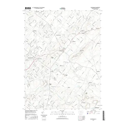
(27)- 1890 Map of Doylestown
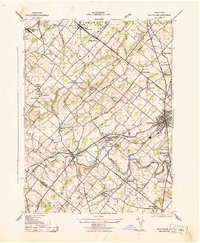
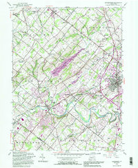
 1890 Doylestown1890 Print · USGSBucks County in the late nineteenth century is captured here as a landscape of established mill towns and farming crossroads. Local historians can trace early rail routes like the Doylestown Branch and discover forgotten names such as New Galena, Griers Corner, and Hinkletown.
 - 1891 Map of Doylestown
 1891 Doylestown1891 Print · USGSBucks County and the Delaware River valley are captured in the late Victorian era as the region's agricultural and industrial patterns were firmly established. Genealogists and historians can trace old homestead locations near Kellers Church, identify stops along the Penna Railroad, and find riverside hamlets like Raven Rock and Tumble.11 unique versions available
 - 1942 Map of Norristown
 1942 Norristown1942 Print · USGSSoutheastern Pennsylvania at the onset of World War II shows a landscape of busy industrial river towns and expanding rail suburbs. Genealogists and historians can trace the early transit networks connecting Norristown, Doylestown, and the riverfront at New Hope.
 - 1943 Map of Doylestown
 1943 Doylestown1943 Print · USGSBucks County during the early 1940s reveals a settled landscape of crossroads hamlets and family-named landmarks connected by the Reading railroad. Researchers can trace ancestral roots through sites like Beulah Cemetery, the Farm School, and the Luth Ch Spire in Dublin.
 - 1943 Map of Buckingham
 1943 Buckingham1943 Print · USGSBucks County at the height of the Second World War reveals a landscape of tight-knit rural villages and essential rail connections. Genealogists and historians can trace family roots through landmarks like the Hughesian School, Mt Gilead Church, and stops along the Reading railroad.
 - 1944 Map of Newark, 1971 Print
 1944 Newark1971 Print · USGSThe industrial corridor from Philadelphia to New York was in a period of massive transition during the mid-forties. Genealogists and researchers can trace the rail lines of the Lehigh Valley RR, locate military installations like Picatinny Arsenal, and explore the early sprawl near Levittown.5 unique versions available
 - 1949 Map of Newark
 1949 Newark1949 Print · USGSThe industrial corridor between Philadelphia and New York comes alive in this post-war survey. Genealogists and historians can trace the massive rail networks of the Reading Railroad and locate major installations like Fort Dix or Picatinny Arsenal.2 unique versions available
 - 1953 Map of Buckingham, 1954 Print
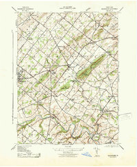
 1953 Buckingham1954 Print · USGSBucks County at mid-century remains a landscape of rolling townships and rural crossroads connected by the Reading Railroad. Genealogists and local historians can trace the foundations of DOYLESTOWN and Buckingham through landmarks like the Buckingham Valley Mill, Bycot Sta, and Mt Gilead Ch.7 unique versions available
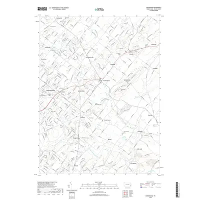
 - 1953 Map of Doylestown, 1954 Print
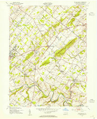
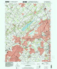
 1953 Doylestown1954 Print · USGSBucks County in the early fifties shows a landscape of growing boroughs and deep-rooted rural townships. Researchers can trace ancestral locations through numerous named schoolhouses and local institutions like the National Agricultural College and Beulah Chapel.6 unique versions available
 - 1956 Map of Newark
 1956 Newark1956 Print · USGSThe industrial heart of the Mid-Atlantic is captured here at the dawn of the highway era, tracing the dense corridors between Newark and Philadelphia. Genealogists and local historians can map the rail networks of the Reading RR or locate mid-century military life at Fort Dix Military Reservation.2 unique versions available
 - 1957 Map of Newark
 1957 Newark1957 Print · USGSThe industrial and military heart of the Mid-Atlantic is mapped during its post-war suburban boom. Genealogists and historians can trace the intricate rail corridors of the Reading Railroad and locate key landmarks from Princeton University to Fort Hancock.
 - 1960 Map of Newark
 1960 Newark1960 Print · USGSThe industrial heart of the Mid-Atlantic is shown at mid-century, stretching from the dense urban centers of Newark and Philadelphia to the Blue Mountain ridges. Researchers can trace historic rail lines, coastal defenses at Fort Hancock, and the riverfront growth of Trenton and Easton.3 unique versions available
 - 1964 Map of Newark
 1964 Newark1964 Print · USGSGreater New Jersey and eastern Pennsylvania appear at the peak of their industrial and rail-centered development in the mid-sixties. Genealogists and historians can trace the paths of the Pennsylvania RR, identify mid-century landmarks like CAMP KILMER, or follow the Schuylkill River through READING.2 unique versions available
 - 1984 Map of Reading, 1986 Print
 1984 Reading1986 Print · USGSSoutheastern Pennsylvania in the mid-eighties shows a landscape of established industrial hubs and rapid suburban expansion. Trace local history through landmarks like Valley Forge National Historical Park, the Willow Grove Naval Air Station, and Kutztown University.2 unique versions available
 - 1992 Map of Doylestown, 1995 Print
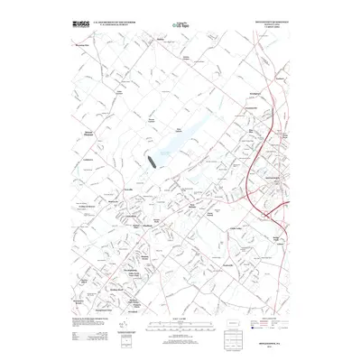
 1992 Doylestown1995 Print · USGSBucks County at the start of the nineties reveals a landscape of growing towns and preserved open spaces along the Neshaminy Creek. Trace the footprints of historical communities like New Britain and Chalfont, or locate local landmarks like Beulah Chapel and the Warrington Airfield.
 - 1999 Map of Doylestown, 2001 Print
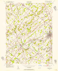
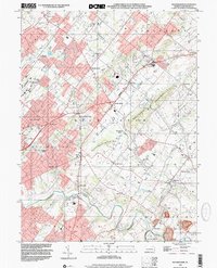
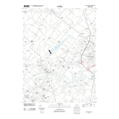
 1999 Doylestown2001 Print · USGSBucks County at the close of the century shows a landscape where historic crossroads like Doylestown meet modern infrastructure. Researchers can trace local landmarks such as the County Home, Beulah Cem Chapel, and the Peace Valley Reservoir.
 - 1999 Map of Buckingham, 2001 Print
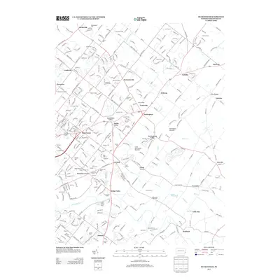
 1999 Buckingham2001 Print · USGSBucks County was undergoing steady suburban change at the end of the millennium, yet its historic township patterns remained clear. Researchers can trace family sites near Lahaska, Furlong, and Wycombe, or find community landmarks like the Mt Gilead Ch and Gardenville Sch.
 - 2010 Map of Buckingham, 2010 Print
 2010 Buckingham2010 Print · USGSCovers Doylestown Township, including Warrington Township, Buckingham Township, and other nearby areas
 - 2010 Map of Doylestown, 2010 Print
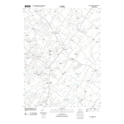
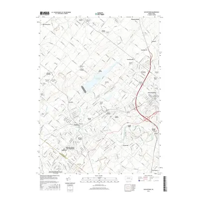
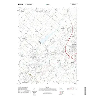
 2010 Doylestown2010 Print · USGSCovers Doylestown Township, including Warrington Township, Buckingham Township, and other nearby areas
 - 2013 Map of Buckingham, 2013 Print
 2013 Buckingham2013 Print · USGSCovers Doylestown Township, including Warrington Township, Buckingham Township, and other nearby areas
 - 2013 Map of Doylestown, 2013 Print
 2013 Doylestown2013 Print · USGSCovers Doylestown Township, including Warrington Township, Buckingham Township, and other nearby areas
 - 2016 Map of Doylestown, 2016 Print
 2016 Doylestown2016 Print · USGSCovers Doylestown Township, including Warrington Township, Buckingham Township, and other nearby areas
 - 2016 Map of Buckingham, 2016 Print
 2016 Buckingham2016 Print · USGSCovers Doylestown Township, including Warrington Township, Buckingham Township, and other nearby areas
 - 2019 Map of Buckingham, 2019 Print
 2019 Buckingham2019 Print · USGSCovers Doylestown Township, including Warrington Township, Buckingham Township, and other nearby areas
 - 2019 Map of Doylestown, 2019 Print
 2019 Doylestown2019 Print · USGSCovers Doylestown Township, including Warrington Township, Buckingham Township, and other nearby areas
Showing maps 1-25 of 27
Top cities near Doylestown Township
- Philadelphia historical maps
- Bensalem Township historical maps
- Abington Township historical maps
- Middletown Township historical maps
- Cheltenham Township historical maps
- Norristown historical maps
See more
Top neighborhoods of Doylestown Township
- Tradesville historical maps
- Edison historical maps
- Poole's Corner historical maps
- Castle Valley historical maps
- Bridge Point historical maps
- Pine Run historical maps
Frequently asked questions
- What are the different types of historical maps available for Doylestown Township?
- What is the oldest map of Doylestown Township?
- Where can I purchase historical maps of Doylestown Township for my home or office?
- Where can I download high-res historical maps of Doylestown Township?
- Are there historical topographic maps available for Doylestown Township?
- Is there historical aerial imagery available for Doylestown Township?
- Where are historical maps of Doylestown Township sourced from?