2020s Maps of Northampton Township, Pennsylvania
Explore 4 historic maps of Northampton Township from the 2020s. These maps offer a rare glimpse into what life looked like during the 2020s — showing old roads, neighborhoods, homes, and landmarks that have changed or disappeared over time.
Whether you're researching your family's past, planning a metal detecting trip, or studying how Northampton Township's landscape evolved across the 2020s, these high-resolution maps are a powerful tool for exploring the history of this region.
- Focus on a specific era: All maps on this page are from the 2020s, giving you a focused view of this time period.
- See what’s changed: Compare century-old streets, trails, and buildings to today's modern landscape using overlays and satellite layers.
- Research with precision: Use these maps for genealogy, historical research, land use analysis, or educational projects.
- View, download, or print: Maps are fully viewable online in high resolution, and can be downloaded or printed for your own records.
Start exploring Northampton Township's history through authentic maps from the 2020s. This is your window into the past.
Northampton Township, PA maps
(4)- 2023 Map of Langhorne, 2023 Print
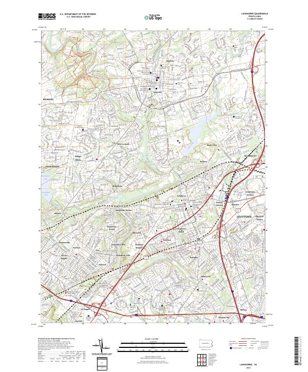 2023 Langhorne2023 Print · USGSBucks County's suburban landscape and colonial history converge in this detailed survey of the corridor between Newtown and Levittown. Researchers can locate several significant burial grounds, including a Revolutionary War Burial Site and the Saint James Episcopal Church Cem.
 - 2023 Map of Buckingham, 2023 Print
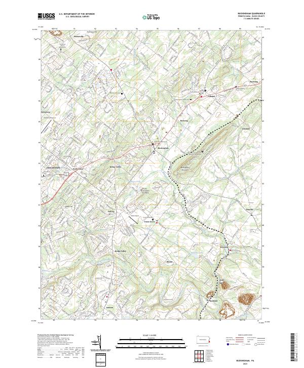 2023 Buckingham2023 Print · USGSBucks County community life and quiet country lanes are captured here in the early twenty-first century. Genealogists can trace family roots through sites like Buckingham Friends Cem and the Gilead African Methodist Episcopal Church Cem.
 - 2023 Map of Hatboro, 2023 Print
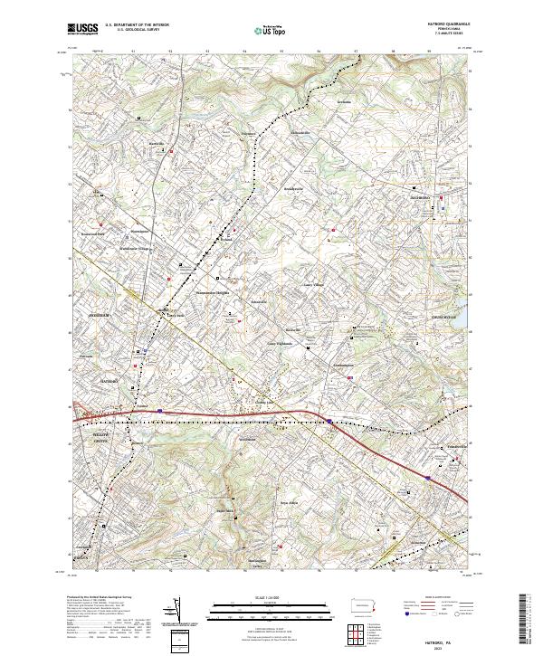 2023 Hatboro2023 Print · USGSThe suburbs north of Philadelphia come into sharp focus in this recent survey of the Hatboro and Warminster corridor. Genealogists can locate numerous burial sites, including the Craven VanSant Burying Grounds and Old Reformed Church Graveyard.
 - 2023 Map of Lambertville, 2023 Print
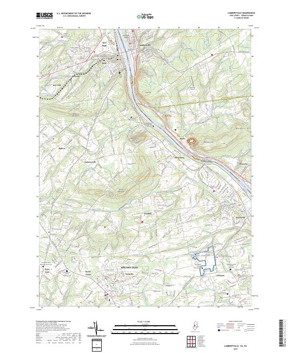 2023 Lambertville2023 Print · USGSLambertville and New Hope anchor this river valley landscape at the New Jersey-Pennsylvania border. Genealogists and historians can trace numerous family sites from the Solebury Friends Graveyard to the Washington Crossing National Cem.
End of results
Showing maps 1-4 of 4
Top cities near Northampton Township
- Philadelphia historical maps
- Trenton historical maps
- Bensalem Township historical maps
- Abington Township historical maps
- Levittown historical maps
- Middletown Township historical maps
See more
Top neighborhoods of Northampton Township
- Saint Leonard historical maps
- Village Shires historical maps
- Grenoble historical maps
- Bridgetown historical maps
- Richboro historical maps
- Breadysville historical maps
See more
Frequently asked questions
- What are the different types of historical maps available for Northampton Township?
- What is the oldest map of Northampton Township?
- Where can I purchase historical maps of Northampton Township for my home or office?
- Where can I download high-res historical maps of Northampton Township?
- Are there historical topographic maps available for Northampton Township?
- Is there historical aerial imagery available for Northampton Township?
- Where are historical maps of Northampton Township sourced from?