1900-1909 Maps of Butler County, Pennsylvania
Explore 11 historic maps of Butler County from 1900-1909. These maps offer a rare glimpse into what life looked like during the 1900s — showing old roads, neighborhoods, homes, and landmarks that have changed or disappeared over time.
Whether you're researching your family's past, planning a metal detecting trip, or studying how Butler County's landscape evolved across the 1900s, these high-resolution maps are a powerful tool for exploring the history of this region.
- Focus on a specific era: All maps on this page are from the 1900s, giving you a focused view of this time period.
- See what’s changed: Compare century-old streets, trails, and buildings to today's modern landscape using overlays and satellite layers.
- Research with precision: Use these maps for genealogy, historical research, land use analysis, or educational projects.
- View, download, or print: Maps are fully viewable online in high resolution, and can be downloaded or printed for your own records.
Start exploring Butler County's history through authentic maps from the 1900s. This is your window into the past.
Butler County, PA maps
(11)- 1900 Map of Kittanning, 1963 Print
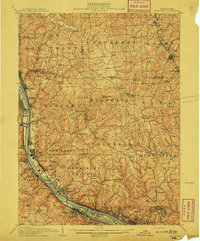
 1900 Kittanning1963 Print · USGSThe Allegheny River valley was a bustling corridor of rail and river industry at the turn of the century. Genealogists and researchers can trace family landmarks and early industrial sites like Redbank Furnace, Laceys Store, and Buffalo Mills.
 - 1902 Map of Kittanning
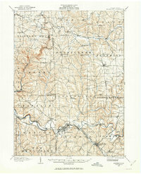
 1902 Kittanning1902 Print · USGSThe Allegheny River corridor at the start of the twentieth century shows a region shaped by heavy rail and early industry. Trace family roots and old commercial sites like Redbank Furnace, East Brady, and the milling hub at Worthington.6 unique versions available
 - 1906 Map of Sewickley, 1960 Print
 1906 Sewickley1960 Print · USGSWestern Pennsylvania’s river-and-rail corridor is captured here at the start of the century, showing the industrial development along the Ohio River. Researchers can trace early infrastructure like Dam No 4 or locate landmarks such as the Camp Meeting Grounds and Parks Quarries.
 - 1907 Map of Foxburg, 1953 Print
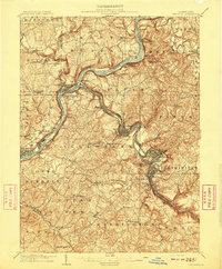
 1907 Foxburg1953 Print · USGSThe river-and-rail economies of Clarion and Armstrong counties are on full display in this early 1900s survey. Genealogists and industrial historians can trace vanished post offices like Perryville Pollock PO, early iron works at Canoe Furnace, and the riverside tracks of the Pennsylvania railroad.2 unique versions available
 - 1907 Map of Freeport, 1956 Print
 1907 Freeport1956 Print · USGSThe industrial river valleys of Armstrong, Westmoreland, and Butler counties come alive in this early 1900s survey. Genealogists and researchers can trace the rail-and-river network through Freeport and Schenley, locating old post offices at Garvers Ferry and Dime.
 - 1908 Map of Foxburg
 1908 Foxburg1908 Print · USGSThe Pennsylvania river valleys thrive during the early twentieth-century industrial boom, as river traffic and railroads intersect in the heart of the coal and iron region. Researchers can locate early post offices at New Salem Lamartine PO, industrial sites like Sarah Furnace, and the Blue Goose Mine.5 unique versions available
 - 1908 Map of Sewickley
 1908 Sewickley1908 Print · USGSThe industrial corridor of the Ohio River valley is captured here in the early twentieth century, showing a landscape defined by steam-era transport and valley settlements. Researchers can trace the riverfront rail networks of the Pennsylvania System and locate historic landmarks like Aliquippa Park and the Campmeeting Grounds.7 unique versions available
 - 1908 Map of New Kensington, 1956 Print
 1908 New Kensington1956 Print · USGSThe Allegheny River valley and its surrounding townships are captured here at the start of the twentieth century. Researchers can trace early railroad stops at Allison Park Sta, find rural landmarks like Sandy Hill School, and locate the Fulton Ferry crossing.
 - 1908 Map of Zelienople, 1963 Print
 1908 Zelienople1963 Print · USGSButler County and parts of Lawrence and Beaver Counties are shown in the first decade of the 1900s, when the region's river-and-rail economy was in full swing. Genealogists and historians can trace family roots at McConnells Mill, locate schools like Tollgate School, or explore the early streets of Zelienople and Harmony.
 - 1909 Map of Freeport
 1909 Freeport1909 Print · USGSThe industrial river valleys of the Allegheny and Kiskiminitas are captured here during the peak of Pennsylvania's rail-and-river era. Researchers can trace the early layouts of Freeport and Leechburg or locate vanished sites like the Lucesco PO.5 unique versions available
 - 1909 Map of Butler, 1957 Print
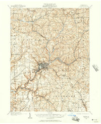 1909 Butler1957 Print · USGSButler and its surrounding townships thrive at the peak of the rail era, before the dominance of modern highways. Genealogists can trace family roots through numerous local schools and churches, from Lyndora and Unionville to White Church and Elliott School.2 unique versions available
End of results
Showing maps 1-11 of 11
Top cities of Butler County
- Cranberry Township historical maps
- Butler historical maps
- Zelienople historical maps
- Slippery Rock historical maps
- Clinton Township historical maps
- Seven Fields historical maps
See more
Frequently asked questions
- What are the different types of historical maps available for Butler County?
- What is the oldest map of Butler County?
- Where can I purchase historical maps of Butler County for my home or office?
- Where can I download high-res historical maps of Butler County?
- Are there historical topographic maps available for Butler County?
- Is there historical aerial imagery available for Butler County?
- Where are historical maps of Butler County sourced from?