2020s Maps of Summit Township, Pennsylvania
Explore 4 historic maps of Summit Township from the 2020s. These maps offer a rare glimpse into what life looked like during the 2020s — showing old roads, neighborhoods, homes, and landmarks that have changed or disappeared over time.
Whether you're researching your family's past, planning a metal detecting trip, or studying how Summit Township's landscape evolved across the 2020s, these high-resolution maps are a powerful tool for exploring the history of this region.
- Focus on a specific era: All maps on this page are from the 2020s, giving you a focused view of this time period.
- See what’s changed: Compare century-old streets, trails, and buildings to today's modern landscape using overlays and satellite layers.
- Research with precision: Use these maps for genealogy, historical research, land use analysis, or educational projects.
- View, download, or print: Maps are fully viewable online in high resolution, and can be downloaded or printed for your own records.
Start exploring Summit Township's history through authentic maps from the 2020s. This is your window into the past.
Summit Township, PA maps
(4)- 2023 Map of East Butler, 2023 Print
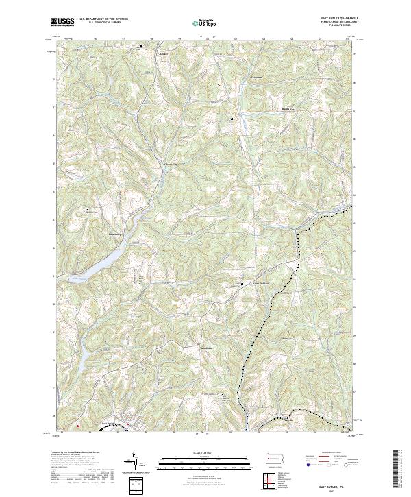 2023 East Butler2023 Print · USGSButler County's rolling upland terrain and small-town networks are captured in this modern survey of the region northeast of Butler. Genealogists and local historians can trace family locations near Concord Cem, the waters of Lake Oneida, and the historic settlement of Greece City.
 - 2023 Map of Saxonburg, 2023 Print
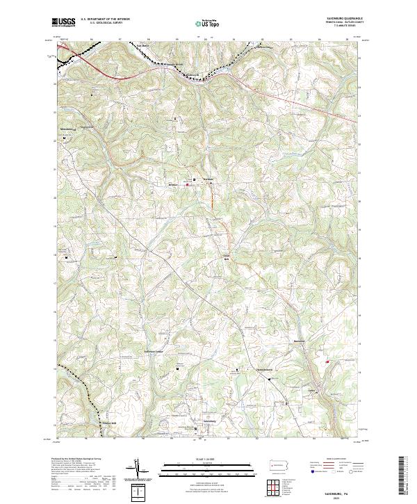 2023 Saxonburg2023 Print · USGSSaxonburg and its surrounding hamlets are captured in this recent survey of Butler County. Researchers can trace family history through numerous sites like B'nai Abraham Cem, the Butler-Freeport Community Trl, and Frazier Mill.
 - 2023 Map of Butler, 2023 Print
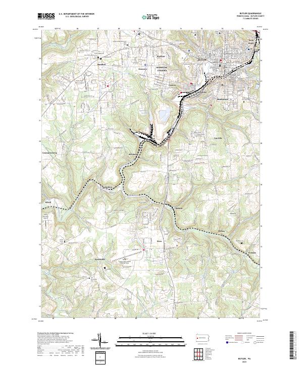 2023 Butler2023 Print · USGSButler and its outlying boroughs show a landscape shaped by creek valleys and industrial growth in the early twenty-first century. Genealogists and local historians can locate several burial sites and institutions, including Old Brownsdale Cem and the Butler County Courthouse.
 - 2023 Map of Mount Chestnut, 2023 Print
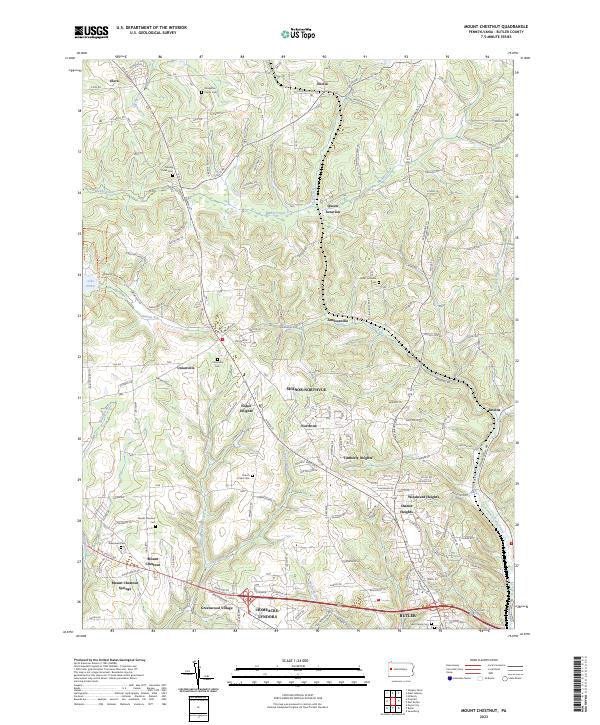 2023 Mount Chestnut2023 Print · USGSButler and its northern townships are captured here in a moment of continued suburban expansion into the rural Pennsylvania hills. Researchers can trace family history at the Stoughton Family Cem or explore the terrain around Queen Junction and Moraine State Park.
End of results
Showing maps 1-4 of 4
Top cities near Summit Township
- Butler historical maps
- Harrison Township historical maps
- Clinton Township historical maps
- North Buffalo Township historical maps
- Muddy Creek historical maps
- Leechburg historical maps
See more
Top neighborhoods of Summit Township
- Herman historical maps
- Vogleyville historical maps
- Wadsworth historical maps
- Brinker historical maps
- Carbon Center historical maps
- Bonnie Brook historical maps
Frequently asked questions
- What are the different types of historical maps available for Summit Township?
- What is the oldest map of Summit Township?
- Where can I purchase historical maps of Summit Township for my home or office?
- Where can I download high-res historical maps of Summit Township?
- Are there historical topographic maps available for Summit Township?
- Is there historical aerial imagery available for Summit Township?
- Where are historical maps of Summit Township sourced from?