1950s Maps of East Nottingham Township, Pennsylvania
Explore 10 historic maps of East Nottingham Township from the 1950s. These maps offer a rare glimpse into what life looked like during the 1950s — showing old roads, neighborhoods, homes, and landmarks that have changed or disappeared over time.
Whether you're researching your family's past, planning a metal detecting trip, or studying how East Nottingham Township's landscape evolved across the 1950s, these high-resolution maps are a powerful tool for exploring the history of this region.
- Focus on a specific era: All maps on this page are from the 1950s, giving you a focused view of this time period.
- See what’s changed: Compare century-old streets, trails, and buildings to today's modern landscape using overlays and satellite layers.
- Research with precision: Use these maps for genealogy, historical research, land use analysis, or educational projects.
- View, download, or print: Maps are fully viewable online in high resolution, and can be downloaded or printed for your own records.
Start exploring East Nottingham Township's history through authentic maps from the 1950s. This is your window into the past.
East Nottingham Township, PA maps
(10)- 1953 Map of Bay View, 1954 Print
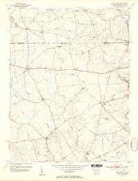 1953 Bay View1954 Print · USGSThe Pennsylvania-Maryland border country is captured here in the early 1950s, showing the rural communities split by the Mason and Dixon Line. Researchers can locate several community hubs, including the Union Sch, Boulden Chapel, and the Pleasant Hill Lookout Tower.8 unique versions available
 - 1953 Map of Rising Sun, 1954 Print
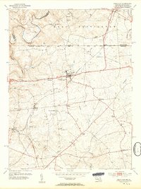 1953 Rising Sun1954 Print · USGSNorthern Cecil County comes to life in the early fifties, following the historic Mason and Dixon Line into Pennsylvania. Genealogists can trace family names at West Nottingham Cem, Richards Oak, and the Brookview Chapel.6 unique versions available
 - 1953 Map of Oxford, 1955 Print
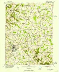 1953 Oxford1955 Print · USGSChester County's rural townships and academic centers are captured here in the early fifties. Researchers can locate numerous family-named landmarks and institutions like Lincoln University, Faggs Manor, and the Chestnut Grove Sch.4 unique versions available
 - 1954 Map of Baltimore
 1954 Baltimore1954 Print · USGSThe Mid-Atlantic region in the early fifties shows a landscape of growing suburban centers and heavy rail corridors. Trace mid-century transit networks and military landmarks from the Aberdeen Proving Ground to the Gettysburg National Military Park.
 - 1955 Map of Wilmington
 1955 Wilmington1955 Print · USGSThe Delaware Valley and Jersey Shore are seen here during the mid-fifties era of rapid suburban expansion and highway development. You can trace the path of the New Jersey Turnpike, locate the Fort Dix Military Reservation, or explore the rail networks of the Pennsylvania Railroad.
 - 1955 Map of Kirkwood, 1957 Print
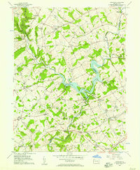 1955 Kirkwood1957 Print · USGSThe Lancaster and Chester County line comes alive in the mid-fifties, dominated by the waters of Octoraro Lake and the rural townships surrounding it. Researchers can trace ancestral locations at Colerain Cem Ch, Little Britain, and the Township Central Sch.4 unique versions available
 - 1956 Map of Baltimore
 1956 Baltimore1956 Print · USGSMid-century Maryland and Pennsylvania are captured here during a period of massive suburban and military growth across the Chesapeake region. Genealogists and historians can trace the rail corridors of the Baltimore & Ohio RR and locate landmarks like Fort McHenry or the Aberdeen Proving Ground.
 - 1957 Map of Wilmington
 1957 Wilmington1957 Print · USGSThe mid-Atlantic coastal plain comes alive in the mid-fifties as the New Jersey Turnpike and Garden State Parkway redefine travel. Researchers can trace the rail-to-road transition and find landmarks like Ship John Shoal Light and the Fort Dix Military Reservation.2 unique versions available
 - 1957 Map of Baltimore, 1964 Print
 1957 Baltimore1964 Print · USGSMaryland and Southern Pennsylvania are shown during the mid-century expansion of the Baltimore-Washington corridor. Researchers can trace the extensive rail lines of the Baltimore & Ohio RR and locate sites like Fort Detrick and Gettysburg National Military Park.5 unique versions available
 - 1959 Map of Wilmington
 1959 Wilmington1959 Print · USGSThe Delaware Valley and Jersey Shore are seen here in the late fifties, during a period of massive suburban and highway expansion. Researchers can trace mid-century infrastructure like the N J Turnpike or locate coastal landmarks from Barnegat Bay to the Maurice River.3 unique versions available
End of results
Showing maps 1-10 of 10
Top cities near East Nottingham Township
- Newark historical maps
- Elkton historical maps
- West Lampeter Township historical maps
- Aberdeen historical maps
- Coatesville historical maps
- Havre de Grace historical maps
See more
Top neighborhoods of East Nottingham Township
- Maple Grove historical maps
- Chrome historical maps
- Elkdale historical maps
- Barnsley historical maps
- Hopewell historical maps
Frequently asked questions
- What are the different types of historical maps available for East Nottingham Township?
- What is the oldest map of East Nottingham Township?
- Where can I purchase historical maps of East Nottingham Township for my home or office?
- Where can I download high-res historical maps of East Nottingham Township?
- Are there historical topographic maps available for East Nottingham Township?
- Is there historical aerial imagery available for East Nottingham Township?
- Where are historical maps of East Nottingham Township sourced from?