Old Maps of Columbia County, Pennsylvania for Academic Research
Study the evolution of Columbia County with 161 high-resolution historic maps. Whether you're teaching, researching, or modeling changes in land use, these maps provide essential visual documentation of urban, environmental, and geographic change.
- Analyze long-term change: Track patterns in development, transportation, and natural features.
- Ideal for environmental or urban studies: Support academic projects with primary historical map data.
- Use in the classroom or lab: Educators and researchers rely on these maps to bring historical context to life.
These maps are a powerful tool for teaching, research, and visualizing how Columbia County has changed over the decades.
Columbia County, PA maps
(161)- 1889 Map of Catawissa, 1954 Print
 1889 Catawissa1954 Print · USGSThe anthracite coal region and Susquehanna River valley come alive in this late 19th-century survey. Genealogists and historians can trace the early rail networks of the Philadelphia and Reading Railroad connecting industrial hubs like Centralia, Mount Carmel, and Ashland.
 - 1892 Map of Catawissa
 1892 Catawissa1892 Print · USGSThe Pennsylvania anthracite region comes into focus during the late nineteenth-century coal boom. Genealogists and historians can trace rail-centered towns like Centralia, Ashland, and Mount Carmel alongside the historic Bloomsburg Ferry.
 - 1892 Map of Shamokin
 1892 Shamokin1892 Print · USGSNorthumberland and Montour Counties are shown here during their industrial prime, when coal and rail shaped every valley. Researchers can trace the early footprints of Shamokin and Danville or locate smaller rail stops like Wolverton Station and Paxinos.
 - 1892 Map of Mahanoy
 1892 Mahanoy1892 Print · USGSSchuylkill and Luzerne counties are captured here at a peak of industrial development during the 1890s coal era. Researchers can trace the massive rail networks serving Shenandoah, Mahanoy City, and lost junctions like Silver Brook Junction.
 - 1893 Map of Shamokin
 1893 Shamokin1893 Print · USGSNorthumberland County's coal-and-rail landscape is captured here during the peak of its industrial development in the late nineteenth century. Researchers can trace the extensive rail networks serving settlements like Shamokin, Danville, and Trevorton, alongside early infrastructure like the Weigh Scale.6 unique versions available
 - 1893 Map of Mahanoy, 1898 Print
 1893 Mahanoy1898 Print · USGSSchuylkill and Luzerne counties are shown at the height of the coal era, revealing a landscape etched by mining and rail commerce. Genealogists and industrial historians can trace the specific neighborhoods of Shenandoah, Mahanoy City, and the railway junctions at Tamanend and Delano.7 unique versions available
 - 1894 Map of Catawissa
 1894 Catawissa1894 Print · USGSPennsylvania's anthracite coal region and the Susquehanna valley appear here in the late nineteenth century, defined by a massive expansion of rail and ridge-top settlements. Researchers can trace old transit lines like the Lehigh Valley Railroad through Centralia or locate early rural hubs like Mifflin X Roads.6 unique versions available
 - 1894 Map of Shickshinny
 1894 Shickshinny1894 Print · USGSLuzerne County at the height of the coal and canal era reveals a landscape shaped by river transport and mountain ridges. Trace the remnants of the Pennsylvania Canal and locate long-standing river crossings like Hicks Ferry and Beach Haven Ferry.6 unique versions available
 - 1894 Map of Bloomsburg
 1894 Bloomsburg1894 Print · USGSThe Sesquehanna River valley in the late nineteenth century shows a landscape shaped by competing rail and water transport. Genealogists can trace family roots in river towns like Mifflinville or follow the mills and stations along Fishing Creek and the Sullivan RR.6 unique versions available
 - 1934 Map of Laporte
 1934 Laporte1934 Print · USGSSullivan County in the early thirties was a landscape of timber camps and coal towns connected by the Lehigh Valley railroad. Genealogists and local historians can trace family locations through old landmarks like Richards Grove, the Sugarloaf Sch, and Jamison City.3 unique versions available
 - 1935 Map of Hughesville
 1935 Hughesville1935 Print · USGSThe rural landscapes of Lycoming and Columbia counties are captured here in the mid-1930s, documenting a time when small schoolhouses and family farms still defined the region. Researchers can trace the Pennsylvania rail line and locate ancestral sites like Wintersteen Sch, Exchange, and Washingtonville.3 unique versions available
 - 1943 Map of Shamokin
 1943 Shamokin1943 Print · USGSNorthumberland and Montour Counties were hubs of industry and river trade in the 1940s. Genealogists and historians can trace rail-era landmarks like Wolverton Station and coal-country staples such as the Trevorton Colliery and Zion Church.
 - 1946 Map of Shickshinny
 1946 Shickshinny1946 Print · USGSLuzerne County's river-and-ridge landscape is captured here in the mid-1940s, as the Pennsylvania railroad follows the Susquehanna River through the mountains. Genealogists can trace family names at the Sorber Cemetery or locate old schoolhouses like Sunshine School and McKendree School.2 unique versions available
 - 1946 Map of Berwick
 1946 Berwick1946 Print · USGSBerwick and the Susquehanna River valley are shown here in the mid-forties, highlighting a landscape of river-oriented industry and mountain-bound rural life. Genealogists can trace numerous local landmarks including Mt Zion Ch, Harter Sch, and the riverside community of Beach Haven.2 unique versions available
 - 1947 Map of Bloomsburg
 1947 Bloomsburg1947 Print · USGSColumbia County at the dawn of the postwar era reveals a bustling river valley centered on Bloomsburg. Researchers can trace the legacy of the State Teachers College, local industry at the Paper Mill, and rural sites like Hidlay Ch.2 unique versions available
 - 1947 Map of Ashland
 1947 Ashland1947 Print · USGSAnthracite coal country comes into sharp focus during the mid-1940s as the valley towns of Schuylkill and Columbia counties reach their peak development. Genealogists and researchers can trace the street grids of Ashland, find the Miners Hospital, and locate Centralia years before its famous underground fires.3 unique versions available
 - 1947 Map of Mt. Carmel
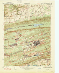 1947 Mt. Carmel1947 Print · USGSThe Pennsylvania coal region is shown here at its post-war industrial peak, bounded by the ridges of Big Mountain and Locust Mountain. Genealogists and historians can trace the intricate rail networks and compact neighborhoods of Mount Carmel, Kulpmont, and Locust Summit.2 unique versions available
 - 1947 Map of Stillwater
 1947 Stillwater1947 Print · USGSMid-century Columbia and Luzerne counties come alive in this survey of the upland farms and creek valleys north of the Susquehanna. Genealogists can locate family landmarks such as Belles Cem, St James Ch, and numerous country schools like Town Hill Sch.2 unique versions available
 - 1947 Map of Mifflinville
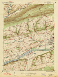 1947 Mifflinville1947 Print · USGSThe Susquehanna River valley in the late 1940s reveals a corridor of industrial growth and rural tradition. Researchers can trace family roots at Roselawn Cem, locate the old Center Sch, or follow the rail lines through Lime Ridge and Mifflinville.2 unique versions available
 - 1947 Map of Catawissa
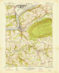 1947 Catawissa1947 Print · USGSColumbia County at the dawn of the post-war era reveals a bustling river valley shaped by coal-hauling railroads and rural industry. Genealogists can trace family names at Parrs Mill, Mt Zion Cem, and many local schools like Clayton Sch.2 unique versions available
 - 1947 Map of Benton
 1947 Benton1947 Print · USGSBenton and the banks of Fishing Creek were centerpieces of Columbia County life just after the war. Local historians can trace the foundations of these communities through the Coles Mill site, the Rohrsburg Cem, and small rural schools like Upper Pine Sch.2 unique versions available
 - 1948 Map of Shumans
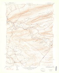 1948 Shumans1948 Print · USGSColumbia County in the late 1940s is defined by its deep creek valleys and the Reading railroad lines that connected its rural hamlets. Researchers can locate vanished landmarks like the Beaver Sch and trace family roots in settlements like Shumans and Kulp.2 unique versions available
 - 1950 Map of Nuremberg
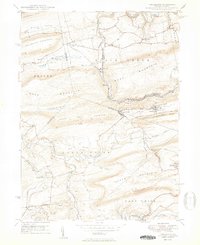 1950 Nuremberg1950 Print · USGSThe tri-county borderlands of Eastern Pennsylvania are captured here at the start of the 1950s. Genealogists can trace family names at Millers Corner and Raricks, or locate ancestors at the Nuremberg Cem and Mt Zion Ch.2 unique versions available
 - 1950 Map of Harrisburg, 1952 Print
 1950 Harrisburg1952 Print · USGSMid-century Central Pennsylvania comes alive through its dense rail networks and river valley settlements during the post-war industrial era. Genealogists and historians can trace family roots through hubs like Harrisburg, locate Carlisle Barracks, or follow the Pennsylvania RR through the Lebanon Valley.
 - 1952 Map of Shamokin, 1954 Print
 1952 Shamokin1954 Print · USGSNorthumberland County in the early 1950s shows a landscape defined by the Susquehanna River and the coal-rich ridges of Big Mountain. Genealogists can locate family names at Pine Hill Cem or trace landmarks like the Slovac Academy and Geisinger Hospital.3 unique versions available
Showing maps 1-25 of 161
Top cities of Columbia County
- Bloomsburg historical maps
- Berwick historical maps
- Greenwood Township historical maps
- North Centre Township historical maps
- Millville historical maps
- Benton historical maps
See more
Frequently asked questions
- What are the different types of historical maps available for Columbia County?
- What is the oldest map of Columbia County?
- Where can I purchase historical maps of Columbia County for my home or office?
- Where can I download high-res historical maps of Columbia County?
- Are there historical topographic maps available for Columbia County?
- Is there historical aerial imagery available for Columbia County?
- Where are historical maps of Columbia County sourced from?