1950s Maps of Crawford County, Pennsylvania
Explore 15 historic maps of Crawford County from the 1950s. These maps offer a rare glimpse into what life looked like during the 1950s — showing old roads, neighborhoods, homes, and landmarks that have changed or disappeared over time.
Whether you're researching your family's past, planning a metal detecting trip, or studying how Crawford County's landscape evolved across the 1950s, these high-resolution maps are a powerful tool for exploring the history of this region.
- Focus on a specific era: All maps on this page are from the 1950s, giving you a focused view of this time period.
- See what’s changed: Compare century-old streets, trails, and buildings to today's modern landscape using overlays and satellite layers.
- Research with precision: Use these maps for genealogy, historical research, land use analysis, or educational projects.
- View, download, or print: Maps are fully viewable online in high resolution, and can be downloaded or printed for your own records.
Start exploring Crawford County's history through authentic maps from the 1950s. This is your window into the past.
Crawford County, PA maps
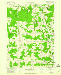
(15)- 1950 Map of Cleveland
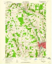
 1950 Cleveland1950 Print · USGSCovers Crawford County, including Cleveland, Akron, and other nearby areas
 - 1956 Map of Cleveland, 1967 Print
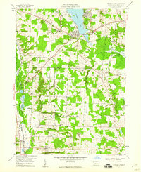
 1956 Cleveland1967 Print · USGSNortheast Ohio and Western Pennsylvania are shown at their industrial height during the mid-fifties, from the steel mills to the lakeshore. Researchers can trace the massive Ravenna Arsenal, the Ohio Turnpike, and vanished rail sidings of the B & O RR.3 unique versions available
 - 1957 Map of Warren, 1964 Print
 1957 Warren1964 Print · USGSThe northern Pennsylvania oil and timber country comes into focus in the mid-fifties, showing the region before modern highway expansions. Trace the industrial rail networks of the Pennsylvania RR and the early Allegheny River Reservoir near Warren and Oil City.4 unique versions available
 - 1958 Map of Warren
 1958 Warren1958 Print · USGSNorthern Pennsylvania’s timber and oil country is captured here during the late fifties, showing the interplay of industrial valleys and vast state forests. Genealogists can trace family connections across the Cornplanter Indian Reservation or through rail hubs like Oil City and Saint Marys.
 - 1958 Map of Greensville West, 1960 Print
 1958 Greensville West1960 Print · USGSWestern Pennsylvania in the late fifties shows a bustling industrial and academic hub centered on the Shenango River. Genealogists and historians can trace the foundations of Greenville, from Thiel College to the path of the historic Erie Extension Canal.4 unique versions available
 - 1958 Map of Greensville East, 1960 Print
 1958 Greensville East1960 Print · USGSMercer County is captured in the late fifties as a bustling crossroads of the New York Central and other major railroads. Genealogists and local researchers can trace family landmarks like Leechs Corners, Stevenson Cem, and Camp Rowland.3 unique versions available
 - 1959 Map of Warren
 1959 Warren1959 Print · USGSNorthern Pennsylvania's oil and timber country comes alive in this late-fifties study of the forest-clad plateaus. Trace the historic Cornplanter (Indian Reservation), the sprawling Oil Field, and the rail lines of the Pennsylvania RR.2 unique versions available
 - 1959 Map of Conneautville, 1960 Print
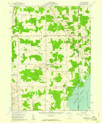
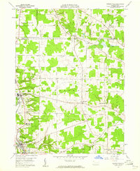 1959 Conneautville1960 Print · USGSCrawford County's agricultural and rail-oriented landscape is captured here in the late fifties, showcasing the vital Bessemer & Lake Erie line. Researchers can trace family history through local landmarks like St Nicholas Ch, Rundell, and the Conneaut Valley High Sch.6 unique versions available
 - 1959 Map of Hartstown, 1960 Print
 1959 Hartstown1960 Print · USGSCrawford County's western edge transitioned into a major recreational and conservation landscape in the late fifties. Genealogists can trace family footprints at Patton Cem or Southside Cem and locate vanished schoolhouses like North Shenango Sch.3 unique versions available
 - 1959 Map of Harmonsburg, 1960 Print
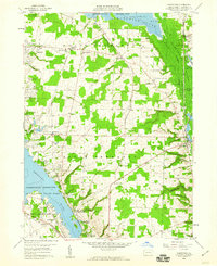
 1959 Harmonsburg1960 Print · USGSCrawford County's lake district is captured here in the late fifties, centered on the recreational and rail hub near the northern tip of the lake. Local historians can trace the paths of the Bessemer and Lake Erie Extension Canal and locate family landmarks like Oak Hill Cem and Dicksonburg.4 unique versions available
 - 1959 Map of Beaver Center, 1960 Print
 1959 Beaver Center1960 Print · USGSIn the rural hills of Crawford County during the late fifties, the landscape is defined by the winding Conneaut Creek and a network of small rail towns. You can trace family roots through White Cem or locate the old Drive-in Theater and the historic Shadeland station.4 unique versions available
 - 1959 Map of Conneaut Lake, 1960 Print
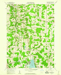
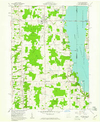
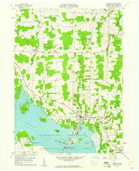
 1959 Conneaut Lake1960 Print · USGSCrawford County in the late fifties shows a landscape balancing lakeside recreation with heavy industry and rail transport. Genealogists and historians can trace family plots at Adsit Cem or follow the path of the Erie RR and the Lake Erie and Ohio River Canal.4 unique versions available
 - 1959 Map of Andover, 1961 Print
 1959 Andover1961 Print · USGSAndover and Williamsfield sit at the edge of the Pymatuning Reservoir in the late fifties, where rural life meets a growing recreation industry. Researchers can trace family sites like Maple Grove Cem, the New York Central rail line, and the local Drive-in Theater.4 unique versions available
 - 1959 Map of Leon, 1961 Print
 1959 Leon1961 Print · USGSThe Ohio-Pennsylvania borderlands come into focus in the late fifties as the Pymatuning Reservoir dominates the local landscape. Researchers can trace the heritage of rural Richmond and Pierpont through landmarks like Richmond Cem, Pennline Ch, and the New York Central railroad.6 unique versions available
 - 1959 Map of Linesville, 1961 Print
 1959 Linesville1961 Print · USGSLinesville and the Crawford County countryside are shown here in the late fifties as the local landscape adapted to the Pymatuning impoundment. Researchers can trace numerous small burial grounds like Manning Cem and Quaker Cem or find landmarks like the State Fish Hatchery.3 unique versions available
End of results
Showing maps 1-15 of 15
Top cities of Crawford County
- Meadville historical maps
- Titusville historical maps
- Cambridge Springs historical maps
- Spring Township historical maps
- Linesville historical maps
- Cochranton historical maps
See more
Frequently asked questions
- What are the different types of historical maps available for Crawford County?
- What is the oldest map of Crawford County?
- Where can I purchase historical maps of Crawford County for my home or office?
- Where can I download high-res historical maps of Crawford County?
- Are there historical topographic maps available for Crawford County?
- Is there historical aerial imagery available for Crawford County?
- Where are historical maps of Crawford County sourced from?