2020s Maps of Fairfield Township, Pennsylvania
Explore 4 historic maps of Fairfield Township from the 2020s. These maps offer a rare glimpse into what life looked like during the 2020s — showing old roads, neighborhoods, homes, and landmarks that have changed or disappeared over time.
Whether you're researching your family's past, planning a metal detecting trip, or studying how Fairfield Township's landscape evolved across the 2020s, these high-resolution maps are a powerful tool for exploring the history of this region.
- Focus on a specific era: All maps on this page are from the 2020s, giving you a focused view of this time period.
- See what’s changed: Compare century-old streets, trails, and buildings to today's modern landscape using overlays and satellite layers.
- Research with precision: Use these maps for genealogy, historical research, land use analysis, or educational projects.
- View, download, or print: Maps are fully viewable online in high resolution, and can be downloaded or printed for your own records.
Start exploring Fairfield Township's history through authentic maps from the 2020s. This is your window into the past.
Fairfield Township, PA maps
(4)- 2023 Map of Cochranton, 2023 Print
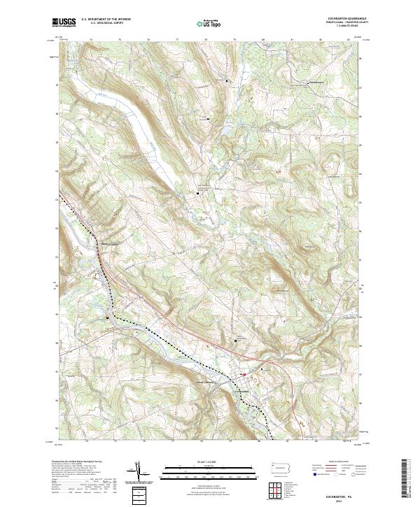 2023 Cochranton2023 Print · USGSCochranton and the surrounding French Creek valley are captured in this contemporary survey of Crawford County. Researchers can trace ancestral roots through numerous local burial grounds including Cochranton Cem and Ewing Cem, or explore the old crossroads at Shaws Corners.
 - 2023 Map of Geneva, 2023 Print
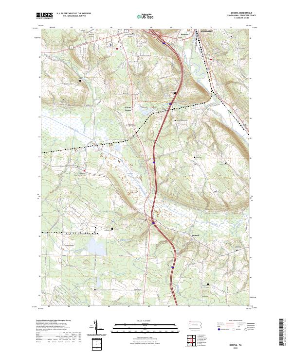 2023 Geneva2023 Print · USGSCrawford County's diverse landscape is documented in this recent survey, from the edge of Meadville down through the expansive Conneaut Marsh. Researchers can locate numerous local landmarks including Port Meadville Airport, Rock Creek Falls, and several family-named burial sites like Mumford Chapel Cem.
 - 2023 Map of Hadley, 2023 Print
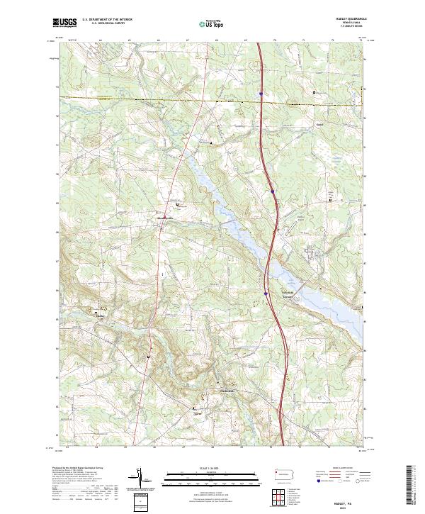 2023 Hadley2023 Print · USGSThe area around Sheakleyville and Hadley is documented here in the early twenty-first century, featuring the expansive waters of Lake Wilhelm. Genealogists can trace local roots at Sheakleyville Cem, Hadley Cem, and Mount Hope Cem.
 - 2023 Map of New Lebanon, 2023 Print
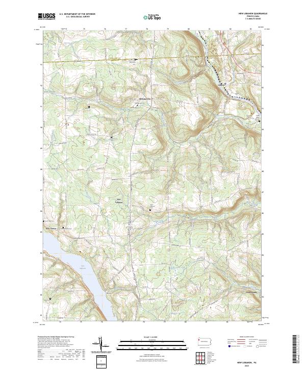 2023 New Lebanon2023 Print · USGSThe rural countryside of Mercer and Crawford counties comes into focus in the early 2020s, revealing a landscape of established family farms and quiet crossroads. Researchers can trace the layout of local burial grounds and settlements from Milledgeville to the banks of Lake Wilhelm and French Creek.
End of results
Showing maps 1-4 of 4
Top cities near Fairfield Township
- Meadville historical maps
- Sugarcreek historical maps
- Cochranton historical maps
- Fairview Township historical maps
- Saegertown historical maps
- Sandy Lake historical maps
See more
Top neighborhoods of Fairfield Township
Frequently asked questions
- What are the different types of historical maps available for Fairfield Township?
- What is the oldest map of Fairfield Township?
- Where can I purchase historical maps of Fairfield Township for my home or office?
- Where can I download high-res historical maps of Fairfield Township?
- Are there historical topographic maps available for Fairfield Township?
- Is there historical aerial imagery available for Fairfield Township?
- Where are historical maps of Fairfield Township sourced from?