Old Maps of Upper Paxton Township, Pennsylvania for Metal Detecting
Plan your next treasure hunt with 33 historic maps of Upper Paxton Township. Find old homesites, ghost towns, trails, and gathering spots that may be lost to time — perfect for identifying promising metal detecting locations.
- Locate forgotten sites: Uncover places like long-lost settlements, abandoned rail lines, or gathering spots.
- Plan better hunts: Use map overlays combined with LiDAR or satellite views to narrow in on historically rich areas.
- Made for detectorists: Thousands of hobbyists use these maps to discover relics, coins, and hidden history.
Use these historic maps to boost your research and find new opportunities beneath the surface of Upper Paxton Township.
Upper Paxton Township, PA maps
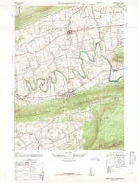
(33)- 1893 Map of Millersburg
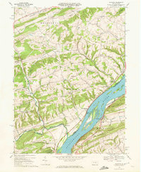
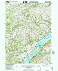
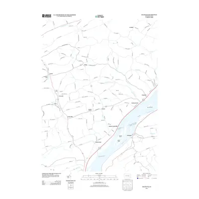
 1893 Millersburg1893 Print · USGSThe Susquehanna River valley in the 1890s shows a landscape shaped by competing transport systems and mountain ridges. Trace the path of the Pennsylvania Canal through Liverpool or locate family roots in Millersburg and Elizabethville.7 unique versions available
 - 1943 Map of Millersburg
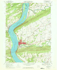
 1943 Millersburg1943 Print · USGSDauphin and Northumberland counties appear here during the mid-1940s, defined by the river-and-rail economy along the Susquehanna River. Researchers can trace the heritage of small valley towns through landmarks like St Johns Church, Morning Glory School, and the Limestone Quarries.
 - 1947 Map of Elizabethville
 1947 Elizabethville1947 Print · USGSPost-war Dauphin County unfolds across the Lykens Valley in this mid-century survey of rural townships and mountain ridges. Genealogists can trace family roots through numerous local landmarks like Maple Grove Cem, Straw Church & Cem, and the Pennsylvania RR corridor.2 unique versions available
 - 1947 Map of Millersburg
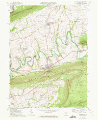
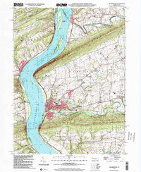
 1947 Millersburg1947 Print · USGSThe Susquehanna River valley and the ridges of Central Pennsylvania are captured here just after the war. Local historians can trace family sites like Killinger School, navigate the Millersburg Ferry, and locate old river crossings such as Montgomery Ferry.2 unique versions available
 - 1947 Map of Dalmatia
 1947 Dalmatia1947 Print · USGSThe Susquehanna River corridor in the late 1940s serves as a vital artery for the Pennsylvania Railroad and the historic Susquehanna Trail. Genealogists and local historians can trace family roots through numerous rural landmarks like Aline School, Bot Schafts Church, and the riverfront village of Dalmatia.2 unique versions available
 - 1950 Map of Harrisburg, 1952 Print
 1950 Harrisburg1952 Print · USGSMid-century Central Pennsylvania comes alive through its dense rail networks and river valley settlements during the post-war industrial era. Genealogists and historians can trace family roots through hubs like Harrisburg, locate Carlisle Barracks, or follow the Pennsylvania RR through the Lebanon Valley.
 - 1953 Map of Millersburg, 1956 Print
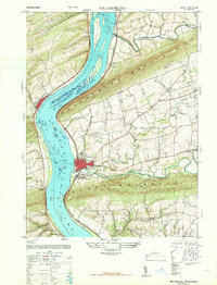
 1953 Millersburg1956 Print · USGSCentral Pennsylvania's river valleys and mountain ridges are captured here during the early fifties, showing a landscape defined by the Susquehanna River. Researchers can locate vanished landmarks like the Abandoned Canal, the Oakdale Sta, and numerous country schools including Keiters Sch.3 unique versions available
 - 1957 Map of Harrisburg
 1957 Harrisburg1957 Print · USGSMid-century Central Pennsylvania comes into focus as a bustling network of rail, river, and mountain ridges. Genealogists and historians can trace the development of the State Capitol and surrounding hubs like Middletown, Columbia, and Pottsville.7 unique versions available
 - 1961 Map of Harrisburg
 1961 Harrisburg1961 Print · USGSCentral Pennsylvania is shown at a mid-century peak of industrial and military activity, from the Susquehanna water gaps to the fertile Dutch Country. Genealogists and historians can trace the rail corridors of the Pennsylvania RR and find landmarks like Carlisle Barracks or the Anthracite Coal Fields.2 unique versions available
 - 1964 Map of Harrisburg
 1964 Harrisburg1964 Print · USGSCentral Pennsylvania in the mid-fifties reveals a landscape shaped by ridge-and-valley geology and critical Cold War infrastructure. Researchers can trace the massive Indiantown Gap Military Reservation or the rail corridors of the Pennsylvania RR and Reading RR.
 - 1969 Map of Elizabethville, 1972 Print
 1969 Elizabethville1972 Print · USGSDauphin County’s ridge-and-valley landscape is captured here in the late sixties, showing the agricultural and industrial character of the Wiconisco Creek valley. Researchers can locate family landmarks such as St Johns Ch, Maple Grove Cem, and the historic Oakdale Station along the Penn Central tracks.2 unique versions available
 - 1969 Map of Dalmatia, 1972 Print
 1969 Dalmatia1972 Print · USGSNorthumberland and Snyder counties meet along the Susquehanna during the late sixties, a time when rail and river still defined the local economy. Researchers can trace family roots at St Pauls Ch, locate a historic Covered Bridge, or explore the riverside at McKees Half Falls.2 unique versions available
 - 1969 Map of Millersburg, 1972 Print
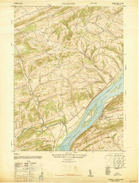
 1969 Millersburg1972 Print · USGSThe Susquehanna River valley near Millersburg comes alive in the late sixties, showcasing the area's rail-and-river heritage. Genealogists and historians can trace family-named sites like Rickard Memorial Cem Ch, the historic Ferry, and Montgomery Ferry.4 unique versions available
 - 1977 Map of Dalmatia, 1979 Print
 1977 Dalmatia1979 Print · USGSThe Susquehanna River valley and its complex ridge-side farms are captured here in the late seventies. Researchers can trace the layout of small crossroads settlements like Meiservill and Verdilla or follow the path of Mahantango Creek.
 - 1977 Map of Millersburg, 1979 Print
 1977 Millersburg1979 Print · USGSThe Susquehanna River valley near the end of the 1970s shows a landscape of riverfront towns and ridge-top forests. Trace the historic layouts of Millersburg, Lenkerville, and Liverpool set against Mahantango Mountain.
 - 1984 Map of Sunbury, 1985 Print
 1984 Sunbury1985 Print · USGSPennsylvania coal country and the Susquehanna valley appear here in the early eighties, showcasing a landscape defined by industrial ridges and river towns. Genealogists and historians can trace rail corridors like Conrail and explore mountain settlements from Mahanoy City to Elizabethville.2 unique versions available
 - 1999 Map of Dalmatia, 2001 Print
 1999 Dalmatia2001 Print · USGSThe Susquehanna River valley at the turn of the millennium shows a landscape of river islands and ridge-side settlements. Researchers can locate vanished rural landmarks and family-named sites like McKees Half Falls, the Covered Bridge near Meiserville, and Grubbs Ch.
 - 1999 Map of Millersburg, 2001 Print
 1999 Millersburg2001 Print · USGSDauphin County river towns and mountain ridges are captured here at the end of the century. Genealogists and local historians can trace the paths of the Ferry and Montgomery Ferry or locate rural landmarks like St Lukes Ch and the Covered Bridge.
 - 2010 Map of Elizabethville, 2010 Print
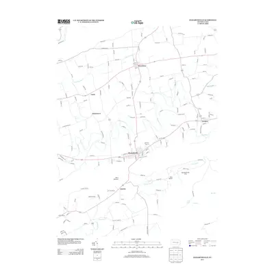
 2010 Elizabethville2010 Print · USGSCovers Upper Paxton Township, including Elizabethville, Wiconisco Township, and other nearby areas
 - 2010 Map of Dalmatia, 2010 Print
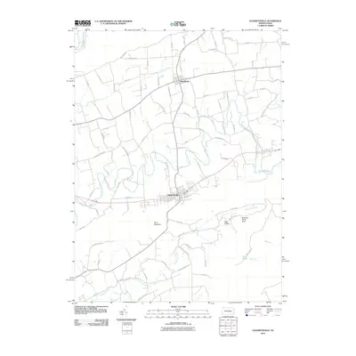
 2010 Dalmatia2010 Print · USGSCovers Upper Paxton Township, including Chapman, Perry Township, and other nearby areas
 - 2010 Map of Millersburg, 2010 Print
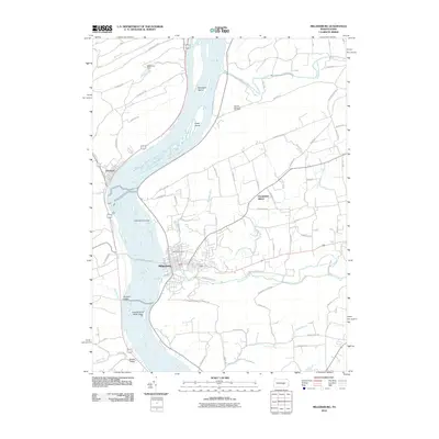 2010 Millersburg2010 Print · USGSCovers Upper Paxton Township, including Malta, Lenkerville, and other nearby areas
 - 2013 Map of Dalmatia, 2013 Print
 2013 Dalmatia2013 Print · USGSCovers Upper Paxton Township, including Chapman, Perry Township, and other nearby areas
 - 2013 Map of Elizabethville, 2013 Print
 2013 Elizabethville2013 Print · USGSCovers Upper Paxton Township, including Elizabethville, Wiconisco Township, and other nearby areas
 - 2013 Map of Millersburg, 2013 Print
 2013 Millersburg2013 Print · USGSCovers Upper Paxton Township, including Malta, Lenkerville, and other nearby areas
 - 2016 Map of Elizabethville, 2016 Print
 2016 Elizabethville2016 Print · USGSCovers Upper Paxton Township, including Elizabethville, Wiconisco Township, and other nearby areas
Showing maps 1-25 of 33
Top cities near Upper Paxton Township
- Linglestown historical maps
- Selinsgrove historical maps
- Skyline View historical maps
- Newport historical maps
- Chapman historical maps
- Middleburg historical maps
See more
Top neighborhoods of Upper Paxton Township
- Paxton historical maps
- Pleasant Hills historical maps
- Reservoir Heights historical maps
- Lenkerville historical maps
- Killinger historical maps
- Rife historical maps
See more
Frequently asked questions
- What are the different types of historical maps available for Upper Paxton Township?
- What is the oldest map of Upper Paxton Township?
- Where can I purchase historical maps of Upper Paxton Township for my home or office?
- Where can I download high-res historical maps of Upper Paxton Township?
- Are there historical topographic maps available for Upper Paxton Township?
- Is there historical aerial imagery available for Upper Paxton Township?
- Where are historical maps of Upper Paxton Township sourced from?