Old Maps of Dunbar Township, Pennsylvania for Metal Detecting
Plan your next treasure hunt with 55 historic maps of Dunbar Township. Find old homesites, ghost towns, trails, and gathering spots that may be lost to time — perfect for identifying promising metal detecting locations.
- Locate forgotten sites: Uncover places like long-lost settlements, abandoned rail lines, or gathering spots.
- Plan better hunts: Use map overlays combined with LiDAR or satellite views to narrow in on historically rich areas.
- Made for detectorists: Thousands of hobbyists use these maps to discover relics, coins, and hidden history.
Use these historic maps to boost your research and find new opportunities beneath the surface of Dunbar Township.
Dunbar Township, PA maps
(55)- 1900 Map of Uniontown
 1900 Uniontown1900 Print · USGSFayette County at the turn of the century shows a landscape defined by the iron and coal industries and early American frontier history. Researchers can locate significant sites like Fort Necessity, Braddocks Grave, and the path of the National Pike.5 unique versions available
 - 1902 Map of Connellsville
 1902 Connellsville1902 Print · USGSThe Pennsylvania coke region comes alive at the turn of the century as a labyrinth of coal mines and competing rail lines. Researchers can trace the industrial footprint of Star Mines, explore the river landings along the Youghiogheny River, and find old junctions like Bells Mills.5 unique versions available
 - 1922 Map of Confluence
 1922 Confluence1922 Print · USGSThe confluence of the Youghiogheny River and Casselman River was a major rail and river hub in the 1920s. Genealogists and local historians can trace the foundations of many small settlements and mountain schools, from Ohiopyle to the Baldwin Mine and Wesley Chapel.3 unique versions available
 - 1931 Map of Connellsville, 1954 Print
 1931 Connellsville1954 Print · USGSSouthwestern Pennsylvania's coal and rail heartland is meticulously detailed here in the early thirties. Local researchers can trace the industrial footprint of Star Mines, the sprawling rail yards of Connellsville, and rural landmarks like Bryner Ch and Mud Sch.2 unique versions available
 - 1931 Map of Uniontown, 1956 Print
 1931 Uniontown1956 Print · USGSFayette County is captured in the early 1930s during a period of transition for its mountain communities and industrial furnace towns. Genealogists can trace family roots at Sylvan Heights Cem or locate the rural Hughes Sch and Wharton Furnace.2 unique versions available
 - 1931 Map of Confluence, 1958 Print
 1931 Confluence1958 Print · USGSThe Laurel Highlands at the start of the 1930s reveal a landscape of deep river valleys and high ridges defined by coal mining and heavy rail. Genealogists can trace family names through dozens of rural sites like Sands Church, Somerfield, and the Mary Ann Mine.2 unique versions available
 - 1933 Map of Confluence
 1933 Confluence1933 Print · USGSThe Laurel Highlands during the early 1930s come into focus through the river networks of Fayette and Somerset counties. Trace family roots at Paddytown or Somerfield, and locate long-gone schoolhouses such as Clay Run School and the Mary Ann Mine.2 unique versions available
 - 1936 Map of Connellsville
 1936 Connellsville1936 Print · USGSSouthwestern Pennsylvania during the mid-1930s reveals a landscape of industrial power and rural community along the Youghiogheny River. Genealogists and historians can trace family roots through numerous named schools like Jefferson Sch and Gault Sch, or locate former industrial hubs at Star Mines and the Fairgrounds.3 unique versions available
 - 1939 Map of Uniontown
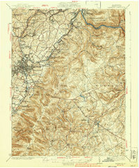 1939 Uniontown1939 Print · USGSFayette County was a powerhouse of industry and history during the 1930s. Genealogists and historians can trace the coke ovens and colliery towns from Juniatta Ovens to Lemont Furnace, or locate the Fort Necessity Battlefield Site.2 unique versions available
 - 1948 Map of Cumberland
 1948 Cumberland1948 Print · USGSMid-century Appalachia and the Shenandoah Valley are shown in detail, documenting the industrial and transportation hubs of the tri-state area. Genealogists can trace family roots through settlements like Double Tollgate and Bunker Hill or along the Baltimore & Ohio RR.3 unique versions available
 - 1952 Map of Cumberland
 1952 Cumberland1952 Print · USGSThe Potomac Highlands and the Shenandoah Valley are revealed in this early 1950s survey of the Appalachian interior. Researchers can trace the river-and-rail corridors connecting Cumberland, Winchester, and the recreational waters of Deep Creek Lake.
 - 1953 Map of Pittsburgh
 1953 Pittsburgh1953 Print · USGSWestern Pennsylvania's industrial landscape at the start of the fifties shows the steel and rail corridors between Pittsburgh and Altoona. Trace family roots in river towns like Tarentum or follow the Pennsylvania Turnpike across Laurel Hill.
 - 1954 Map of Pittsburgh
 1954 Pittsburgh1954 Print · USGSWestern Pennsylvania in the early fifties remains a powerhouse of heavy industry and vital transit corridors. Genealogists and historians can trace the rail-and-river network connecting Pittsburgh, Johnstown, and Altoona via the Pennsylvania RR and the Lincoln Highway.2 unique versions available
 - 1956 Map of Cumberland, 1966 Print
 1956 Cumberland1966 Print · USGSThe tri-state Highlands in the mid-1950s show a landscape shaped by coal, timber, and the massive presence of the Baltimore & Ohio RR. Researchers can trace the industrial corridor from Cumberland through the Allegheny Mountains to mountain retreats like Deep Creek Lake.6 unique versions available
 - 1957 Map of Cumberland
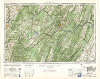 1957 Cumberland1957 Print · USGSThe Potomac River valley and the ridges of the Allegheny Front define this mid-century landscape at the intersection of Maryland, West Virginia, and Pennsylvania. Trace the steam-era rail lines of the Baltimore and Ohio RR or locate rural landmarks like St Stephens Church and Stony River Dam.
 - 1958 Map of Pittsburgh
 1958 Pittsburgh1958 Print · USGSWestern Pennsylvania in the late fifties shows an industrial heartland defined by the confluence of the Allegheny River and Monongahela River. Researchers can trace the sprawling rail networks of the Pennsylvania RR and find established towns like Butler, Latrobe, and Windber.5 unique versions available
 - 1959 Map of Pittsburgh
 1959 Pittsburgh1959 Print · USGSWestern Pennsylvania in the late fifties is captured here at the height of its industrial era. Genealogists and historians can trace the riverfront growth of Pittsburgh, the rail works at Altoona, and the mountain gaps of Laurel Hill.
 - 1961 Map of Cumberland
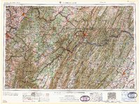 1961 Cumberland1961 Print · USGSThe tri-state highlands of Maryland, West Virginia, and Pennsylvania are shown in the mid-twentieth century as a complex landscape of ridges and river valleys. Researchers can trace the winding Potomac River and find old rail-and-river towns like Cumberland, Keyser, and Morgantown.
 - 1962 Map of Cumberland
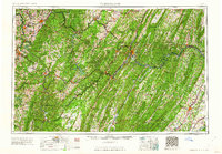 1962 Cumberland1962 Print · USGSThe central Appalachians meet at the height of the mid-century industrial era, showing the rugged topography between Morgantown and Winchester. Genealogists can trace family lands near Fort Necessity or along the vital Baltimore & Ohio RR corridors.
 - 1963 Map of Uniontown, 1965 Print
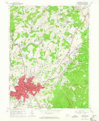 1963 Uniontown1965 Print · USGSUniontown and the surrounding Fayette County hills are captured here in the early sixties, a landscape defined by mining heritage and deep-rooted parishes. Genealogists and local historians can trace family locations through numerous sites like Calvary Cem, Vances Mill, and the many schools of North Union.3 unique versions available
 - 1964 Map of Pittsburgh
 1964 Pittsburgh1964 Print · USGSWestern Pennsylvania in the late fifties and early sixties shows a landscape of powerful river industries and expanding highways. Genealogists and historians can trace the rail corridors of the Pennsylvania RR through industrial hubs like Johnstown, Altoona, and Nanty Glo.
 - 1964 Map of Dawson, 1965 Print
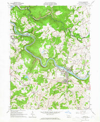 1964 Dawson1965 Print · USGSFayette County’s industrial heart is revealed in the mid-sixties as coal and rail dominate the Youghiogheny River valley. Researchers can trace the heritage of local patch towns like Dawson, find the historic Alliance Furnace, or locate family plots at Bethel Cem.4 unique versions available
 - 1964 Map of Connellsville, 1966 Print
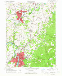 1964 Connellsville1966 Print · USGSMid-century Fayette and Westmoreland Counties are defined here by a dense network of industrial rail lines and riverside towns. Genealogists and historians can trace the foundations of Connellsville, locate West Overton, and find landmarks like St Ritas Cem.5 unique versions available
 - 1964 Map of South Connellsville, 1966 Print
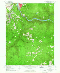 1964 South Connellsville1966 Print · USGSFayette County's coal and rail heritage is on full display here during the mid-1960s, centered on the Youghiogheny River corridor. Genealogists and historians can trace local landmarks like Greenbrier Ch, Roebuck Cem, and the industrial sites around Furnace Hill.4 unique versions available
 - 1967 Map of Mill Run, 1970 Print
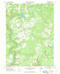 1967 Mill Run1970 Print · USGSFayette County’s mountain ridges and river gorges are captured here in the late sixties as the region balanced industry and recreation. Genealogists and local historians can locate Hickman Chapel, Rogers Mill, and the rail junction at Mill Run.3 unique versions available
Showing maps 1-25 of 55
Top cities near Dunbar Township
- Uniontown historical maps
- Connellsville historical maps
- Redstone historical maps
- Scottdale historical maps
- Mount Pleasant historical maps
- Springhill Township historical maps
See more
Top neighborhoods of Dunbar Township
- New Haven historical maps
- Trotter historical maps
- Wheeler historical maps
- Crossland historical maps
- Little Summit historical maps
- Mahoning historical maps
See more
Frequently asked questions
- What are the different types of historical maps available for Dunbar Township?
- What is the oldest map of Dunbar Township?
- Where can I purchase historical maps of Dunbar Township for my home or office?
- Where can I download high-res historical maps of Dunbar Township?
- Are there historical topographic maps available for Dunbar Township?
- Is there historical aerial imagery available for Dunbar Township?
- Where are historical maps of Dunbar Township sourced from?