2020s Maps of Licking Creek Township, Pennsylvania
Explore 6 historic maps of Licking Creek Township from the 2020s. These maps offer a rare glimpse into what life looked like during the 2020s — showing old roads, neighborhoods, homes, and landmarks that have changed or disappeared over time.
Whether you're researching your family's past, planning a metal detecting trip, or studying how Licking Creek Township's landscape evolved across the 2020s, these high-resolution maps are a powerful tool for exploring the history of this region.
- Focus on a specific era: All maps on this page are from the 2020s, giving you a focused view of this time period.
- See what’s changed: Compare century-old streets, trails, and buildings to today's modern landscape using overlays and satellite layers.
- Research with precision: Use these maps for genealogy, historical research, land use analysis, or educational projects.
- View, download, or print: Maps are fully viewable online in high resolution, and can be downloaded or printed for your own records.
Start exploring Licking Creek Township's history through authentic maps from the 2020s. This is your window into the past.
Licking Creek Township, PA maps
- 2023 Map of McConnellsburg, 2023 Print
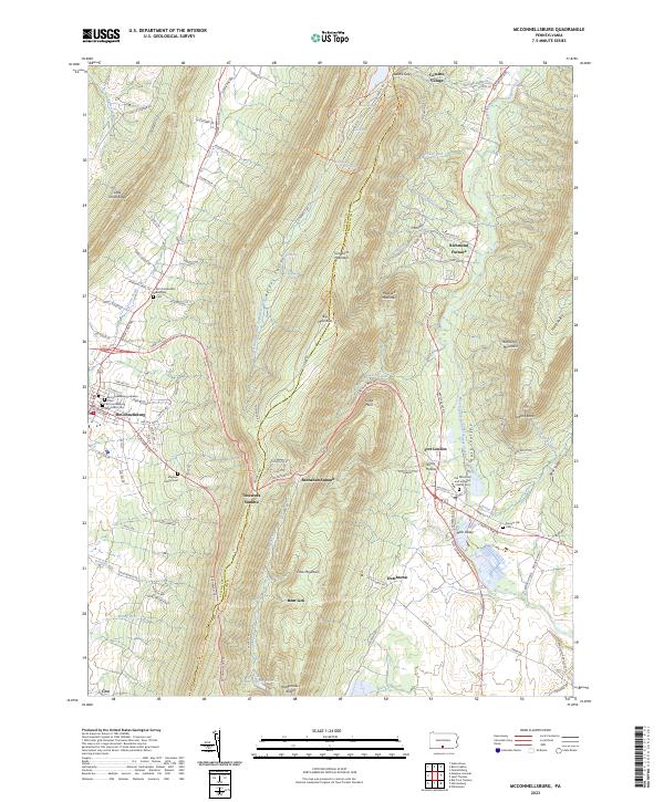 2023 McConnellsburg2023 Print · USGSThe valleys and high ridges of Fulton and Franklin Counties are documented here as they appeared in recent years. Genealogists can locate family burial sites like Magsam Family Cem and the McConnellsburg Methodist Cem or explore the history of Richmond Furnace.
 - 2023 Map of Hustontown, 2023 Print
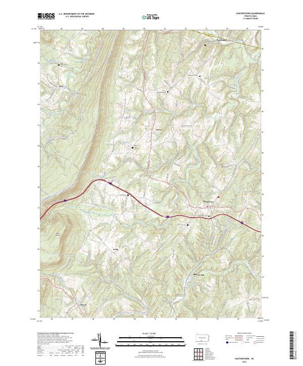 2023 Hustontown2023 Print · USGSFulton County and the eastern slopes of Sideling Hill are documented here in recent detail. Researchers can trace rural legacy through many family-named landmarks like Mellotts Mill and local burial sites such as Winegardner Cem and Fairview Cem.
 - 2023 Map of Breezewood, 2023 Print
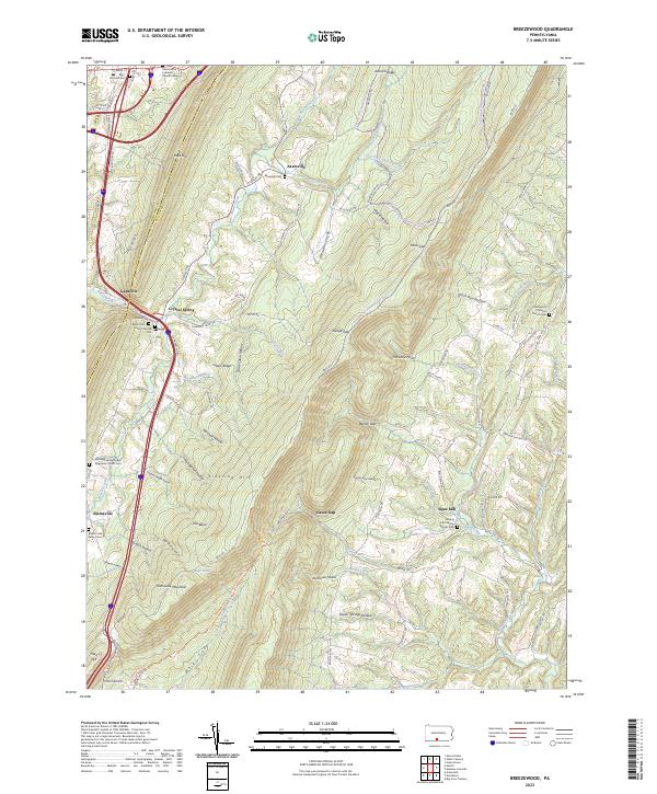 2023 Breezewood2023 Print · USGSThe ridge-and-valley country of Fulton and Bedford Counties is shown here in the 2020s, revealing a landscape of steep hollows and high summits. Genealogists can trace family burial sites at Rays Hill Cem Old, the Sideling Hill Christian Church Cem, and Akersville Cem.
 - 2023 Map of Meadow Grounds, 2023 Print
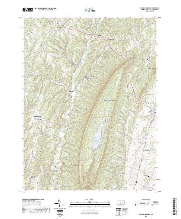 2023 Meadow Grounds2023 Print · USGSFulton County’s ridge-and-valley landscape is documented here in the early twenty-first century, centered on the high basin of Meadow Grounds Lake. Local historians can trace family ties at Green Hill Presbyterian Cem, Wink Cem, and the Bethlehem United Brethren Cem.
 - 2023 Map of Burnt Cabins, 2023 Print
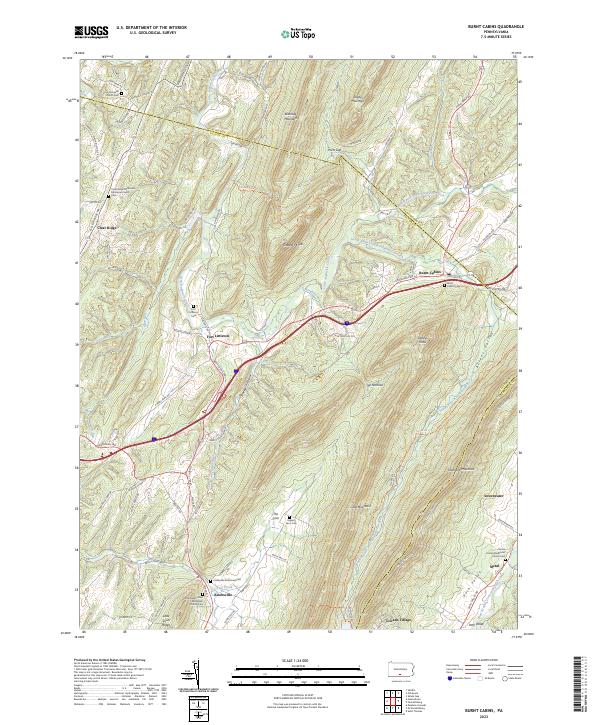 2023 Burnt Cabins2023 Print · USGSThe ridge-and-valley landscape of Fulton County is captured here in detail, showcasing a region defined by its narrow gaps and historic mountain passes. Genealogists can trace family sites at Englert Farm Cem, Knobsville, and the historic Fort Littleton Cem.
 - 2023 Map of Wells Tannery, 2023 Print
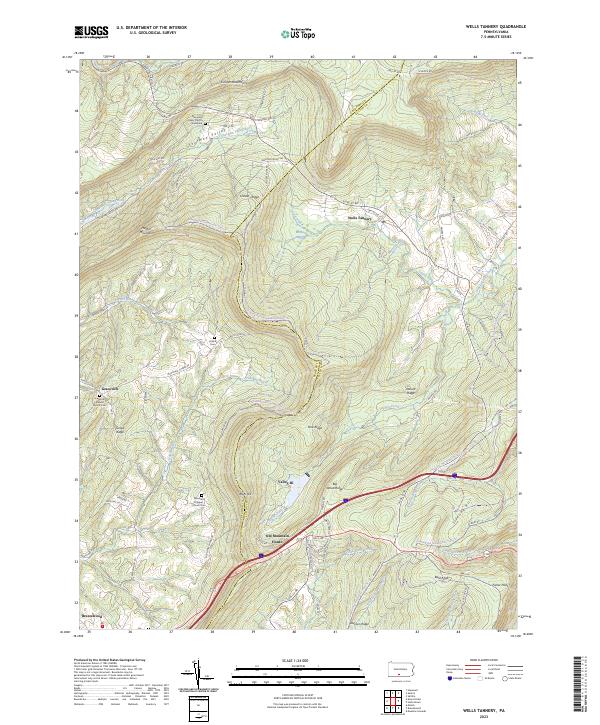 2023 Wells Tannery2023 Print · USGSDeep in the mountains of south-central Pennsylvania, this survey captures the rural character of the Bedford-Fulton border. Genealogists can trace family names at Hinish Cem and Graceville Lutheran Church Cem near the Old Mountain House.
End of results
Showing maps 1-6
Top cities near Licking Creek Township
- Metal Township historical maps
- Mercersburg historical maps
- McConnellsburg historical maps
- Todd Township historical maps
- Three Springs historical maps
- Broad Top City historical maps
See more
Top neighborhoods of Licking Creek Township
- Mellotts Mill historical maps
- Saluvia historical maps
- Andover historical maps
- Breezy Point historical maps
- Green Hill historical maps
- Harrisonville historical maps
See more
Frequently asked questions
- What are the different types of historical maps available for Licking Creek Township?
- What is the oldest map of Licking Creek Township?
- Where can I purchase historical maps of Licking Creek Township for my home or office?
- Where can I download high-res historical maps of Licking Creek Township?
- Are there historical topographic maps available for Licking Creek Township?
- Is there historical aerial imagery available for Licking Creek Township?
- Where are historical maps of Licking Creek Township sourced from?