Old Maps of Licking Creek Township, Pennsylvania for Academic Research
Study the evolution of Licking Creek Township with 78 high-resolution historic maps. Whether you're teaching, researching, or modeling changes in land use, these maps provide essential visual documentation of urban, environmental, and geographic change.
- Analyze long-term change: Track patterns in development, transportation, and natural features.
- Ideal for environmental or urban studies: Support academic projects with primary historical map data.
- Use in the classroom or lab: Educators and researchers rely on these maps to bring historical context to life.
These maps are a powerful tool for teaching, research, and visualizing how Licking Creek Township has changed over the decades.
Licking Creek Township, PA maps
(78)- 1900 Map of Mercersburg
 1900 Mercersburg1900 Print · USGSFranklin County at the turn of the century is captured here as a landscape of iron furnaces and valley farms. Trace the early transport lines through Mercersburg, Richmond Furnace, and the old Southern Pennsylvania Br. rail line.
 - 1902 Map of Mercersburg
 1902 Mercersburg1902 Print · USGSFranklin and Fulton counties at the opening of the twentieth century show a landscape defined by iron furnaces and mountain gaps. Genealogists and historians can trace rail lines to Mercersburg Junction or locate family sites near Welsh Run and Foltz.5 unique versions available
 - 1925 Map of Needmore
 1925 Needmore1925 Print · USGSFulton County’s ridges and valleys are meticulously detailed in the mid-1920s, showing the early path of the Lincoln Highway. Researchers can locate dozens of country institutions, from the Old Mountain House to the Sideling Hill Baptist Church and Sipes Mill.
 - 1930 Map of Broad Top, 1958 Print
 1930 Broad Top1958 Print · USGSThe Broad Top coalfields of the 1930s come alive through this survey of the region's mining towns and mountain ridges. Genealogists can trace family footprints at Bills Place, Miller Sch, and the Garlick Mine along the Huntingdon and Broad Top Mountain RR.2 unique versions available
 - 1933 Map of Broad Top
 1933 Broad Top1933 Print · USGSBroad Top Mountain and its surrounding coalfields were at a peak of rail-driven activity in the early thirties. Local historians can trace the precise routes of the Huntingdon and Broad Top Mountain RR and locate community landmarks like Wells Tannery and Eagle Foundry Ch.3 unique versions available
 - 1935 Map of Needmore
 1935 Needmore1935 Print · USGSFulton County settlements and ridge-and-valley farmsteads are documented here in the years before the Second World War. Genealogists can trace family names at Wink Cem or locate rural landmarks like Hammans Store, Sipes Mill, and Big Cove Tannery.
 - 1939 Map of Needmore
 1939 Needmore1939 Print · USGSFulton County and the Bedford-Franklin borderlands appear here in the late thirties, showing a rural landscape defined by steep ridges and narrow valleys. Researchers can locate family landmarks like Sipes Mill, Wink Cem, and the Big Cove Tannery.3 unique versions available
 - 1939 Map of Orbisonia, 1954 Print
 1939 Orbisonia1954 Print · USGSOrbisonia and the surrounding mountain gaps are captured in the late thirties just as the modern turnpike was transforming the valley. Researchers can trace the narrow-gauge East Broad Top RR or find rural landmarks like Burnt Cabins and Jordan Cem.7 unique versions available
 - 1940 Map of Orbisonia
 1940 Orbisonia1940 Print · USGSCentral Pennsylvania's Ridge and Valley province is captured here just as the Pennsylvania Turnpike reached Burnt Cabins. Researchers can trace the narrow-gauge EAST BROAD TOP RR and locate family landmarks like Jordan Cem, Kuhns Mill, or St Marys Ch.2 unique versions available
 - 1942 Map of Hagerstown
 1942 Hagerstown1942 Print · USGSThe Cumberland Valley and Potomac corridor are captured here at the height of the Second World War rail-and-river era. Genealogists and historians can trace the industrial landscape of Richmond Furnace, the route of the Chesapeake and Ohio Canal, and the grounds of Camp Ritchie.
 - 1943 Map of Hagerstown
 1943 Hagerstown1943 Print · USGSThe Cumberland Valley was a critical wartime logistics hub in the 1940s, teeming with rail traffic and new military installations. Genealogists and historians can trace the Chesapeake and Ohio Canal or locate local landmarks like Richmond Furnace and Camp Ritchie.
 - 1943 Map of Mercersburg, 1955 Print
 1943 Mercersburg1955 Print · USGSFranklin County in the 1940s is captured here in its transition from a ridge-and-valley wilderness to a settled agricultural heartland. Genealogists can trace family landmarks like Claylick Sch, the historic Mercersburg Academy, and the village of Fort Loudon.2 unique versions available
 - 1944 Map of Mc Connellsburg
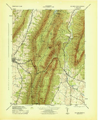 1944 Mc Connellsburg1944 Print · USGSFranklin and Fulton counties are captured here during the mid-forties, showing the deep valleys between the Tuscarora and Cove mountain ridges. Genealogists can locate rural schoolhouses like Jugtown School and small settlements like Richmond Furnace or Dutchtown.5 unique versions available
 - 1944 Map of Orbisonia
 1944 Orbisonia1944 Print · USGSCentral Pennsylvania's ridge-and-valley landscape is shown here at the height of the narrow-gauge era just as modern highways arrived. Researchers can trace the East Broad Top RR through Rockhill, find legacy family sites like Kuhns Mill, and locate the Pennsylvania Turnpike near Burnt Cabins.3 unique versions available
 - 1948 Map of Baltimore
 1948 Baltimore1948 Print · USGSMaryland and Pennsylvania crossroads are captured in the late 1940s, showing a landscape defined by historic rail lines and major military installations. Genealogists can trace family connections in Gettysburg, Westminster, and near the U.S. Naval Academy in Annapolis.2 unique versions available
 - 1948 Map of Cumberland
 1948 Cumberland1948 Print · USGSMid-century Appalachia and the Shenandoah Valley are shown in detail, documenting the industrial and transportation hubs of the tri-state area. Genealogists can trace family roots through settlements like Double Tollgate and Bunker Hill or along the Baltimore & Ohio RR.3 unique versions available
 - 1950 Map of Harrisburg, 1952 Print
 1950 Harrisburg1952 Print · USGSMid-century Central Pennsylvania comes alive through its dense rail networks and river valley settlements during the post-war industrial era. Genealogists and historians can trace family roots through hubs like Harrisburg, locate Carlisle Barracks, or follow the Pennsylvania RR through the Lebanon Valley.
 - 1952 Map of Cumberland
 1952 Cumberland1952 Print · USGSThe Potomac Highlands and the Shenandoah Valley are revealed in this early 1950s survey of the Appalachian interior. Researchers can trace the river-and-rail corridors connecting Cumberland, Winchester, and the recreational waters of Deep Creek Lake.
 - 1953 Map of Pittsburgh
 1953 Pittsburgh1953 Print · USGSWestern Pennsylvania's industrial landscape at the start of the fifties shows the steel and rail corridors between Pittsburgh and Altoona. Trace family roots in river towns like Tarentum or follow the Pennsylvania Turnpike across Laurel Hill.
 - 1954 Map of Pittsburgh
 1954 Pittsburgh1954 Print · USGSWestern Pennsylvania in the early fifties remains a powerhouse of heavy industry and vital transit corridors. Genealogists and historians can trace the rail-and-river network connecting Pittsburgh, Johnstown, and Altoona via the Pennsylvania RR and the Lincoln Highway.2 unique versions available
 - 1954 Map of Baltimore
 1954 Baltimore1954 Print · USGSThe Mid-Atlantic region in the early fifties shows a landscape of growing suburban centers and heavy rail corridors. Trace mid-century transit networks and military landmarks from the Aberdeen Proving Ground to the Gettysburg National Military Park.
 - 1956 Map of Baltimore
 1956 Baltimore1956 Print · USGSMid-century Maryland and Pennsylvania are captured here during a period of massive suburban and military growth across the Chesapeake region. Genealogists and historians can trace the rail corridors of the Baltimore & Ohio RR and locate landmarks like Fort McHenry or the Aberdeen Proving Ground.
 - 1956 Map of Cumberland, 1966 Print
 1956 Cumberland1966 Print · USGSThe tri-state Highlands in the mid-1950s show a landscape shaped by coal, timber, and the massive presence of the Baltimore & Ohio RR. Researchers can trace the industrial corridor from Cumberland through the Allegheny Mountains to mountain retreats like Deep Creek Lake.6 unique versions available
 - 1957 Map of Harrisburg
 1957 Harrisburg1957 Print · USGSMid-century Central Pennsylvania comes into focus as a bustling network of rail, river, and mountain ridges. Genealogists and historians can trace the development of the State Capitol and surrounding hubs like Middletown, Columbia, and Pottsville.7 unique versions available
 - 1957 Map of Cumberland
 1957 Cumberland1957 Print · USGSThe Potomac River valley and the ridges of the Allegheny Front define this mid-century landscape at the intersection of Maryland, West Virginia, and Pennsylvania. Trace the steam-era rail lines of the Baltimore and Ohio RR or locate rural landmarks like St Stephens Church and Stony River Dam.
Showing maps 1-25 of 78
Top cities near Licking Creek Township
- Metal Township historical maps
- Mercersburg historical maps
- McConnellsburg historical maps
- Todd Township historical maps
- Three Springs historical maps
- Broad Top City historical maps
See more
Top neighborhoods of Licking Creek Township
- Mellotts Mill historical maps
- Saluvia historical maps
- Green Hill historical maps
- Harrisonville historical maps
- Pleasant Ridge historical maps
- Andover historical maps
See more
Frequently asked questions
- What are the different types of historical maps available for Licking Creek Township?
- What is the oldest map of Licking Creek Township?
- Where can I purchase historical maps of Licking Creek Township for my home or office?
- Where can I download high-res historical maps of Licking Creek Township?
- Are there historical topographic maps available for Licking Creek Township?
- Is there historical aerial imagery available for Licking Creek Township?
- Where are historical maps of Licking Creek Township sourced from?