Old Maps of Greene County, Pennsylvania for Metal Detecting
Plan your next treasure hunt with 174 historic maps of Greene County. Find old homesites, ghost towns, trails, and gathering spots that may be lost to time — perfect for identifying promising metal detecting locations.
- Locate forgotten sites: Uncover places like long-lost settlements, abandoned rail lines, or gathering spots.
- Plan better hunts: Use map overlays combined with LiDAR or satellite views to narrow in on historically rich areas.
- Made for detectorists: Thousands of hobbyists use these maps to discover relics, coins, and hidden history.
Use these historic maps to boost your research and find new opportunities beneath the surface of Greene County.
Greene County, PA maps
(174)- 1900 Map of Masontown
 1900 Masontown1900 Print · USGSThe Monongahela River valley was a hub of transit and industry at the turn of the century, defined by its numerous ferry crossings and coal-country junctions. Researchers can trace historic river crossings like McCanns Ferry, follow the National Pike, and locate vanished rail stops at Ache Junction.
 - 1901 Map of Amity, 1956 Print
 1901 Amity1956 Print · USGSWashington County at the turn of the century shows a landscape transitioning between historic pikes and the burgeoning rail era. Researchers can trace ancestral property near Tenmile Creek or follow the route of the National Pike through Laboratory and Zediker.
 - 1901 Map of Waynesburg, 1958 Print
 1901 Waynesburg1958 Print · USGSGreene County at the start of the twentieth century shows a landscape of deep valleys and rising townships connected by the South Fork of Tenmile Creek. Genealogists can trace family names through landmarks like Rees Mill, Gump, and the dual settlement of Kirby Newtown.
 - 1902 Map of Morgantown
 1902 Morgantown1902 Print · USGSMorgantown and the Monongahela River corridor appear here at the dawn of the twentieth century, captured during a period of industrial growth. Genealogists and historians can trace old iron industry sites like Clinton Furnace, river crossings at Ice's Ferry, and early rail routes.5 unique versions available
 - 1903 Map of Littleton
 1903 Littleton1903 Print · USGSThe West Virginia and Pennsylvania borderlands appear here at the turn of the century, marked by deep ridges and creek-side settlements. Trace the path of the B. and O. R. R. as it connects Littleton to outlying hamlets like Wileyville and Burchfield.
 - 1903 Map of Masontown
 1903 Masontown1903 Print · USGSThe Monongahela River valley at the turn of the century was a vital artery of ferries and river locks connecting Fayette and Greene Counties. Genealogists and local historians can trace family roots through riverfront landings and towns like Greensboro, Masontown, and Smithfield.4 unique versions available
 - 1904 Map of Amity
 1904 Amity1904 Print · USGSWashington County at the start of the twentieth century was a bustling nexus of rail and road, centered on the growing city of WASHINGTON. Researchers can trace early property lines and rail stops like Meadowlands, Laboratory, and the Pittsburg and Washington Turnpike.6 unique versions available
 - 1904 Map of Blacksville
 1904 Blacksville1904 Print · USGSThe West Virginia and Pennsylvania border comes alive in this survey from the early twentieth century. Researchers can trace the river economy along the Monongahela at Lock No. 13 or locate rural homesteads near Fairview Amos P.O. and Blacksville.3 unique versions available
 - 1904 Map of Waynesburg
 1904 Waynesburg1904 Print · USGSGreene County was a landscape of deeply carved creek valleys and rural crossroads at the start of the twentieth century. Genealogists and local historians can trace early property settings near Waynesburg, Rees Mill, and the riverside borough of Rices Landing.5 unique versions available
 - 1904 Map of Cameron
 1904 Cameron1904 Print · USGSMarshall County's river-and-rail economy is frozen in time at the dawn of the century, showing the dense settlement patterns of the West Virginia panhandle. Researchers can trace the Baltimore and Ohio R R through Rosbys Rock or locate rural landmarks like Beelers Station and the Waynesburg Turnpike.4 unique versions available
 - 1905 Map of Mannington
 1905 Mannington1905 Print · USGSThe West Virginia-Pennsylvania borderlands are captured here at the start of the twentieth century, showing a landscape defined by deep ridges and rail-side commerce. Genealogists can trace family roots through locations like Hundred Church, Wadestown, and Brave P.O. along the state line.2 unique versions available
 - 1905 Map of Rogersville
 1905 Rogersville1905 Print · USGSGreene and Washington counties are documented here at the turn of the century as a maze of ridge-and-valley settlements. Genealogists can trace early homesteads and commerce hubs like Harveys P.O. Graysville, Simpson Store, and Ryerson Station.4 unique versions available
 - 1905 Map of Littleton
 1905 Littleton1905 Print · USGSWetzel County and the surrounding borderlands appear here in the early twentieth century, showing a landscape defined by steep ridges and rail corridors. Researchers can trace the B and O RR through Littleton or find small settlements like Saint Joseph and Silver Hill.2 unique versions available
 - 1907 Map of Claysville
 1907 Claysville1907 Print · USGSWashington County during the first decade of the 1900s shows a dense network of hill-country townships connected by the Baltimore and Ohio RR. Researchers can trace rural life through numerous named schoolhouses and local post offices like Crothers PO and Vienna Coon Island PO.5 unique versions available
 - 1923 Map of Blacksville, 1956 Print
 1923 Blacksville1956 Print · USGSMonongalia and Marion counties appear here during the early twentieth century as the coal and rail economy began to reshape the rural landscape. Researchers can find numerous family landmarks, from Town School and Olive Church to the industrial works at Montana Mines.
 - 1923 Map of Mannington, 1956 Print
 1923 Mannington1956 Print · USGSMannington and the surrounding hollows of Marion and Monongalia counties appear here in the early twenties as a dense network of rural life. Genealogists can trace family footprints through numerous small landmarks like Blackshire Chapel, Efaw Knob, and Glover Gap.
 - 1924 Map of Littleton, 1957 Print
 1924 Littleton1957 Print · USGSWetzel County at the height of the rail era shows a landscape densely packed with small-town life and rural industry. Genealogists can trace family names and locations at Scheidler Run Church, Otter Den School, and along the Baltimore and Ohio line.
 - 1925 Map of Blacksville
 1925 Blacksville1925 Print · USGSMonongalia and Marion Counties are shown in the mid-1920s, a period when rural life centered on a vast network of neighborhood schools and churches. Genealogists can trace family roots through specific landmarks like Stumptown School, Montana Mines, and Monumental Church.4 unique versions available
 - 1925 Map of Morgantown
 1925 Morgantown1925 Print · USGSMorgantown and the Monongahela River valley are shown in the mid-1920s as industrial rail corridors and mountain settlements expanded. Trace old family schoolhouses, mining-era rail stops at Dellslow Sta, and the historic Laurel Iron Works near the Cheat River.2 unique versions available
 - 1926 Map of Littleton
 1926 Littleton1926 Print · USGSWetzel County in the mid-twenties is a landscape of high ridges and deep hollows where community life centered on countless rural schools and churches. Trace family roots and vanished landmarks from Saint Joseph down to Smithfield, including Higgins Chapel and Antioch School.2 unique versions available
 - 1926 Map of Mannington
 1926 Mannington1926 Print · USGSNorthern West Virginia and the Pennsylvania borderlands are shown here in the 1920s during a period of steady rural growth. Genealogists can trace family names through dozens of upland sites like Saint Cloud, Glover Gap, and the uniquely named The Little Red Church.2 unique versions available
 - 1931 Map of Masontown, 1957 Print
 1931 Masontown1957 Print · USGSFayette County’s industrial landscape is captured here during the 1930s, showing the high-water mark of the regional coal and coke era. Genealogists and historians can trace company towns and numbered mines like Tower Hill No 1 and Thompson No 2 alongside river crossings like Crows Ferry.
 - 1931 Map of Morgantown, 1962 Print
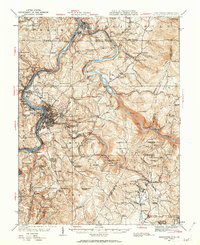 1931 Morgantown1962 Print · USGSMorgantown and the Monongahela River valley are shown here during the early twentieth-century peak of the regional rail-and-river economy. Genealogists can trace family names through numerous rural landmarks like Lazzell School, Burns Chapel, and Clinton Furnace.
 - 1933 Map of Morgantown
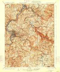 1933 Morgantown1933 Print · USGSMorgantown and the surrounding Monongalia County river valleys are captured here in the early 1930s during a period of industrial maturity. Genealogists and historians can trace family locations near Clinton Furnace, Maidsville PO and Sta, and McClure Chapel.3 unique versions available
 - 1935 Map of Masontown
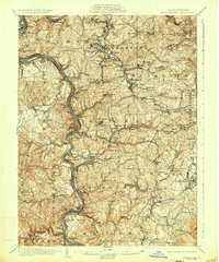 1935 Masontown1935 Print · USGSFayette and Greene Counties come alive in the 1930s as the river-and-rail economy of the Monongahela Valley reaches its peak. Genealogists can trace family roots through numerous country schools like Christopher Sch and historic sites such as Friendship Hill.2 unique versions available
Showing maps 1-25 of 174
Top cities of Greene County
- Waynesburg historical maps
- Dunkard Township historical maps
- Aleppo Township historical maps
- Carmichaels historical maps
- Rices Landing historical maps
- Jefferson historical maps
See more
Frequently asked questions
- What are the different types of historical maps available for Greene County?
- What is the oldest map of Greene County?
- Where can I purchase historical maps of Greene County for my home or office?
- Where can I download high-res historical maps of Greene County?
- Are there historical topographic maps available for Greene County?
- Is there historical aerial imagery available for Greene County?
- Where are historical maps of Greene County sourced from?