1990s Maps of Earl Township, Pennsylvania
Explore 7 historic maps of Earl Township from the 1990s. These maps offer a rare glimpse into what life looked like during the 1990s — showing old roads, neighborhoods, homes, and landmarks that have changed or disappeared over time.
Whether you're researching your family's past, planning a metal detecting trip, or studying how Earl Township's landscape evolved across the 1990s, these high-resolution maps are a powerful tool for exploring the history of this region.
- Focus on a specific era: All maps on this page are from the 1990s, giving you a focused view of this time period.
- See what’s changed: Compare century-old streets, trails, and buildings to today's modern landscape using overlays and satellite layers.
- Research with precision: Use these maps for genealogy, historical research, land use analysis, or educational projects.
- View, download, or print: Maps are fully viewable online in high resolution, and can be downloaded or printed for your own records.
Start exploring Earl Township's history through authentic maps from the 1990s. This is your window into the past.
Earl Township, PA maps
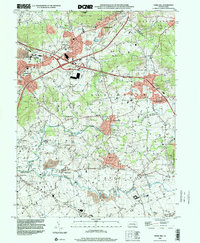
(7)- 1992 Map of Leola, 1994 Print
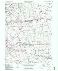 1992 Leola1994 Print · USGSLancaster County's agrarian landscape is captured here in the early 1990s, centered on the historic crossroads of Leola and Bareville. Genealogists and historians can trace family locations near Bird in Hand, Carpenter Ch, and the numerous local schoolhouses like Mill Creek Sch.2 unique versions available
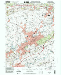
 - 1992 Map of New Holland, 1994 Print
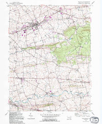 1992 New Holland1994 Print · USGSLancaster County's agricultural heartland is captured here in the late twentieth century, showing a landscape of tight-knit villages and sprawling farms. Researchers can trace family roots through numerous local landmarks like Lady of Lourdes, Zeltenreich Ch, and rural schoolhouses including Hatville Sch.
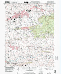
 - 1992 Map of Ephrata, 1995 Print
 1992 Ephrata1995 Print · USGSLancaster County's northern townships appear here during a period of sustained growth, balancing industrial rail access with traditional rural crossroads. Researchers can locate dozens of historic landmarks, from the Reading RR lines in Denver to local congregational sites like Steinmetz Ch and St Pauls Ch.
 - 1999 Map of Leola, 2001 Print
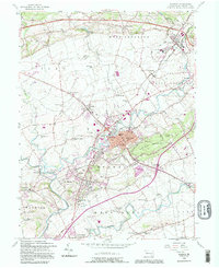
 1999 Leola2001 Print · USGSLancaster County at the turn of the millennium shows a fascinating mix of rural tradition and modern infrastructure. Trace family roots and local history across Bird in Hand, Leola, and school sites like Shaeffer Sch.
 - 1999 Map of Terre Hill, 2001 Print
 1999 Terre Hill2001 Print · USGSNortheastern Lancaster County at the end of the century retains its traditional rural layout despite the path of the Pennsylvania Turnpike. Genealogists and historians can trace numerous local landmarks including Salem Cem, Reddenbach Ch, and the many schools of East Earl.
 - 1999 Map of Ephrata, 2001 Print
 1999 Ephrata2001 Print · USGSNorthern Lancaster County at the turn of the millennium shows a blend of growing boroughs and deep-rooted rural townships. Researchers can trace historic family landmarks through sites like Mellingers Ch, Hans Graf Sch, and Fairview Cem.
 - 1999 Map of New Holland, 2001 Print
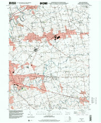
 1999 New Holland2001 Print · USGSLancaster County at the close of the millennium shows a preserved rural landscape between the Lincoln Highway and Welsh Mountain. Researchers can trace the heritage of local settlements like Intercourse, Blue Ball, and Paradise alongside numerous historic schoolhouses and country churches.
End of results
Showing maps 1-7 of 7
Top cities near Earl Township
- Reading historical maps
- Lancaster historical maps
- West Lampeter Township historical maps
- Ephrata historical maps
- Wyomissing historical maps
- Lititz historical maps
See more
Top neighborhoods of Earl Township
- Hinkletown historical maps
- Groffdale historical maps
- Vogansville historical maps
- Laurel Hill historical maps
- Martindale historical maps
Frequently asked questions
- What are the different types of historical maps available for Earl Township?
- What is the oldest map of Earl Township?
- Where can I purchase historical maps of Earl Township for my home or office?
- Where can I download high-res historical maps of Earl Township?
- Are there historical topographic maps available for Earl Township?
- Is there historical aerial imagery available for Earl Township?
- Where are historical maps of Earl Township sourced from?