1990s Maps of Luzerne County, Pennsylvania
Explore 21 historic maps of Luzerne County from the 1990s. These maps offer a rare glimpse into what life looked like during the 1990s — showing old roads, neighborhoods, homes, and landmarks that have changed or disappeared over time.
Whether you're researching your family's past, planning a metal detecting trip, or studying how Luzerne County's landscape evolved across the 1990s, these high-resolution maps are a powerful tool for exploring the history of this region.
- Focus on a specific era: All maps on this page are from the 1990s, giving you a focused view of this time period.
- See what’s changed: Compare century-old streets, trails, and buildings to today's modern landscape using overlays and satellite layers.
- Research with precision: Use these maps for genealogy, historical research, land use analysis, or educational projects.
- View, download, or print: Maps are fully viewable online in high resolution, and can be downloaded or printed for your own records.
Start exploring Luzerne County's history through authentic maps from the 1990s. This is your window into the past.
Luzerne County, PA maps
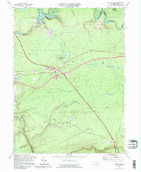
(21)- 1992 Map of Pleasant View Summit, 1995 Print
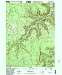
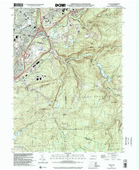
 1992 Pleasant View Summit1995 Print · USGSThe high plateau of the Poconos in the 1990s reveals a landscape defined by state forests and historic watercourses. Genealogists and hikers can trace the Bear Creek Railroad Grade or locate old sites near Stoddartsville and Shades Glen.
 - 1992 Map of Hickory Run, 1995 Print
 1992 Hickory Run1995 Print · USGSThe Poconos region in the early nineties reveals a landscape where major transportation corridors like the Northeast Extension meet vast state-managed woodlands. Genealogists and researchers can trace the vicinity of Leonardsville or East Side and explore the rugged geology of Boulder Field.
 - 1994 Map of Ransom, 1995 Print
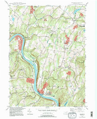 1994 Ransom1995 Print · USGSThe rural river valley near Scranton shows its late-twentieth-century character as the Susquehanna River flows past small hubs like Ransom and West Falls. Genealogists and local historians can trace landmarks like Newton Center Cem, the Exeter Twp Sch, and the winding Sullivan Trail.
 - 1994 Map of Wilkes-Barre East, 1995 Print
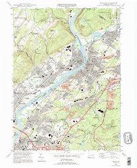
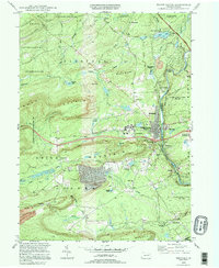
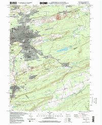
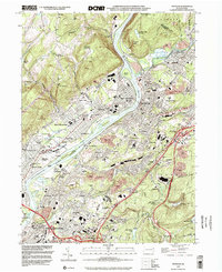
 1994 Wilkes-Barre East1995 Print · USGSWilkes-Barre and its southern highlands are captured in the mid-nineties, showing the intersection of valley industry and mountain retreats. Genealogists and historians can trace family-named sites from Llewellyn Corners to the estates at Glen Summit and the historic Ochre Mill.
 - 1994 Map of Avoca, 1995 Print
 1994 Avoca1995 Print · USGSThe Lackawanna Valley at the end of the twentieth century shows a dense network of coal-country boroughs and major transportation hubs. Genealogists and historians can trace family plots in the Polish National Cem or locate neighborhoods in Old Forge and Avoca.
 - 1994 Map of Pittston, 1995 Print
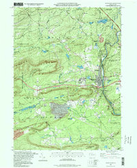
 1994 Pittston1995 Print · USGSThe Wyoming Valley at the end of the twentieth century shows a landscape defined by the confluence of the Susquehanna and Lackawanna Rivers. Genealogists and historians can locate legacy sites like Wyoming Seminary, the Wyoming Monument, and numerous family cemeteries.
 - 1994 Map of White Haven, 1995 Print
 1994 White Haven1995 Print · USGSWhite Haven and the Lehigh Gorge appear in the mid-nineties as a landscape defined by rugged state parks and old industrial corridors. Genealogists and hikers can trace the paths of the old RR grade near Tannery, locate family plots at St Patrick Cem, and explore the lakeside development of Penn Lake Park.
 - 1995 Map of Hazleton, 1996 Print
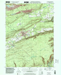
 1995 Hazleton1996 Print · USGSHazleton and its surrounding mining patches are shown in the mid-nineties as the region balanced its industrial legacy with modern growth. Genealogists can trace family neighborhoods like Hazleton Heights and locate local landmarks such as Mt Laurel Cem and the Heights Terrace Sch.
 - 1995 Map of Red Rock, 1998 Print
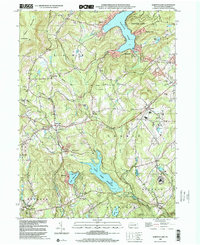
 1995 Red Rock1998 Print · USGSThe high plateau where Sullivan, Luzerne, and Columbia counties converge was a hub of timbering and mountain recreation in the mid-nineties. Trace the path of the Old Railroad Grade or locate the Covered Bridge near historical settlements like Jamison City and Tri Mills.
 - 1997 Map of White Haven, 1998 Print
 1997 White Haven1998 Print · USGSWhite Haven and the Lehigh Gorge are shown in the late 1990s as the region transitioned from industrial rail hub to a corridor of state parks. Genealogists and researchers can trace local landmarks like St Patrick Cem, the Mountainview Ch, and the operations at Scale Siding.
 - 1997 Map of Thornhurst, 1998 Print
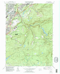
 1997 Thornhurst1998 Print · USGSThe Lehigh River valley and the Poconos plateau come into focus during the late nineties, showing a landscape shaped by conservation and seasonal recreation. Researchers can trace family sites at Clifton Cem or explore the wetlands of City of Rome Swamp and Bradys Lake.
 - 1997 Map of Hickory Run, 1998 Print
 1997 Hickory Run1998 Print · USGSCarbon County’s rugged Pocono plateau is defined here by protected lands and the Lehigh River corridor in the late nineties. Researchers can locate the sprawling Boulder Field, trace the old settlement at Leonardsville, or follow the Northeast Extension through Hickory Run State Park.
 - 1997 Map of Pleasant View Summit, 1999 Print
 1997 Pleasant View Summit1999 Print · USGSThe Pocono plateau near the turn of the millennium remained a landscape of dense forests and river confluences. Genealogists and hikers can trace old routes like Tannery Road, locate the Lookout Tower on Big Pine Hill, and explore the riverside site of Stoddartsville.
 - 1997 Map of Dutch Mtn, 1999 Print
 1997 Dutch Mtn1999 Print · USGSThe high-plateau wilderness of the Endless Mountains is captured here in the late nineties. Genealogists and hikers can trace the geography around Bellasylva, locate the Ricketts Fire Tower, and explore the wetlands of Crane Swamp.
 - 1997 Map of Hazleton, 2000 Print
 1997 Hazleton2000 Print · USGSThe Anthracite coal region of Luzerne and Carbon Counties is captured in the late nineties, documenting a landscape where industry and community intertwine. Researchers can trace the layout of mining towns like Jeddo and Ebervale or locate local landmarks like St Johns Ch and the Hazleton Municipal Airport.
 - 1999 Map of Freeland, 2001 Print
 1999 Freeland2001 Print · USGSLuzerne County's coal and mountain country is documented here during the late 1990s as modern highways began to bypass older mining towns. Genealogists and local historians can trace family locations near Freeland and smaller communities like Pardeesville, Blytheburn, and Upper Lehigh.
 - 1999 Map of Harveys Lake, 2001 Print
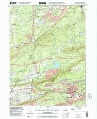
 1999 Harveys Lake2001 Print · USGSLuzerne County's uplands are captured here at the end of the century, showing a landscape defined by the waters of Harveys Lake and Pikes Creek Reservoir. Researchers can trace local history through sites like Wordan Place, St Anns Cem, and the Rock Sch.
 - 1999 Map of Wilkes-Barre East, 2002 Print
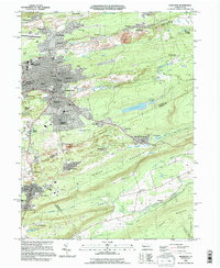
 1999 Wilkes-Barre East2002 Print · USGSWilkes-Barre and its mountain surrounds are shown at the close of the twentieth century as urban life meets vast conservation lands. Researchers can locate historic Oliver Mills, the Ochre Mill, and family landmarks like the Rosenzweig Landing Field.
 - 1999 Map of Avoca, 2002 Print
 1999 Avoca2002 Print · USGSThe Lackawanna River valley near the turn of the millennium shows a landscape defined by heavy transit and industrial roots. Trace the footprints of Belin Village and Spike Island alongside the Wilkes-Barre Scranton Intl Airport.
 - 1999 Map of Weatherly, 2002 Print
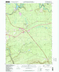
 1999 Weatherly2002 Print · USGSThis Carbon County corridor at the turn of the millennium shows the intersection of anthracite industry and conservation. Genealogists and hikers can trace the mountain settlements of Eckley and Rockport or follow the Lehigh Valley Railroad through the Lehigh Gorge.
 - 1999 Map of Pittston, 2002 Print
 1999 Pittston2002 Print · USGSThe Susquehanna and Lackawanna rivers meet in this 1990s portrait of Pennsylvania's industrial heartland during a period of urban density. Genealogists and historians can trace neighborhood developments in West Wyoming and Yatesville, or locate family sites near St Joseph Cem and Pittston Yards.
End of results
Showing maps 1-21 of 21
Top cities of Luzerne County
- Wilkes-Barre historical maps
- Hazleton historical maps
- Kingston historical maps
- Nanticoke historical maps
- Plains Township historical maps
- Dallas Township historical maps
See more
Frequently asked questions
- What are the different types of historical maps available for Luzerne County?
- What is the oldest map of Luzerne County?
- Where can I purchase historical maps of Luzerne County for my home or office?
- Where can I download high-res historical maps of Luzerne County?
- Are there historical topographic maps available for Luzerne County?
- Is there historical aerial imagery available for Luzerne County?
- Where are historical maps of Luzerne County sourced from?