1900s (20th Century) Maps of Luzerne County, Pennsylvania
Explore 119 historic maps of Luzerne County from the 1900s (20th Century). These maps offer a rare glimpse into what life looked like during the 1900s — showing old roads, neighborhoods, homes, and landmarks that have changed or disappeared over time.
Whether you're researching your family's past, planning a metal detecting trip, or studying how Luzerne County's landscape evolved across the 1900s, these high-resolution maps are a powerful tool for exploring the history of this region.
- Focus on a specific era: All maps on this page are from the 1900s, giving you a focused view of this time period.
- See what’s changed: Compare century-old streets, trails, and buildings to today's modern landscape using overlays and satellite layers.
- Research with precision: Use these maps for genealogy, historical research, land use analysis, or educational projects.
- View, download, or print: Maps are fully viewable online in high resolution, and can be downloaded or printed for your own records.
Start exploring Luzerne County's history through authentic maps from the 1900s. This is your window into the past.
Luzerne County, PA maps
(119)- 1922 Map of Stoddartsville, 1958 Print
 1922 Stoddartsville1958 Print · USGSThe Pennsylvania Poconos at the turn of the century show a landscape of high timber ridges and early mountain resorts. Genealogists and hikers can trace the original paths to Stoddartsville, identify the old Fayette School, or follow the Wilkes-Barre and Eastern rail line.2 unique versions available
 - 1924 Map of Stoddartsville
 1924 Stoddartsville1924 Print · USGSUpper Carbon and Monroe counties are shown in the early twenties as a landscape of timbered hills and headwater streams. Genealogists can locate old rural landmarks like Bradys Switch, the Leonardsville settlement, and the Locust Ridge School.5 unique versions available
 - 1934 Map of Laporte
 1934 Laporte1934 Print · USGSSullivan County in the early thirties was a landscape of timber camps and coal towns connected by the Lehigh Valley railroad. Genealogists and local historians can trace family locations through old landmarks like Richards Grove, the Sugarloaf Sch, and Jamison City.3 unique versions available
 - 1943 Map of Scranton
 1943 Scranton1943 Print · USGSNortheastern Pennsylvania’s coal and rail corridor comes to life in the 1940s, showcasing the dense urban industrial centers of the Wyoming Valley. Genealogists can locate family landmarks like the Fayette School and Locust Ridge School or trace the early paths of the DL & W and Erie railroads.
 - 1943 Map of Stoddartsville
 1943 Stoddartsville1943 Print · USGSThe Pocono Plateau at the height of the Second World War shows a landscape defined by river valleys and developing recreation preserves. Genealogists and local historians can trace rural schoolhouses and small settlements like Stoddartsville, Albrightsville, and the Fishery Sch.
 - 1944 Map of Newark, 1971 Print
 1944 Newark1971 Print · USGSThe industrial corridor from Philadelphia to New York was in a period of massive transition during the mid-forties. Genealogists and researchers can trace the rail lines of the Lehigh Valley RR, locate military installations like Picatinny Arsenal, and explore the early sprawl near Levittown.5 unique versions available
 - 1946 Map of Sybertsville
 1946 Sybertsville1946 Print · USGSLuzerne County's rural townships are captured here just after the war, showing a landscape defined by small farms and local schoolhouses. Genealogists can trace family connections to landmarks like St Johns, Moyers Grove, and the Whitebread Sch.2 unique versions available
 - 1946 Map of Nanticoke
 1946 Nanticoke1946 Print · USGSLuzerne County's industrial heartland is captured here in the mid-1940s, showing the dense rail networks and river towns of the Wyoming Valley. Trace family roots at St Alberts Cem, follow the Pennsylvania Canal (Abandoned), or explore old Glen Lyon.2 unique versions available
 - 1946 Map of Shickshinny
 1946 Shickshinny1946 Print · USGSLuzerne County's river-and-ridge landscape is captured here in the mid-1940s, as the Pennsylvania railroad follows the Susquehanna River through the mountains. Genealogists can trace family names at the Sorber Cemetery or locate old schoolhouses like Sunshine School and McKendree School.2 unique versions available
 - 1946 Map of Berwick
 1946 Berwick1946 Print · USGSBerwick and the Susquehanna River valley are shown here in the mid-forties, highlighting a landscape of river-oriented industry and mountain-bound rural life. Genealogists can trace numerous local landmarks including Mt Zion Ch, Harter Sch, and the riverside community of Beach Haven.2 unique versions available
 - 1946 Map of Kingston, 1959 Print
 1946 Kingston1959 Print · USGSLuzerne County at the height of its mid-century industrial period reveals a landscape of dense riverfront boroughs and wooded ridges. Genealogists can locate family sites among Misericordia College, St Johns Cem, and the streets of Kingston.5 unique versions available
 - 1946 Map of Avoca, 1959 Print
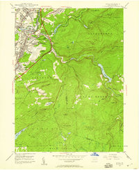 1946 Avoca1959 Print · USGSThe coal-rich Lackawanna Valley is shown here just after the war, as heavy industry and new aviation infrastructure transformed the landscape. Researchers can trace the extensive rail networks and local landmarks like the Consolidated Breaker, Belian Village, and Sacred Heart Cem.5 unique versions available
 - 1946 Map of Dutch Mtn, 1960 Print
 1946 Dutch Mtn1960 Print · USGSThe high plateau of Wyoming and Sullivan counties is captured here in the years following the war, showing a landscape defined by deep creek gorges and remote settlements. Researchers can locate the Fincke Cem, the Bellasylva settlement, and the old Ricketts Fire Tower.3 unique versions available
 - 1946 Map of Harveys Lake, 1962 Print
 1946 Harveys Lake1962 Print · USGSLuzerne County's Back Mountain region appears here in the mid-1940s, characterized by its deep glacial lakes and highland ridges. Researchers can locate vanished landmarks like the Santee Sch, Wordan Place, and numerous family burial grounds including Kocher Cem.5 unique versions available
 - 1946 Map of Noxen, 1963 Print
 1946 Noxen1963 Print · USGSWyoming County settlement and mountain terrain are captured here just after the war, showing the area's transition into Luzerne County. Genealogists can trace family footprints in small hamlets like Noxen, Evans Falls, and Beaumont, or locate the Childrens Welfare Center and Faggles.5 unique versions available
 - 1946 Map of Sweet Valley, 1964 Print
 1946 Sweet Valley1964 Print · USGSLuzerne County in the mid-1940s reveals a landscape of ridge-top forests and valley settlements like Sweet Valley and Kyttle. Researchers can locate historic rural institutions including Bethel Ch, Retreat Sch, and the Splash Dam at Mountain Springs.4 unique versions available
 - 1946 Map of Ransom, 1964 Print
 1946 Ransom1964 Print · USGSThe Susquehanna River valley in the 1940s shows a landscape of river-bend settlements and early aviation infrastructure. Researchers can trace the Lehigh Valley rail line and locate landmarks like the Ransom-Newton State Hospital and Scranton Airport.4 unique versions available
 - 1946 Map of Center Moreland, 1969 Print
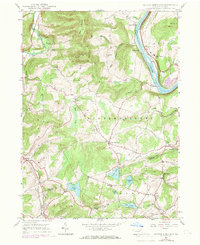 1946 Center Moreland1969 Print · USGSThe Susquehanna River valley and the hills of Wyoming County appear in detail during the post-war era. Researchers can trace the river's transport legacy via the Lehigh Valley line and locate community landmarks like Thurston Ch and the Hunter Sch.3 unique versions available
 - 1947 Map of Stillwater
 1947 Stillwater1947 Print · USGSMid-century Columbia and Luzerne counties come alive in this survey of the upland farms and creek valleys north of the Susquehanna. Genealogists can locate family landmarks such as Belles Cem, St James Ch, and numerous country schools like Town Hill Sch.2 unique versions available
 - 1947 Map of Wilkes-Barre West, 1958 Print
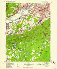 1947 Wilkes-Barre West1958 Print · USGSThe Wyoming Valley anthracite region thrives in the late 1940s, showing a landscape defined by massive coal operations and a dense rail network. Trace local family roots through sites like Shawnee Cem, Sugar Notch, and the neighborhood schools of Wilkes-Barre.6 unique versions available
 - 1947 Map of Wilkes-Barre East, 1959 Print
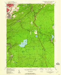 1947 Wilkes-Barre East1959 Print · USGSWilkes-Barre and the eastern ridges of the Wyoming Valley are shown in the post-war era as the anthracite coal industry shaped the landscape. Genealogists can trace family connections at Georgetown, Laurel Run, and Holy Trinity Cem, or locate landmarks like Ochre Mill and Oliver Sch.7 unique versions available
 - 1947 Map of Pittston, 1961 Print
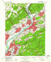 1947 Pittston1961 Print · USGSLuzerne County's industrial heartland is captured here in the late 1940s, showing the dense rail-and-river corridor of the Wyoming Valley. Genealogists can trace family roots through numerous local landmarks, including the Wyoming Monument, St Joseph Cem, and the Port Griffith Sch.4 unique versions available
 - 1947 Map of Hazleton, 1962 Print
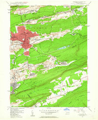 1947 Hazleton1962 Print · USGSThe Pennsylvania coal fields and the industrial hubs of Luzerne County are captured here just after the war. Researchers can trace the rail-and-mine landscape of Ashmore Yards, Lattimer Mines, and the borough of McAdoo.5 unique versions available
 - 1947 Map of White Haven, 1966 Print
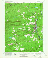 1947 White Haven1966 Print · USGSThe Lehigh River valley in the late 1940s is a landscape defined by industry and rail, where coal mining and transportation intersect. Genealogists can trace family roots through settlements like White Haven and Tannery, or locate local landmarks like Ripple Sch and St Patrick Cem.4 unique versions available
 - 1948 Map of Dutch Mtn
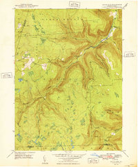 1948 Dutch Mtn1948 Print · USGSThe Pennsylvania highlands north of Ricketts Glen come into focus in the 1940s, showing a remote landscape of steep mountain brooks and high-plateau clearings. Researchers can locate the mountain settlement at Bellasylva, the Fincke Cem, and the Ricketts Fire Tower.2 unique versions available
Showing maps 1-25 of 119
Top cities of Luzerne County
- Wilkes-Barre historical maps
- Hazleton historical maps
- Kingston historical maps
- Nanticoke historical maps
- Plains Township historical maps
- Dallas Township historical maps
See more
Frequently asked questions
- What are the different types of historical maps available for Luzerne County?
- What is the oldest map of Luzerne County?
- Where can I purchase historical maps of Luzerne County for my home or office?
- Where can I download high-res historical maps of Luzerne County?
- Are there historical topographic maps available for Luzerne County?
- Is there historical aerial imagery available for Luzerne County?
- Where are historical maps of Luzerne County sourced from?