2020s Maps of Montgomery County, Pennsylvania
Explore 19 historic maps of Montgomery County from the 2020s. These maps offer a rare glimpse into what life looked like during the 2020s — showing old roads, neighborhoods, homes, and landmarks that have changed or disappeared over time.
Whether you're researching your family's past, planning a metal detecting trip, or studying how Montgomery County's landscape evolved across the 2020s, these high-resolution maps are a powerful tool for exploring the history of this region.
- Focus on a specific era: All maps on this page are from the 2020s, giving you a focused view of this time period.
- See what’s changed: Compare century-old streets, trails, and buildings to today's modern landscape using overlays and satellite layers.
- Research with precision: Use these maps for genealogy, historical research, land use analysis, or educational projects.
- View, download, or print: Maps are fully viewable online in high resolution, and can be downloaded or printed for your own records.
Start exploring Montgomery County's history through authentic maps from the 2020s. This is your window into the past.
Montgomery County, PA maps
(19)- 2023 Map of Philadelphia, 2023 Print
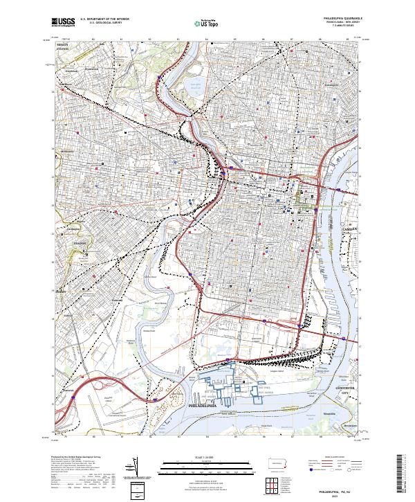 2023 Philadelphia2023 Print · USGSModern Philadelphia reveals its deep history along the Schuylkill River and Delaware River. Genealogists and historians can trace the city's past through Mount Moriah Cem, Mikveh Israel Cem, and the Edgar Allan Poe National Historic Site.
 - 2023 Map of Lansdowne, 2023 Print
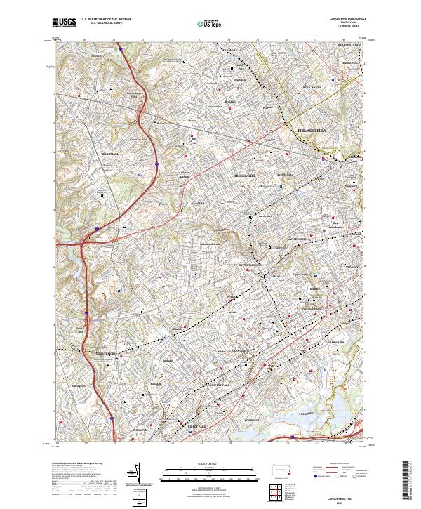 2023 Lansdowne2023 Print · USGSThe suburban development of Delaware County and Philadelphia's western edge is shown here in detail. Genealogy researchers can trace family plots at the Old Haverford Friends Meeting House or the Darby-Friends Burial Ground.
 - 2023 Map of Valley Forge, 2023 Print
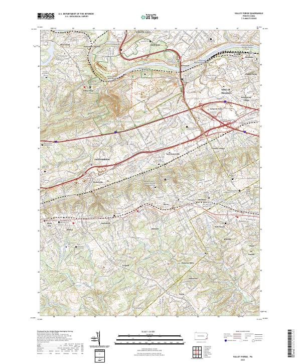 2023 Valley Forge2023 Print · USGSThe Main Line and Valley Forge area are documented here in the early twenty-first century, showing a dense landscape of historic burial grounds and modern suburbs. Genealogists can trace family sites like the Norris Family Burial Ground and Old Eagle Burying Ground near Wayne and Paoli.
 - 2023 Map of Boyertown, 2023 Print
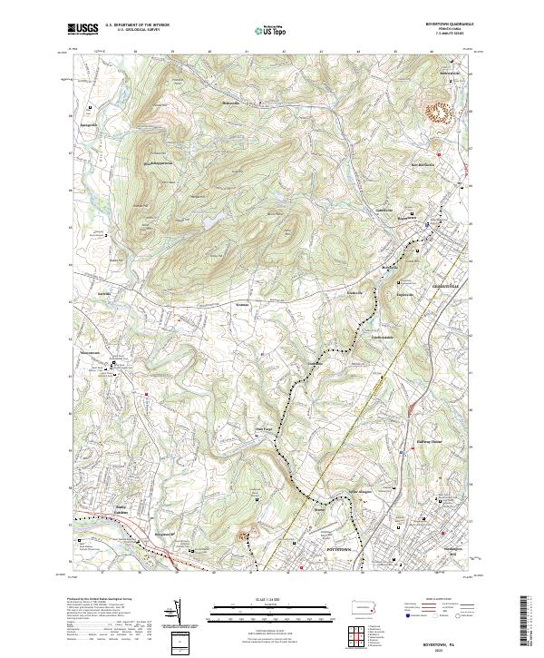 2023 Boyertown2023 Print · USGSSoutheast Pennsylvania's industrial and agricultural roots are on full display in this survey of the Berks and Montgomery county line. Genealogists can trace family heritage through sites like the Levengood Burial Ground and Boyertown Union Church Cem along the Manatawny Creek valley.
 - 2023 Map of Norristown, 2023 Print
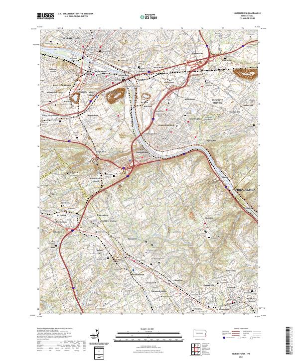 2023 Norristown2023 Print · USGSThe Schuylkill River corridor thrives in this contemporary look at Montgomery County's historic river towns. Researchers can trace family roots at Montgomery Cem or explore the campuses of Villanova University and Bryn Mawr College.
 - 2023 Map of Doylestown, 2023 Print
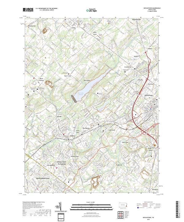 2023 Doylestown2023 Print · USGSBucks County and the outskirts of Montgomery County are shown here in the 2020s, centered on the borough of DOYLESTOWN. Researchers can trace local lineage through the New Britain Baptist Church Cem or Beulah Cem.
 - 2023 Map of Milford Square, 2023 Print
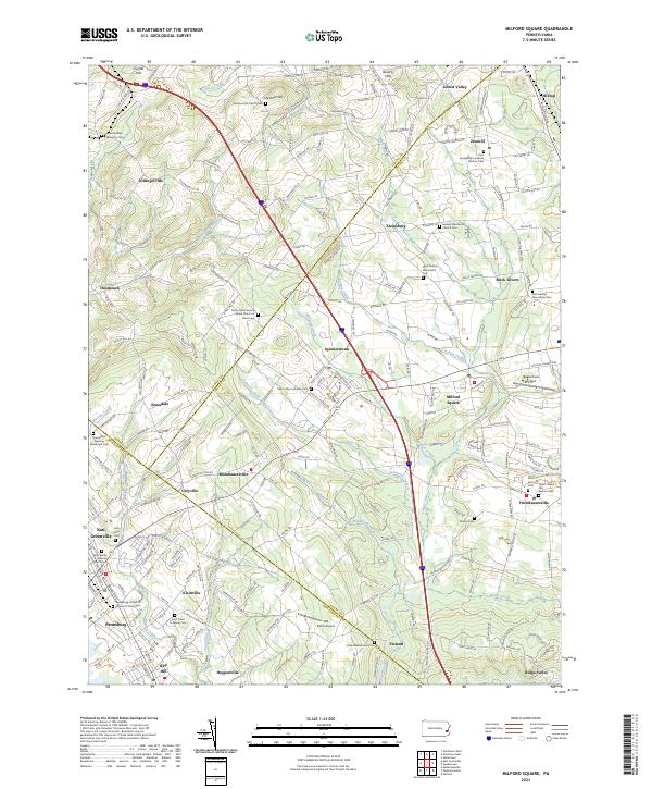 2023 Milford Square2023 Print · USGSUpper Bucks and Montgomery counties meet in this Pennsylvania survey, showcasing a landscape of rural hamlets and deep religious roots. Genealogists can trace family names at the Kraussdale Meeting House and Cem, Finland Mennonite Cem, and Stricker Cem.
 - 2023 Map of Telford, 2023 Print
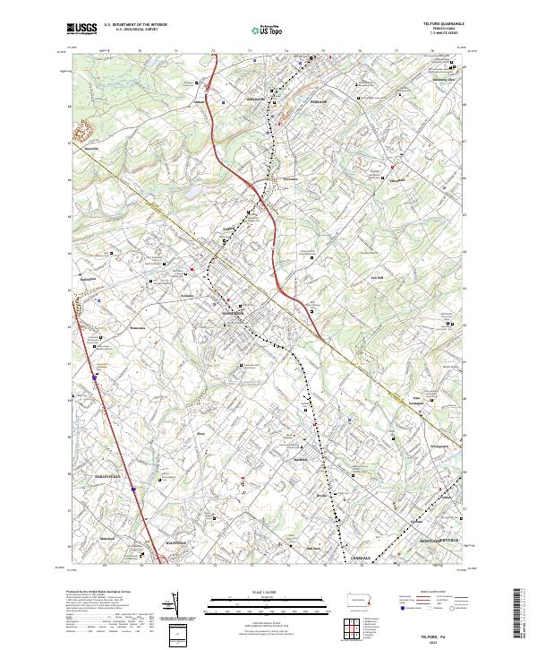 2023 Telford2023 Print · USGSThe Pennsylvania Dutch Country comes alive in this survey of the borderlands between Bucks and Montgomery counties. Genealogists can trace family lines through numerous sites like Indian Creek Mennonite Cem and Jerusalem Union Cem.
 - 2023 Map of Perkiomenville, 2023 Print
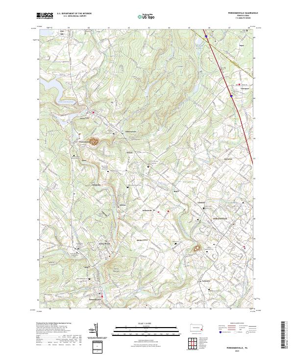 2023 Perkiomenville2023 Print · USGSMontgomery County’s river valleys and historic villages are detailed in this contemporary survey of the Perkiomen region. Genealogists can locate family burial sites at Old Goshenhoppen Cem, Salford Mennonite Cem, and Lederach Burial Ground.
 - 2023 Map of Sassamansville, 2023 Print
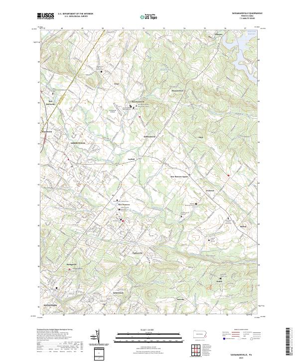 2023 Sassamansville2023 Print · USGSMontgomery County's rolling countryside appears here in the early twenty-first century, showing a landscape rooted in historic settlements and churchyards. Researchers can locate family landmarks like Bertolets Mennonite Church Cem, Sassamansville, and the Leidichs Burial Ground.
 - 2023 Map of Frankford, 2023 Print
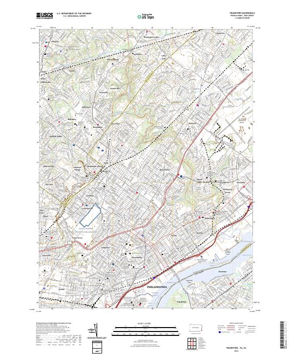 2023 Frankford2023 Print · USGSNortheast Philadelphia and the Delaware River waterfront are captured here in the early twenty-first century. Genealogists can trace family plots at Har Nebo Cem and Saint Dominic Church Cem or explore established neighborhoods from Rockledge to Torresdale.
 - 2023 Map of Pottstown, 2023 Print
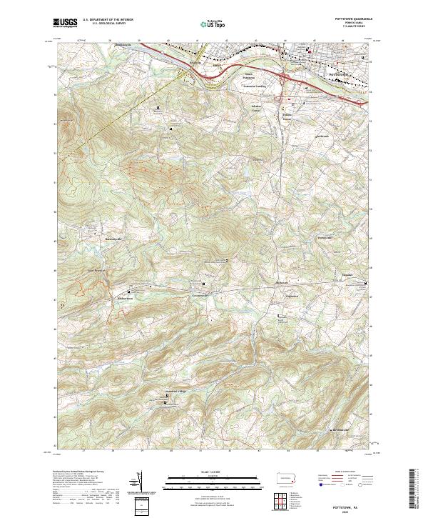 2023 Pottstown2023 Print · USGSThe Schuylkill River valley and the hills of northern Chester County are shown here in modern detail. Genealogists and historians can locate dozens of historic sites, from Nantmeal Village and Coventryville to the African Union Church Cem and Porters Mill.
 - 2023 Map of Lansdale, 2023 Print
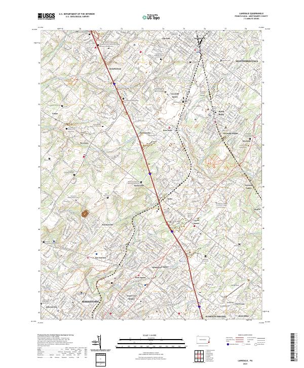 2023 Lansdale2023 Print · USGSLansdale and the Montgomery County suburbs are shown in extensive detail as they appeared in the early 2020s. Genealogists and local historians can trace family ties through dozens of landmarks like Saint Stanislaus Cem, Gwynedd Heights, and the Union Meeting House Cem.
 - 2023 Map of Germantown, 2023 Print
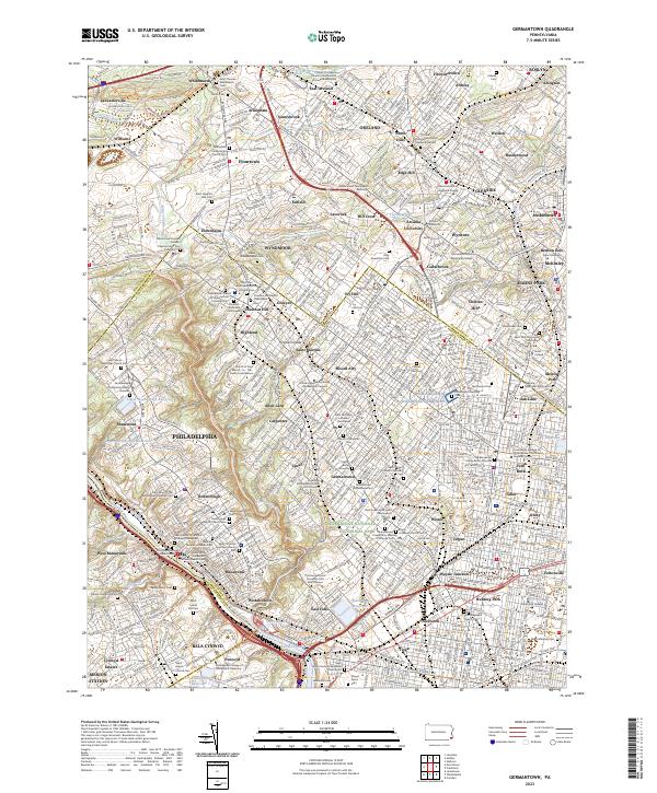 2023 Germantown2023 Print · USGSNorthwest Philadelphia and its Montgomery County suburbs are shown here in modern detail. Researchers can trace dozens of lineage-rich sites including the Yeakel Schwenkfelder Cem, Saint Michael's Lutheran Churchyard, and West Laurel Hill Cem.
 - 2023 Map of Phoenixville, 2023 Print
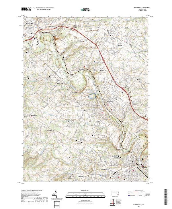 2023 Phoenixville2023 Print · USGSThe Schuylkill River valley comes to life in this contemporary survey of the Pennsylvania heartland near Phoenixville and Pottstown. Genealogists and historians can trace numerous ancestral sites including the Revolutionary Soldiers Cem, Pennhurst, and the Kimberton Friends Burial Ground.
 - 2023 Map of Collegeville, 2023 Print
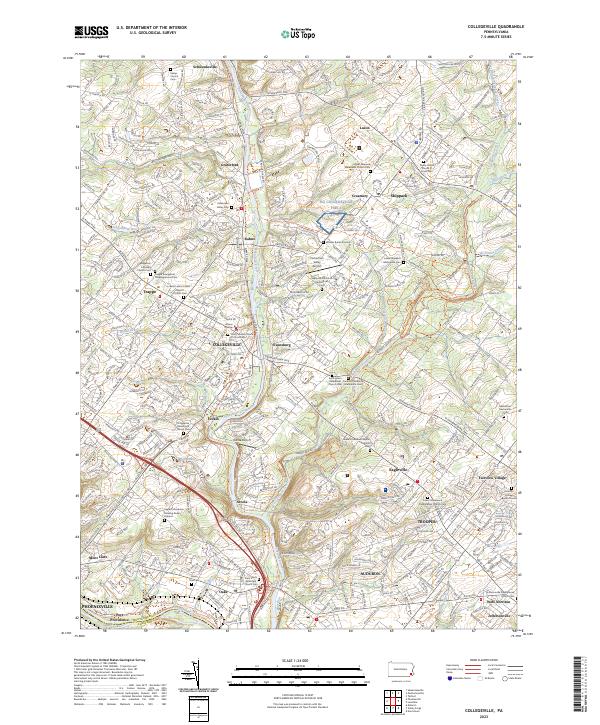 2023 Collegeville2023 Print · USGSThe Perkiomen Valley comes alive in this detailed look at modern Montgomery County, where suburban growth meets centuries of religious heritage. Trace the grounds of Ursinus College or locate ancestral sites like the Keelys Church Cem and Graterford Prison.
 - 2023 Map of Ambler, 2023 Print
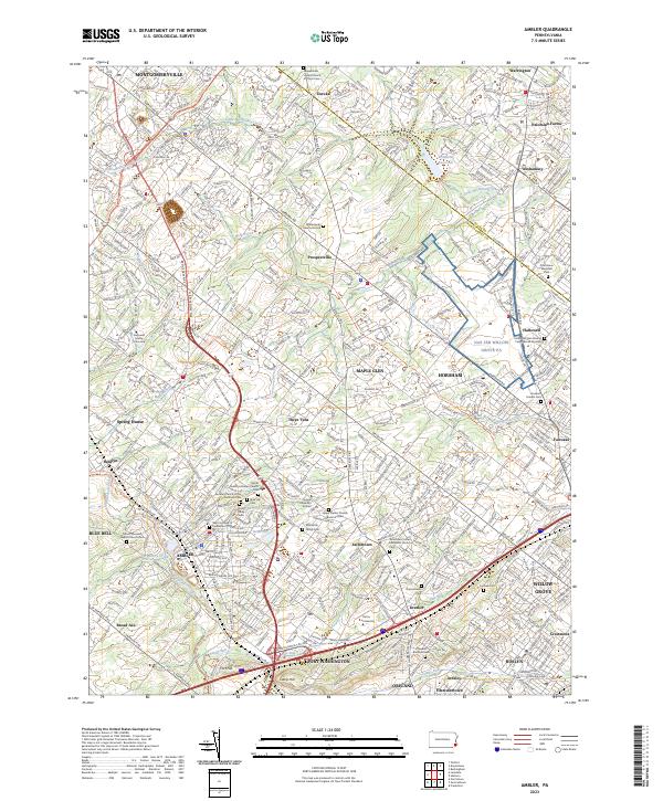 2023 Ambler2023 Print · USGSMontgomery County suburban growth and historic institutional centers are showcased in this modern survey. Genealogists and historians can locate family burial sites like Fitzwater Burial Ground and landmarks such as Temple University Ambler and Fort Hill.
 - 2023 Map of Hatboro, 2023 Print
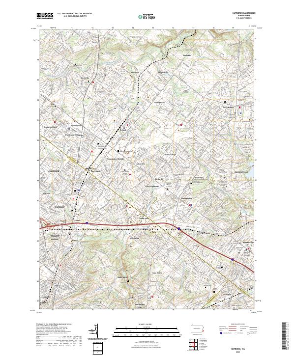 2023 Hatboro2023 Print · USGSThe suburbs north of Philadelphia come into sharp focus in this recent survey of the Hatboro and Warminster corridor. Genealogists can locate numerous burial sites, including the Craven VanSant Burying Grounds and Old Reformed Church Graveyard.
 - 2023 Map of East Greenville, 2023 Print
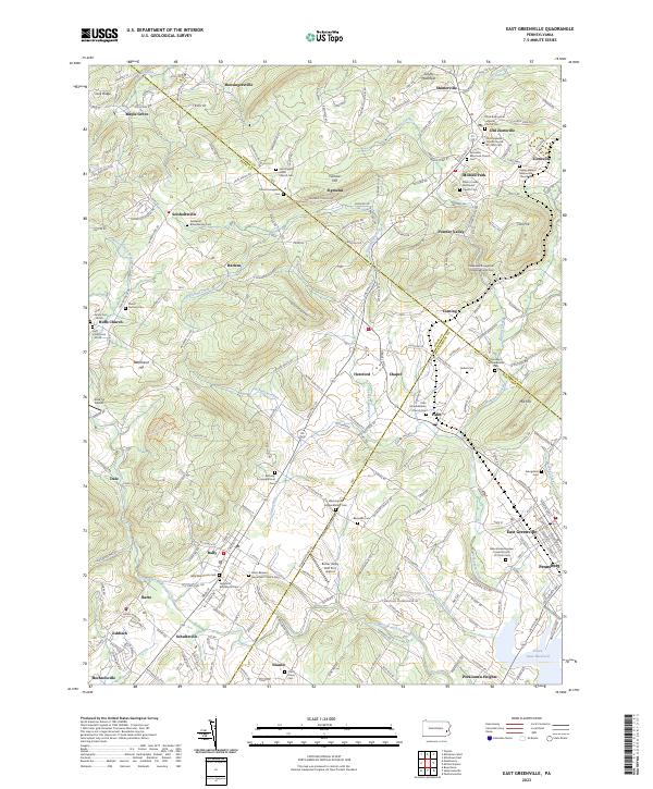 2023 East Greenville2023 Print · USGSThe tri-county border region of Berks, Lehigh, and Montgomery shows a landscape of deep-rooted settlements and intersecting creeks. Genealogists can trace family names and local history through numerous sites like Washington Schwenkfelder Cem and Huff Union Cem-North.
End of results
Showing maps 1-19 of 19
Top cities of Montgomery County
- Abington Township historical maps
- Cheltenham Township historical maps
- Norristown historical maps
- Horsham Township historical maps
- Pottstown historical maps
- Whitemarsh Township historical maps
See more
Frequently asked questions
- What are the different types of historical maps available for Montgomery County?
- What is the oldest map of Montgomery County?
- Where can I purchase historical maps of Montgomery County for my home or office?
- Where can I download high-res historical maps of Montgomery County?
- Are there historical topographic maps available for Montgomery County?
- Is there historical aerial imagery available for Montgomery County?
- Where are historical maps of Montgomery County sourced from?