1960s Maps of Northumberland County, Pennsylvania
Explore 25 historic maps of Northumberland County from the 1960s. These maps offer a rare glimpse into what life looked like during the 1960s — showing old roads, neighborhoods, homes, and landmarks that have changed or disappeared over time.
Whether you're researching your family's past, planning a metal detecting trip, or studying how Northumberland County's landscape evolved across the 1960s, these high-resolution maps are a powerful tool for exploring the history of this region.
- Focus on a specific era: All maps on this page are from the 1960s, giving you a focused view of this time period.
- See what’s changed: Compare century-old streets, trails, and buildings to today's modern landscape using overlays and satellite layers.
- Research with precision: Use these maps for genealogy, historical research, land use analysis, or educational projects.
- View, download, or print: Maps are fully viewable online in high resolution, and can be downloaded or printed for your own records.
Start exploring Northumberland County's history through authentic maps from the 1960s. This is your window into the past.
Northumberland County, PA maps
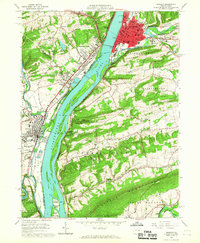
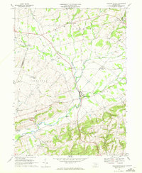
(25)- 1960 Map of Williamsport
 1960 Williamsport1960 Print · USGSNorth-central Pennsylvania in the mid-twentieth century was a vital corridor of rail and river industry stretching from the New York line to the coal regions. Genealogists can trace the rail networks of the Pennsylvania RR and Lehigh Valley RR connecting towns like Williamsport, Towanda, and Lock Haven.
 - 1961 Map of Harrisburg
 1961 Harrisburg1961 Print · USGSCentral Pennsylvania is shown at a mid-century peak of industrial and military activity, from the Susquehanna water gaps to the fertile Dutch Country. Genealogists and historians can trace the rail corridors of the Pennsylvania RR and find landmarks like Carlisle Barracks or the Anthracite Coal Fields.2 unique versions available
 - 1962 Map of Williamsport, 1966 Print
 1962 Williamsport1966 Print · USGSNorth-central Pennsylvania was a landscape of industrial river hubs and vast state woodlands in the early sixties. Researchers can trace the path of the Pennsylvania Railroad through Williamsport and explore the remote reaches of Bucktail State Park.5 unique versions available
 - 1964 Map of Harrisburg
 1964 Harrisburg1964 Print · USGSCentral Pennsylvania in the mid-fifties reveals a landscape shaped by ridge-and-valley geology and critical Cold War infrastructure. Researchers can trace the massive Indiantown Gap Military Reservation or the rail corridors of the Pennsylvania RR and Reading RR.
 - 1965 Map of Williamsport
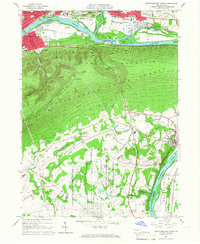
 1965 Williamsport1965 Print · USGSNorth-central Pennsylvania in the mid-1960s is defined by the industrial river towns and vast timberlands of the Allegheny Plateau. Researchers can trace historic rail lines like the Erie Lackawanna and Reading as they thread through Williamsport, Lock Haven, and Jersey Shore.
 - 1965 Map of Milton, 1966 Print
 1965 Milton1966 Print · USGSThe Susquehanna River valley and its industrial hubs are seen here in the mid-sixties, capturing the rail-and-river network of Northumberland and Union counties. Researchers can locate many family landmarks, including Milton Cemetery, the Milton Airport, and the Warrior Run High School.4 unique versions available
 - 1965 Map of Montoursville South, 1967 Print
 1965 Montoursville South1967 Print · USGSLycoming and Union counties are shown in the mid-1960s, documenting the corridor from Williamsport to the prison camp at Allenwood. Trace genealogy and local landmarks from Mt Zion Ch and Washington Cem to the early Reading rail lines.4 unique versions available
 - 1965 Map of Muncy, 1967 Print
 1965 Muncy1967 Print · USGSThe Susquehanna River valley near Muncy in the mid-1960s was a hub of rail transport and state infrastructure. Researchers can locate the State Correctional Institution, trace the Reading railroad corridor, or find family markers in Muncy Cemetery and Clinton Cemetery.4 unique versions available
 - 1965 Map of Northumberland, 1967 Print
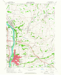
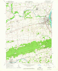
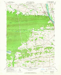
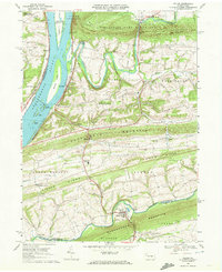
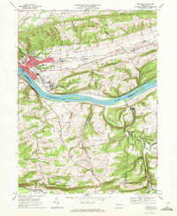
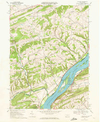
 1965 Northumberland1967 Print · USGSThe Susquehanna River forks meet at Northumberland and Sunbury in the mid-1960s, capturing a landscape of vital riverfront industry and transit. Researchers can trace the rail lines of the Erie-Lackawanna and Reading or locate local landmarks like the Sodom Sch (Historic) and Packers Island.4 unique versions available
 - 1965 Map of Sunbury, 1967 Print
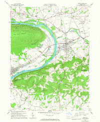
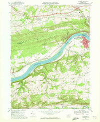
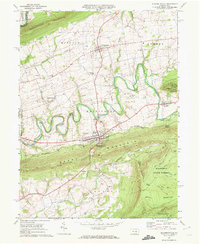
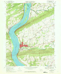
 1965 Sunbury1967 Print · USGSNorthumberland and Snyder counties centered on the Susquehanna River are captured here during a period of steady industrial and educational growth in the mid-sixties. Researchers can find precise locations for Susquehanna University, the historic Fort Augusta, and rural river landings like Fishers Ferry.4 unique versions available
 - 1965 Map of Lewisburg, 1967 Print
 1965 Lewisburg1967 Print · USGSUnion County during the mid-sixties reveals a landscape of academic tradition, rural hamlets, and heavy institutional presence. Researchers can trace the layout of Bucknell University or find long-standing rural landmarks like Emmanuel Ch and the Northeast Federal Penitentiary.2 unique versions available
 - 1965 Map of Allenwood, 1967 Print
 1965 Allenwood1967 Print · USGSThe Susquehanna River valley and the slopes of the Bald Eagle State Forest are captured here in the mid-sixties. Genealogists and local historians can trace the foundations of Kelly Crossroads, find the Washington Cem, and locate landmarks like the Allenwood Prison Camp.3 unique versions available
 - 1966 Map of Williamsport
 1966 Williamsport1966 Print · USGSThe Susquehanna Valley was a hub of transit and industry in the mid-seventies, where the river's West Branch connected major college towns and timberlands. Researchers can trace historical rail lines like the Reading or locate regional landmarks from Jersey Shore to Ricketts Glen State Park.
 - 1968 Map of Hughesville, 1972 Print
 1968 Hughesville1972 Print · USGSHughesville and its rural surroundings in Lycoming County appear here during the late sixties as a network of ridge-top farms and valley hamlets. Researchers can trace local heritage through sites like Moreland Community Ch, Pleasant Hill Cem, and the old Fairgrounds.3 unique versions available
 - 1969 Map of Valley View, 1972 Print
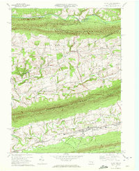 1969 Valley View1972 Print · USGSSchuylkill County and Northumberland County are captured in the late sixties as the valley communities between the ridges entered a new era. Genealogists and historians can trace local families through St Pauls Ch, Pitman, and the Line & Kitt Sch.2 unique versions available
 - 1969 Map of Pillow, 1972 Print
 1969 Pillow1972 Print · USGSThe Susquehanna River and its many islands meet the ridge-and-valley terrain of central Pennsylvania in the late sixties. Genealogists and local historians can trace the rural landscape between Pillow and Port Trevorton, locating Salem Ch, the Penn Central line, and traditional Covered Bridge crossings.2 unique versions available
 - 1969 Map of Riverside, 1972 Print
 1969 Riverside1972 Print · USGSThe river and rail corridors of the Susquehanna valley define this Central Pennsylvania region in the late sixties. Researchers can trace historic industrial sites like Franklin Furnace and family burial grounds including Mt Vernon Cem and Klines Grove Cem.3 unique versions available
 - 1969 Map of Shamokin, 1972 Print
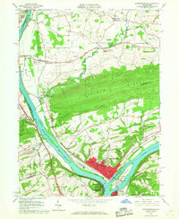
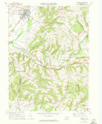
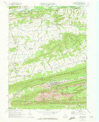
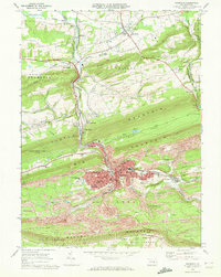 1969 Shamokin1972 Print · USGSNorthumberland County coal country is captured here in the late sixties, showing the dense industrial and residential growth of Shamokin and its surrounding boroughs. Trace the extensive rail networks of the Penn Central and find local landmarks like the Shamokin State Hospital and Kemp Stadium.2 unique versions available
 - 1969 Map of Trevorton, 1972 Print
 1969 Trevorton1972 Print · USGSNorthumberland County's coal country and rural valleys are captured here in the late sixties, showcasing the intersection of heavy industry and small-town life. Researchers can trace the extensive Strip Mines around Trevorton or locate family sites like St Lukes Cem and Augustaville.2 unique versions available
 - 1969 Map of Danville, 1972 Print
 1969 Danville1972 Print · USGSDanville and the Susquehanna River valley are shown in the late sixties as the region's healthcare and rail legacy remained central to local life. Genealogists and historians can trace the foundations of Geisinger Hospital, find rural landmarks like the Riegel Covered Bridge, or locate family sites near Mechanicsville and Knoebels Grove.4 unique versions available
 - 1969 Map of Elizabethville, 1972 Print
 1969 Elizabethville1972 Print · USGSDauphin County’s ridge-and-valley landscape is captured here in the late sixties, showing the agricultural and industrial character of the Wiconisco Creek valley. Researchers can locate family landmarks such as St Johns Ch, Maple Grove Cem, and the historic Oakdale Station along the Penn Central tracks.2 unique versions available
 - 1969 Map of Klingerstown, 1972 Print
 1969 Klingerstown1972 Print · USGSThe rural valleys between Line Mountain and Mahantango Mountain were captured here in the late sixties. Genealogists and local historians can locate specific family landmarks like Himmels Ch, a Covered Bridge on the creek, and the small settlements of Leck Kill and Rough and Ready.3 unique versions available
 - 1969 Map of Washingtonville, 1972 Print
 1969 Washingtonville1972 Print · USGSMontour County agriculture and rural life are preserved here in the late sixties as the region maintained its traditional crossroad hamlets. Researchers can locate family landmarks like the Billmeyer Cem, the historic Covered Bridge, and schools including DeLong Memorial Sch.4 unique versions available
 - 1969 Map of Dalmatia, 1972 Print
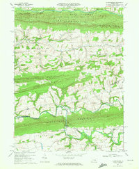
 1969 Dalmatia1972 Print · USGSNorthumberland and Snyder counties meet along the Susquehanna during the late sixties, a time when rail and river still defined the local economy. Researchers can trace family roots at St Pauls Ch, locate a historic Covered Bridge, or explore the riverside at McKees Half Falls.2 unique versions available
 - 1969 Map of Millersburg, 1972 Print
 1969 Millersburg1972 Print · USGSThe Susquehanna River valley near Millersburg comes alive in the late sixties, showcasing the area's rail-and-river heritage. Genealogists and historians can trace family-named sites like Rickard Memorial Cem Ch, the historic Ferry, and Montgomery Ferry.4 unique versions available
End of results
Showing maps 1-25 of 25
Top cities of Northumberland County
- Sunbury historical maps
- Shamokin historical maps
- Mount Carmel historical maps
- Northumberland historical maps
- Kulpmont historical maps
- Riverside historical maps
See more
Frequently asked questions
- What are the different types of historical maps available for Northumberland County?
- What is the oldest map of Northumberland County?
- Where can I purchase historical maps of Northumberland County for my home or office?
- Where can I download high-res historical maps of Northumberland County?
- Are there historical topographic maps available for Northumberland County?
- Is there historical aerial imagery available for Northumberland County?
- Where are historical maps of Northumberland County sourced from?