1950s Maps of Schuylkill County, Pennsylvania
Explore 29 historic maps of Schuylkill County from the 1950s. These maps offer a rare glimpse into what life looked like during the 1950s — showing old roads, neighborhoods, homes, and landmarks that have changed or disappeared over time.
Whether you're researching your family's past, planning a metal detecting trip, or studying how Schuylkill County's landscape evolved across the 1950s, these high-resolution maps are a powerful tool for exploring the history of this region.
- Focus on a specific era: All maps on this page are from the 1950s, giving you a focused view of this time period.
- See what’s changed: Compare century-old streets, trails, and buildings to today's modern landscape using overlays and satellite layers.
- Research with precision: Use these maps for genealogy, historical research, land use analysis, or educational projects.
- View, download, or print: Maps are fully viewable online in high resolution, and can be downloaded or printed for your own records.
Start exploring Schuylkill County's history through authentic maps from the 1950s. This is your window into the past.
Schuylkill County, PA maps
(29)- 1950 Map of Shenandoah
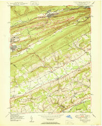
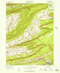
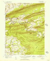
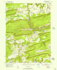
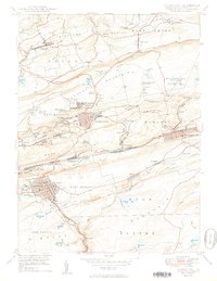 1950 Shenandoah1950 Print · USGSSchuylkill County’s coal heartland is revealed at its mid-century peak, showing the dense rail and mining infrastructure of the anthracite region. Genealogy researchers can trace family sites from Shenandoah to Mahanoy City, locating landmarks like The Peddlars Grave and Old White Ch.2 unique versions available
 - 1950 Map of Tamaqua
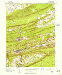
 1950 Tamaqua1950 Print · USGSThe anthracite coal region of Schuylkill and Carbon counties comes into sharp focus during the mid-century peak of industrial activity. Trace the dense rail networks of the Reading Co through Tamaqua and locate ancestral landmarks like the Odd Fellows Cem or Owl Creek Sch.2 unique versions available
 - 1950 Map of Hazleton
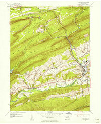
 1950 Hazleton1950 Print · USGSThe anthracite coal region of Pennsylvania comes into sharp focus during the post-war era. Researchers can trace the extensive rail networks of the Lehigh Valley and identify localized mining communities like Lattimer Mines (PO) and Coxes Village.2 unique versions available
 - 1950 Map of Nuremberg
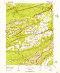
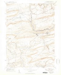 1950 Nuremberg1950 Print · USGSThe tri-county borderlands of Eastern Pennsylvania are captured here at the start of the 1950s. Genealogists can trace family names at Millers Corner and Raricks, or locate ancestors at the Nuremberg Cem and Mt Zion Ch.2 unique versions available
 - 1950 Map of Nesquehoning
 1950 Nesquehoning1950 Print · USGSCarbon County's anthracite landscape is captured here in the mid-twentieth century as rail and mining towns still hummed with activity. Genealogists can locate family landmarks from Bloomingdale to Mertz Town, including the Our Lady of Mt Carmel Cem and East Penn Airport.2 unique versions available
 - 1950 Map of Harrisburg, 1952 Print
 1950 Harrisburg1952 Print · USGSMid-century Central Pennsylvania comes alive through its dense rail networks and river valley settlements during the post-war industrial era. Genealogists and historians can trace family roots through hubs like Harrisburg, locate Carlisle Barracks, or follow the Pennsylvania RR through the Lebanon Valley.
 - 1953 Map of Ashland, 1956 Print
 1953 Ashland1956 Print · USGSIn the 1950s, the anthracite coal region around Ashland and Girardville was at its industrial peak. Genealogists can trace family homes in Centralia or Gordon and locate landmarks like Immaculate Heart Academy or the Centralia Fire Tower.5 unique versions available
 - 1954 Map of Pine Grove, 1956 Print
 1954 Pine Grove1956 Print · USGSSchuylkill County in the mid-1950s reveals a landscape defined by industrial railroads and small valley settlements. Researchers can trace ancestral locations from Hollerman Cem to local landmarks like the Drive-in Theater and Swatara Valley Airport.4 unique versions available
 - 1954 Map of Delano, 1956 Print
 1954 Delano1956 Print · USGSSchuylkill County at the height of its rail-and-mine era reveals an intricate landscape of industrial junctions and valley settlements. Genealogists and historians can trace the footprint of community life at the St Peters Ch, Primrose Mine, and the Lakeside Sch.5 unique versions available
 - 1954 Map of Tremont, 1956 Print
 1954 Tremont1956 Print · USGSSchuylkill County in the mid-fifties shows a landscape defined by the anthracite valleys and the parallel ridges of the Appalachians. Researchers can trace the READING rail lines through Tremont and Donaldson, or locate family landmarks like Salem Ch and Klingers Sch.4 unique versions available
 - 1955 Map of Swatara Hill, 1956 Print
 1955 Swatara Hill1956 Print · USGSSchuylkill County in the mid-fifties shows a landscape of ridge-top trails and valley railroads. Genealogists and historians can trace family-named landmarks like Schweigerts Sch or visit rural congregations at Hauers Ch and St Marks Ch.6 unique versions available
 - 1955 Map of Mount Carmel, 1956 Print
 1955 Mount Carmel1956 Print · USGSNorthumberland County's coal-country landscape is meticulously detailed here in the mid-fifties, showing the rail-dependent corridor between Kulpmont and Mount Carmel. Genealogists and historians can trace the foundations of local life through the Township Sch, Mount Carmel Cemetery, and the Drive-in Theater at Natalie.5 unique versions available
 - 1955 Map of Conyngham, 1956 Print
 1955 Conyngham1956 Print · USGSThe anthracite coal fields of Luzerne and Schuylkill counties are shown here in the mid-fifties, just as strip mining began to reshape the ridges. Genealogists and historians can locate family homes in Oneida, Sheppton, or Kelayres, and trace the rail lines of the Reading and Lehigh Valley railroads.6 unique versions available
 - 1955 Map of Shumans, 1956 Print
 1955 Shumans1956 Print · USGSColumbia County’s ridge-and-valley landscape is captured here in the mid-1950s as the Reading railroad follows the winding Catawissa Creek. Genealogists can locate family landmarks like Michaels Cem, Harkers Ch, and the old Beaver Sch.5 unique versions available
 - 1955 Map of Minersville, 1956 Print
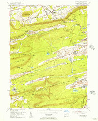
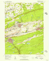
 1955 Minersville1956 Print · USGSSchuylkill County mining towns thrive amidst the ridges of the anthracite coal region in the mid-1950s. Genealogists and industrial historians can trace the intricate rail lines of the Reading and find vanished local landmarks like Triedens Ch and New Mines.6 unique versions available
 - 1955 Map of Fredericksburg, 1956 Print
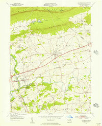 1955 Fredericksburg1956 Print · USGSCentered on Fredericksburg and Jonestown in the mid-1950s, this area shows a productive valley landscape framed by the Blue Mountain ridges. Genealogists can locate family landmarks like Groff Sch, Meckville Ch, and the old crossroads at Bunker Hill or Freeport Mills.7 unique versions available
 - 1955 Map of Shenandoah, 1956 Print
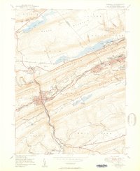
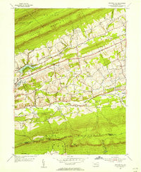
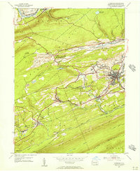
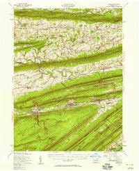
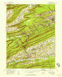
 1955 Shenandoah1956 Print · USGSAnthracite coal country comes alive in the mid-fifties, showing the dense rail networks and industrial settlements of the Schuylkill valley. Trace family roots in Shenandoah or Mahanoy City, and locate landmarks like Old White Ch and the Incline.5 unique versions available
 - 1955 Map of Nuremberg, 1956 Print
 1955 Nuremberg1956 Print · USGSThe anthracite region near the Luzerne and Schuylkill border is shown here in the mid-1950s, highlighting the industrial rail network and hilltop mining towns. Researchers can trace family roots through sites like Nuremberg Cem, Zion Grove, and the mining village of Oneida.6 unique versions available
 - 1955 Map of Lykens, 1958 Print
 1955 Lykens1958 Print · USGSThe anthracite coal valleys of Dauphin and Schuylkill counties are shown here in the mid-1950s, a time of transition for the region's industrial landscape. Genealogists can trace family roots through numerous country landmarks like Himmels Ch, Kissingers Sch, and the Pitman Post Office.2 unique versions available
 - 1955 Map of Pine Grove, 1958 Print
 1955 Pine Grove1958 Print · USGSSchuylkill County coal towns and the Blue Mountain ridges are documented here in the mid-1950s. Genealogists and researchers can locate family-named landmarks like Klingers Sch and Hauer Ch alongside coal-era infrastructure like Coal Castle.3 unique versions available
 - 1955 Map of Catawissa, 1960 Print
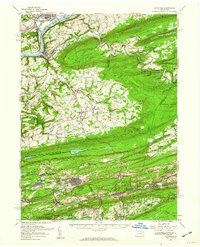 1955 Catawissa1960 Print · USGSThe coal and river valleys of Columbia and Schuylkill counties are shown here in the mid-1950s. Genealogists and historians can trace family roots through numerous sites like Centralia, St Marys Cem, and Parrs Mill.2 unique versions available
 - 1955 Map of Mahanoy, 1960 Print
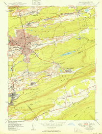
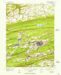
 1955 Mahanoy1960 Print · USGSThe anthracite coalfields of Schuylkill County are shown in full industrial operation during the mid-1950s. Researchers can locate specific colliery sites and landmarks like Harwood, the Mahanoy Tunnel, and the lone Peddlars Grave.
 - 1956 Map of Newark
 1956 Newark1956 Print · USGSThe industrial heart of the Mid-Atlantic is captured here at the dawn of the highway era, tracing the dense corridors between Newark and Philadelphia. Genealogists and local historians can map the rail networks of the Reading RR or locate mid-century military life at Fort Dix Military Reservation.2 unique versions available
 - 1956 Map of New Ringgold, 1957 Print
 1956 New Ringgold1957 Print · USGSSchuylkill and Berks counties are captured here in the mid-fifties, showing a landscape of ridge-top trails and valley railroads. Genealogists and historians can trace family roots through the West Penn Ch Cem, numerous rural schoolhouses like Dorset Sch, and the quiet borough of New Ringgold.6 unique versions available
 - 1956 Map of Hamburg, 1957 Print
 1956 Hamburg1957 Print · USGSBerks County is captured here in the mid-1950s, where the industrial valley of the Schuylkill River meets the ridge of Blue Mountain. Genealogists and researchers can find Five Locks, the Hamburg Tuberculosis Sanatorium, and local schools like Heinly Sch.10 unique versions available
Showing maps 1-25 of 29
Top cities of Schuylkill County
- Pottsville historical maps
- Tamaqua historical maps
- Shenandoah historical maps
- Schuylkill Haven historical maps
- Mahanoy City historical maps
- Minersville historical maps
See more
Frequently asked questions
- What are the different types of historical maps available for Schuylkill County?
- What is the oldest map of Schuylkill County?
- Where can I purchase historical maps of Schuylkill County for my home or office?
- Where can I download high-res historical maps of Schuylkill County?
- Are there historical topographic maps available for Schuylkill County?
- Is there historical aerial imagery available for Schuylkill County?
- Where are historical maps of Schuylkill County sourced from?