1970s Maps of Schuylkill County, Pennsylvania
Explore 16 historic maps of Schuylkill County from the 1970s. These maps offer a rare glimpse into what life looked like during the 1970s — showing old roads, neighborhoods, homes, and landmarks that have changed or disappeared over time.
Whether you're researching your family's past, planning a metal detecting trip, or studying how Schuylkill County's landscape evolved across the 1970s, these high-resolution maps are a powerful tool for exploring the history of this region.
- Focus on a specific era: All maps on this page are from the 1970s, giving you a focused view of this time period.
- See what’s changed: Compare century-old streets, trails, and buildings to today's modern landscape using overlays and satellite layers.
- Research with precision: Use these maps for genealogy, historical research, land use analysis, or educational projects.
- View, download, or print: Maps are fully viewable online in high resolution, and can be downloaded or printed for your own records.
Start exploring Schuylkill County's history through authentic maps from the 1970s. This is your window into the past.
Schuylkill County, PA maps
(16)- 1976 Map of Ashland, 1979 Print
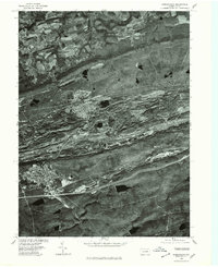
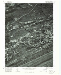
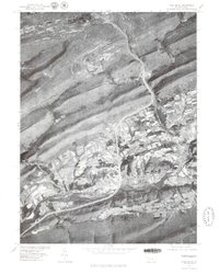
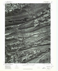 1976 Ashland1979 Print · USGSThe anthracite coal region of Schuylkill County is seen here in the late seventies through detailed aerial orthophotography. Researchers can trace the street grids and industrial footprints of Centralia, Girardville, and Gordon against the ridges of Broad Mountain.
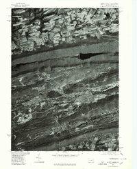
 - 1976 Map of Nuremberg, 1979 Print
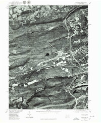
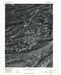
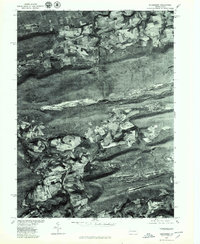 1976 Nuremberg1979 Print · USGSEastern Pennsylvania in the late seventies is shown in this aerial orthophotoquad of the anthracite coal region. Genealogists and local historians can trace the layouts of Nuremberg, Weston, and Rock Glen at the base of Buck Mountain.
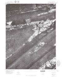
 - 1976 Map of Tamaqua, 1979 Print
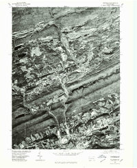
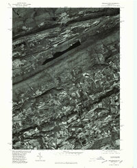
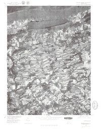
 1976 Tamaqua1979 Print · USGSThe anthracite coal region of Schuylkill and Carbon Counties comes into focus during the 1970s. Researchers can trace the industrial footprint between Tamaqua and Summit Hill, and locate features like the Still Creek Reservoir.
 - 1976 Map of Pottsville, 1979 Print
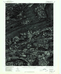
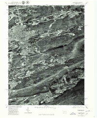
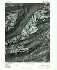
 1976 Pottsville1979 Print · USGSSchuylkill County at the height of the 1970s shows a landscape deeply defined by its industrial heritage and mountain geography. Researchers can trace the layout of anthracite boroughs from Pottsville to New Philadelphia and the path of the Schuylkill River.
 - 1976 Map of Orwigsburg, 1979 Print
 1976 Orwigsburg1979 Print · USGSSchuylkill County agricultural and mountain terrain is captured in the late seventies just as traditional field patterns remained intact. Researchers can trace the exact footprint of settlements like Mckeansburg, Lewistown, and Drehersville.
 - 1976 Map of Shenandoah, 1979 Print
 1976 Shenandoah1979 Print · USGSThe anthracite region of Schuylkill County is seen in the mid-seventies through detailed aerial imagery. Trace the industrial footprint and neighborhood grids of Shenandoah, Mahanoy City, and Frackville as they appeared decades ago.
 - 1976 Map of Conyngham, 1979 Print
 1976 Conyngham1979 Print · USGSLuzerne and Schuylkill counties are shown through detailed aerial imagery in the mid-1970s, revealing the intersection of industry and mountain settlement. Trace the exact layout of coal-region towns like Conyngham, Sheppton, and West Hazleton.
 - 1976 Map of Nesquehoning, 1979 Print
 1976 Nesquehoning1979 Print · USGSCarbon County in the mid-seventies shows a landscape of sharp industrial and agricultural transitions. Genealogists can trace the residential footprints of Jim Thorpe and Lansford or locate rural homesteads near Normal Square.
 - 1976 Map of Hazleton, 1979 Print
 1976 Hazleton1979 Print · USGSIn the Pennsylvania anthracite region during the 1970s, this aerial study shows the urban density of Hazleton against the industrial landscape. Researchers can trace the layout of Mc Adoo and Beaver Meadows at the edge of Spring Mountain.
 - 1976 Map of Minersville, 1979 Print
 1976 Minersville1979 Print · USGSThe Southern Anthracite Field comes into sharp focus during the mid-seventies, showing the physical footprint of Pennsylvania coal country. Genealogists and local historians can trace the residential layouts of Minersville and Llewellyn against the backdrop of Broad Mountain.
 - 1976 Map of Delano, 1979 Print
 1976 Delano1979 Print · USGSSchuylkill County's coal country is shown in detail during the mid-1970s, revealing the intersection of mountain ridges and industrial towns. Local historians can trace the footprints of Delano, Tuscarora, and Mary D against the backdrop of Broad Mountain.
 - 1977 Map of Fredericksburg, 1979 Print
 1977 Fredericksburg1979 Print · USGSNorthern Lebanon County in the late seventies reveals a landscape of varied agricultural patterns and traditional settlements. Researchers can trace the development of Jonestown and Fredericksburg or locate features along Swatara Creek.
 - 1977 Map of Tremont, 1979 Print
 1977 Tremont1979 Print · USGSSchuylkill County's ridge-and-valley landscape is captured in the late seventies through detailed aerial imagery. Trace the development of valley settlements like Hegins and Donaldson alongside the industrial corridors of Broad Mountain.
 - 1977 Map of Pine Grove, 1979 Print
 1977 Pine Grove1979 Print · USGSPine Grove and the coal region foothills are seen from above in the late seventies as modern highways began to reshape the valley. Genealogists and local historians can trace the footprint of settlements like Suedberg and Ravine nestled between Second Mountain and Sharp Mountain.
 - 1977 Map of Mount Carmel, 1979 Print
 1977 Mount Carmel1979 Print · USGSMount Carmel and the anthracite coal region appear here in the late seventies, captured in detailed aerial imagery. Genealogists and historians can trace the gridded streets of Mount Carmel, Kulpmont, and Locust Gap against the ridges of Big Mountain.
 - 1977 Map of Tower City, 1979 Print
 1977 Tower City1979 Print · USGSThe western Schuylkill County coal region is seen here in the late seventies, showing how the dramatic mountain ridges shaped local life. Genealogists and local historians can trace the clear street grids and valley footprints of Tower City, Orwin, and Muir.
End of results
Showing maps 1-16 of 16
Top cities of Schuylkill County
- Pottsville historical maps
- Tamaqua historical maps
- Shenandoah historical maps
- Schuylkill Haven historical maps
- Mahanoy City historical maps
- Minersville historical maps
See more
Frequently asked questions
- What are the different types of historical maps available for Schuylkill County?
- What is the oldest map of Schuylkill County?
- Where can I purchase historical maps of Schuylkill County for my home or office?
- Where can I download high-res historical maps of Schuylkill County?
- Are there historical topographic maps available for Schuylkill County?
- Is there historical aerial imagery available for Schuylkill County?
- Where are historical maps of Schuylkill County sourced from?