1960s Maps of Westmoreland County, Pennsylvania
Explore 25 historic maps of Westmoreland County from the 1960s. These maps offer a rare glimpse into what life looked like during the 1960s — showing old roads, neighborhoods, homes, and landmarks that have changed or disappeared over time.
Whether you're researching your family's past, planning a metal detecting trip, or studying how Westmoreland County's landscape evolved across the 1960s, these high-resolution maps are a powerful tool for exploring the history of this region.
- Focus on a specific era: All maps on this page are from the 1960s, giving you a focused view of this time period.
- See what’s changed: Compare century-old streets, trails, and buildings to today's modern landscape using overlays and satellite layers.
- Research with precision: Use these maps for genealogy, historical research, land use analysis, or educational projects.
- View, download, or print: Maps are fully viewable online in high resolution, and can be downloaded or printed for your own records.
Start exploring Westmoreland County's history through authentic maps from the 1960s. This is your window into the past.
Westmoreland County, PA maps
(25)- 1960 Map of Mc Keesport, 1961 Print
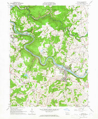
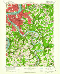 1960 Mc Keesport1961 Print · USGSThe industrial heart of the Monongahela and Youghiogheny valleys is shown here at its mid-century peak. Local historians can trace the intricate rail lines of the Union RR and locate ancestral sites like the North Buena Vista Historic Site or St Josephs Convent.4 unique versions available
 - 1960 Map of Braddock, 1961 Print
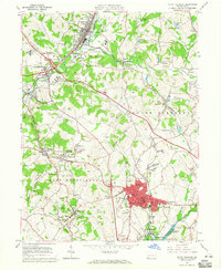
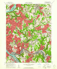 1960 Braddock1961 Print · USGSEastern Allegheny County's industrial and suburban heartland is captured here during the mid-century growth of the 1960s. Trace the intricate rail yards at North Bessemer Yards or locate local landmarks like Woodlawn Cemetery and the Wilkinsburg-Pittsburgh Airport.5 unique versions available
 - 1960 Map of New Kensington West, 1961 Print
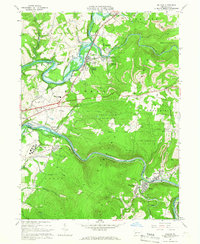
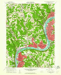 1960 New Kensington West1961 Print · USGSThe industrial Allegheny River corridor hums with activity in the 1960s, anchoring a chain of river towns and rail hubs. Researchers can trace the mid-century development of Oakmont, Cheswick, and New Kensington alongside landmarks like Lock and Dam No 3 and Remich Airport.4 unique versions available
 - 1964 Map of Pittsburgh
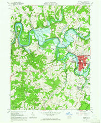
 1964 Pittsburgh1964 Print · USGSWestern Pennsylvania in the late fifties and early sixties shows a landscape of powerful river industries and expanding highways. Genealogists and historians can trace the rail corridors of the Pennsylvania RR through industrial hubs like Johnstown, Altoona, and Nanty Glo.
 - 1964 Map of Latrobe, 1965 Print
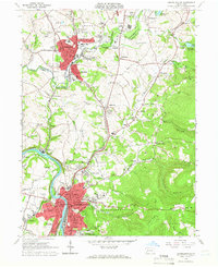
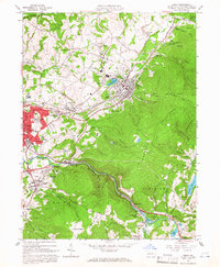
 1964 Latrobe1965 Print · USGSLatrobe and its surrounding coal-patch towns are captured here in the mid-1960s during a peak of industrial and institutional activity. Trace the rail lines and mine sites that built towns like Hostetter and Luxor, or locate family sites near St Vincent College.5 unique versions available
 - 1964 Map of Dawson, 1965 Print
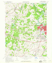
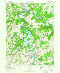
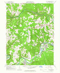
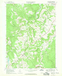
 1964 Dawson1965 Print · USGSFayette County’s industrial heart is revealed in the mid-sixties as coal and rail dominate the Youghiogheny River valley. Researchers can trace the heritage of local patch towns like Dawson, find the historic Alliance Furnace, or locate family plots at Bethel Cem.4 unique versions available
 - 1964 Map of Mount Pleasant, 1965 Print
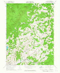
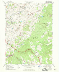
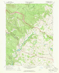
 1964 Mount Pleasant1965 Print · USGSMid-century Westmoreland County is defined here by its dense network of coal patches, rail lines, and manufacturing hubs. Genealogists can trace family roots through numerous small communities like Rufis Dale, Hecla, and Armbrust, or locate ancestral plots in the Polish Cemetery.5 unique versions available
 - 1964 Map of Bolivar, 1966 Print
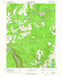
 1964 Bolivar1966 Print · USGSThe Conemaugh River valley in the early sixties shows a landscape defined by industrial extraction and rail transit. Genealogists can locate family names and sites near Black Lick, Josephine, and the Torrance State Hospital.6 unique versions available
 - 1964 Map of Connellsville, 1966 Print
 1964 Connellsville1966 Print · USGSMid-century Fayette and Westmoreland Counties are defined here by a dense network of industrial rail lines and riverside towns. Genealogists and historians can trace the foundations of Connellsville, locate West Overton, and find landmarks like St Ritas Cem.5 unique versions available
 - 1964 Map of Wilpen, 1966 Print
 1964 Wilpen1966 Print · USGSWestmoreland County in the mid-sixties reveals a landscape of industrial transitions and mountain ridges. Genealogists and historians can trace family roots at Green Mountain Cem or locate former landmarks like St Johns Ch and the old railroad grade.4 unique versions available
 - 1964 Map of Saltsburg, 1966 Print
 1964 Saltsburg1966 Print · USGSIndiana and Westmoreland Counties during the mid-sixties show a landscape of heavy industry and civil engineering at the junction of two great rivers. Trace the impact of the Loyalhanna Dam on the terrain near Saltsburg and find historic sites like Union Cem and Tunnelton.3 unique versions available
 - 1964 Map of Rachelwood, 1966 Print
 1964 Rachelwood1966 Print · USGSLaurel Ridge and the Conemaugh River define this Pennsylvania mountain landscape during the early sixties. Researchers can trace family sites and local landmarks like Legat Cem, the historic Baldwin Furnace, and Ross Mountain Park.3 unique versions available
 - 1964 Map of Avonmore, 1966 Print
 1964 Avonmore1966 Print · USGSThe coal and gas country of the Kiskiminetas valley is captured here in the mid-sixties as extraction and industry shaped local life. Researchers can trace the Pennsylvania Railroad through Avonmore and locate community landmarks like Elders Ridge Joint High Sch and Clarksburg Ch.4 unique versions available
 - 1964 Map of Derry, 1966 Print
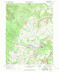
 1964 Derry1966 Print · USGSDerry and Latrobe are shown in the mid-1960s during a period of heavy industrial activity and coal mining. Researchers can locate family landmarks such as St Martins Ch, Sacred Heart Sch, and numerous coal works including Coke Ovens and strip mines.4 unique versions available
 - 1964 Map of New Florence, 1966 Print
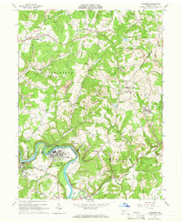
 1964 New Florence1966 Print · USGSThe Indiana and Westmoreland county line was a hub of mining and rail activity in the mid-sixties. Genealogists and local researchers can trace the rail corridor from New Florence to Conpitt Junction or locate family sites near St Marys Cem and Seward.6 unique versions available
 - 1964 Map of Vintondale, 1966 Print
 1964 Vintondale1966 Print · USGSCambria and Indiana counties were defined by the coal and rail industries during the early sixties. Genealogists can trace family roots through the settlements of Vintondale and Dilltown, or locate landmarks like the Delano Sch and Wehrum Mine Dump.3 unique versions available
 - 1964 Map of Johnstown, 1966 Print
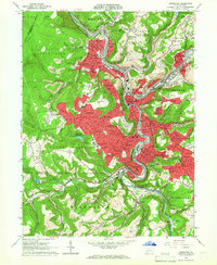 1964 Johnstown1966 Print · USGSThe Conemaugh River valley is captured in the mid-1960s as a dense industrial and rail hub. Genealogists can trace family roots through neighborhood landmarks like Grandview Cemetery, St Nicholas Ch, and the many schools of Westmont and Southmont.6 unique versions available
 - 1964 Map of Blairsville, 1966 Print
 1964 Blairsville1966 Print · USGSThe Conemaugh River valley was a hub of transit and industry in the early sixties, where the steel rails of the Pennsylvania Railroad met the coal mines of Derry. Genealogists can trace family names at Livermore Cem or locate old community landmarks like Old Salem Ch and the Torrance State Hospital.5 unique versions available
 - 1967 Map of Stahlstown, 1970 Print
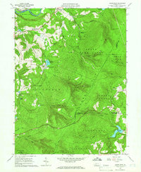
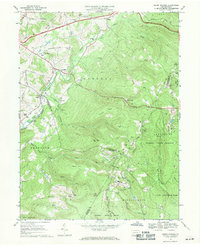
 1967 Stahlstown1970 Print · USGSStahlstown and the rural valleys of Westmoreland County are captured here in the late sixties, showing a landscape shaped by ridge-line agriculture and the Pennsylvania Toll Road. Genealogists can trace family landmarks like Snowball Cem, the Enoch Stahl Sch, and Weaver Mill.5 unique versions available
 - 1967 Map of Mammoth, 1970 Print
 1967 Mammoth1970 Print · USGSWestmoreland County in the late sixties reveals a busy industrial landscape of coal mining towns and hilltop churches. Genealogists can trace family footprints through numerous local sites like Forty Mourners Ch, St Florian Sch, and the Fairground near Mutual.4 unique versions available
 - 1967 Map of Ligonier, 1971 Print
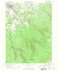 1967 Ligonier1971 Print · USGSWestmoreland County in the late sixties shows a transition from historical industrial sites to a prominent mountain recreation hub. Researchers can trace family roots at Laughlintown Cemetery or locate landmarks like California Furnace, the Marker School, and a Covered Bridge.4 unique versions available
 - 1967 Map of Seven Springs, 1971 Print
 1967 Seven Springs1971 Print · USGSThe Laurel Highlands during the late sixties show a fascinating transition from quiet mountain hamlets to a premier recreation destination. Genealogists and historians can trace family roots at St Raymonds Cem, explore the early footprint of Seven Springs, and locate the Old Railroad Grade near Kregar.4 unique versions available
 - 1967 Map of Bakersville, 1971 Print
 1967 Bakersville1971 Print · USGSSomerset County saw significant development in the 1960s as recreation and transit expanded across the ridgeline. Trace the growth of Bakersville and Lavansville alongside the path of the Pennsylvania Turnpike and the Plateau De Mount Ski Area.5 unique versions available
 - 1967 Map of Boswell, 1971 Print
 1967 Boswell1971 Print · USGSSomerset County’s coal country and rural settlements are captured in the late 1960s, showing the intersection of heavy industry and small-town life. Genealogists can trace family landmarks like Klines Mill, St Marys Ch, and the many cemeteries near Boswell.5 unique versions available
 - 1967 Map of Donegal, 1971 Print
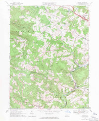 1967 Donegal1971 Print · USGSThe Westmoreland and Fayette county line follows the crest of Chestnut Ridge in the late 1960s. Genealogists and historians can locate remote landmarks like Mt Salem Ch, Brown Cem, and the rail corridor serving Indian Head.4 unique versions available
End of results
Showing maps 1-25 of 25
Top cities of Westmoreland County
- Greensburg historical maps
- New Kensington historical maps
- Lower Burrell historical maps
- Jeannette historical maps
- Latrobe historical maps
- Monessen historical maps
See more
Frequently asked questions
- What are the different types of historical maps available for Westmoreland County?
- What is the oldest map of Westmoreland County?
- Where can I purchase historical maps of Westmoreland County for my home or office?
- Where can I download high-res historical maps of Westmoreland County?
- Are there historical topographic maps available for Westmoreland County?
- Is there historical aerial imagery available for Westmoreland County?
- Where are historical maps of Westmoreland County sourced from?