1990s Maps of Westmoreland County, Pennsylvania
Explore 23 historic maps of Westmoreland County from the 1990s. These maps offer a rare glimpse into what life looked like during the 1990s — showing old roads, neighborhoods, homes, and landmarks that have changed or disappeared over time.
Whether you're researching your family's past, planning a metal detecting trip, or studying how Westmoreland County's landscape evolved across the 1990s, these high-resolution maps are a powerful tool for exploring the history of this region.
- Focus on a specific era: All maps on this page are from the 1990s, giving you a focused view of this time period.
- See what’s changed: Compare century-old streets, trails, and buildings to today's modern landscape using overlays and satellite layers.
- Research with precision: Use these maps for genealogy, historical research, land use analysis, or educational projects.
- View, download, or print: Maps are fully viewable online in high resolution, and can be downloaded or printed for your own records.
Start exploring Westmoreland County's history through authentic maps from the 1990s. This is your window into the past.
Westmoreland County, PA maps
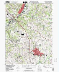
(23)- 1993 Map of New Kensington West
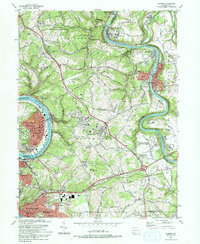
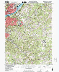
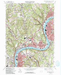 1993 New Kensington West1993 Print · USGSThe industrial corridor along the Allegheny River north of Pittsburgh shows its mature residential and commercial footprint in the 1990s. Researchers can trace family roots through numerous parish sites like St Nicholas Cem or locate industrial landmarks like Lock and Dam No 3.2 unique versions available
 - 1993 Map of Freeport
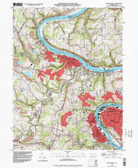
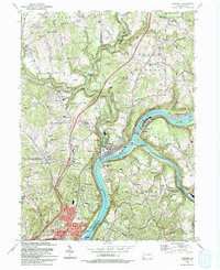 1993 Freeport1993 Print · USGSThe confluence of the Allegheny and Kiskiminetas Rivers defines the industrial landscape of southwestern Pennsylvania in the early nineties. Researchers can trace the riverfront rail lines of CONRAIL, find old family burial grounds like Mud Church Cem, and locate the historic Garvers Ferry site.
 - 1993 Map of Mount Pleasant
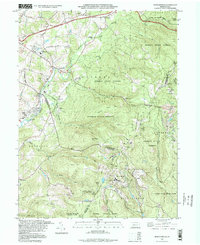
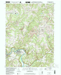
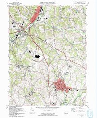 1993 Mount Pleasant1993 Print · USGSMount Pleasant and the surrounding coal-patch villages of Westmoreland County appear in the early nineties as the region balanced its industrial roots with modern highway growth. Local historians can trace old community sites like Standard Shaft, Weavers Old Stand, and Hecla (Southwest PO).
 - 1993 Map of Slickville
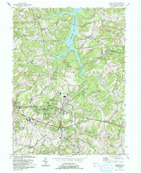 1993 Slickville1993 Print · USGSWestmoreland County communities like Slickville and Delmont appear here in the early nineties, showing a landscape defined by coal mining and growing suburban corridors. Researchers can trace family history at Poke Run Cem, locate the Mamont Sch, or explore the industrial legacy of local Strip Mines.
 - 1993 Map of Donora
 1993 Donora1993 Print · USGSThe industrial river valleys of the Monongahela and Youghiogheny are captured in the early nineties as they balance legacy industry with growing suburbs. Genealogists can trace family roots through sites like Douglass Cem, Apples Mill Ch, and the Concord Pioneer Sch.2 unique versions available
 - 1993 Map of Greensburg
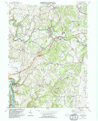
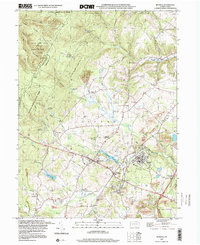
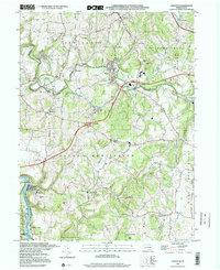
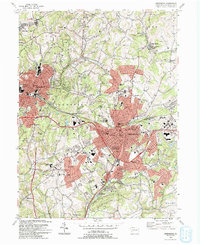 1993 Greensburg1993 Print · USGSGreensburg and the surrounding Westmoreland County boroughs are shown here in the early nineties during a period of significant commercial development. Researchers can trace historic sites like Old Hannastown Historical Park and Bushy Run Battlefield State Park alongside modern landmarks such as Greengate Mall and Seton Hill College.2 unique versions available
 - 1993 Map of Vandergrift
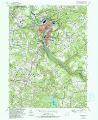 1993 Vandergrift1993 Print · USGSThe Kiskiminetas River valley comes alive in the early nineties, showing the industrial density of Vandergrift and its neighboring boroughs. Genealogists and local historians can trace family locations near the Saints Cosmas & Damian Shrine, identify burial sites at Apollo Cem, or locate the historic Fort Hand Historical Marker.
 - 1993 Map of New Kensington East
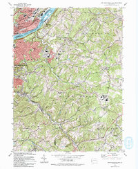 1993 New Kensington East1993 Print · USGSWestmoreland and Allegheny counties meet here in the early nineties, where the river valley's industrial heritage is clearly mapped. Genealogists can trace family landmarks like Mt Hope Cem and St Josephs High Sch among the hills of Natrona Heights and Braeburn.
 - 1993 Map of Mc Keesport, 1998 Print
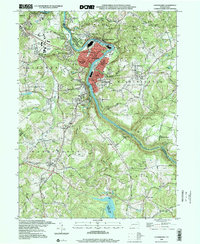
 1993 Mc Keesport1998 Print · USGSIn the late twentieth century, the industrial river valleys of Allegheny County show a complex blend of dense urban centers and sprawling memorial parks. Researchers can trace family ties through numerous local landmarks like St Nicholas Cem, Mt Vernon Cemetery, and the North Buena Vista Historical Site.
 - 1993 Map of Seven Springs, 1998 Print
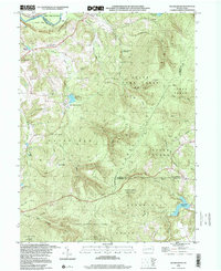
 1993 Seven Springs1998 Print · USGSThe Laurel Highlands during the 1990s show a fascinating blend of traditional mountain settlements and growing recreational destinations. Researchers can locate legacy sites like Horners Mill, Pritts School, and the Nedrow Cem alongside the developed slopes of Seven Springs.
 - 1993 Map of Monongahela, 1999 Print
 1993 Monongahela1999 Print · USGSThe industrial Monongahela Valley is captured in the early nineties, showing a landscape shaped by river commerce and mining. Researchers can trace family roots at Taylor Cem or locate historic landmarks like Shire Oaks and Hazel Kirk.
 - 1994 Map of Smithton
 1994 Smithton1994 Print · USGSWestmoreland County communities like Smithton and Yukon are shown at the close of the twentieth century, as regional infrastructure adapted to the Pennsylvania Turnpike. Researchers can locate family landmarks such as Seven Dolors Cem and Barren Run Sch.
 - 1997 Map of Mount Pleasant, 2000 Print
 1997 Mount Pleasant2000 Print · USGSWestmoreland County at the close of the twentieth century shows a landscape shaped by coal and transit. Genealogists and historians can trace the Standard Shaft and Polish Cemetery or locate old school sites like Alverton School.
 - 1997 Map of Boswell, 2000 Print
 1997 Boswell2000 Print · USGSSomerset County coal towns and the ridges of the Laurel Highlands are captured here in the late nineties as the landscape shifted from active extraction to reclamation. Genealogists and researchers can locate family sites at SS Peter and Paul Cem, Klines Mill, and the settlement of Jenners Crossroads.
 - 1997 Map of Smithton, 2000 Print
 1997 Smithton2000 Print · USGSWestmoreland County at the end of the nineties shows a landscape where the Youghiogheny River valley meets the infrastructure of the turnpike. Researchers can locate family landmarks like St Timothy Cem, the Barren Run Sch, and the borough of Smithton.
 - 1997 Map of Mammoth, 2000 Print
 1997 Mammoth2000 Print · USGSWestmoreland County at the close of the century shows a landscape transitioning from active coal extraction to recreation and residential life. Genealogists and local historians can locate early parish landmarks like St Lukes Cem, trace the Abandoned Railroad, and find local curiosities like the Drive-in Theater.
 - 1998 Map of Vintondale, 1999 Print
 1998 Vintondale1999 Print · USGSIn the late nineties, the area around Vintondale and Wehrum remains defined by its deep mining heritage and the winding Blacklick Creek. Genealogists and historians can locate family landmarks like Memorial Ch and Delano Sch, or trace the old CONRAIL line and the Gallitzin Trail.
 - 1998 Map of Avonmore, 1999 Print
 1998 Avonmore1999 Print · USGSThe loop of the Kiskiminetas River defines this landscape in the late nineties, where coal-rich townships meet the river's bend. Genealogists and historians can trace the foundations of local life through the Spring Church, West View Cem, and the Elders Ridge Joint High Sch.
 - 1998 Map of Vandergrift, 2000 Print
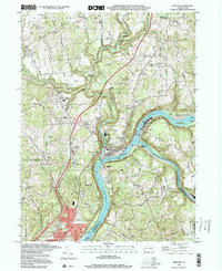
 1998 Vandergrift2000 Print · USGSThe industrial corridor of the Kiskiminetas River is shown in great detail during the late 1990s as it winds past Vandergrift and Apollo. Researchers can locate specific sites like the Fort Hand Historical Marker, Pleasant Hill Cemetery, and the Saints Cosmas & Damian Shrine.
 - 1998 Map of Derry, 2000 Print
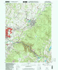 1998 Derry2000 Print · USGSWestmoreland County at the close of the nineties shows a landscape defined by the intersection of industrial mining and steep ridgelines. Genealogists and historians can trace local family roots through sites like Sacred Heart Sch, Keltz Cem, and the small community of Peanut.
 - 1998 Map of Freeport, 2000 Print
 1998 Freeport2000 Print · USGSThe confluence of the Allegheny and Kiskiminetas rivers at the end of the century shows a landscape of deep rail history and industrial riverfronts. Trace family roots at Mount Airy Cemetery or locate old valley crossings like Garvers Ferry and Butler Junction.
 - 1998 Map of New Kensington East, 2000 Print
 1998 New Kensington East2000 Print · USGSThe Allegheny River valley at the close of the century shows a landscape shaped by industry and suburban growth. Genealogists can trace family landmarks like Greenwood Memorial Park Cemetery, St Marys Cem, and Alcoa Center.
 - 1998 Map of Rachelwood, 2000 Print
 1998 Rachelwood2000 Print · USGSThe Westmoreland and Cambria county line area in the late nineties showcases a landscape of protected highlands and mountain reservoirs. Researchers can trace historic industrial sites like Baldwin Furnace and community anchors such as Legat Cem and Rachelwood.
End of results
Showing maps 1-23 of 23
Top cities of Westmoreland County
- Greensburg historical maps
- New Kensington historical maps
- Lower Burrell historical maps
- Jeannette historical maps
- Latrobe historical maps
- Monessen historical maps
See more
Frequently asked questions
- What are the different types of historical maps available for Westmoreland County?
- What is the oldest map of Westmoreland County?
- Where can I purchase historical maps of Westmoreland County for my home or office?
- Where can I download high-res historical maps of Westmoreland County?
- Are there historical topographic maps available for Westmoreland County?
- Is there historical aerial imagery available for Westmoreland County?
- Where are historical maps of Westmoreland County sourced from?