Old Maps of Abbeville County, South Carolina
Explore 25 old maps of Abbeville County, spanning from 1892 to today. These high-resolution historic maps reveal how streets, neighborhoods, landmarks, and natural features evolved over time — perfect for genealogy, metal detecting, research, and local history exploration.
What you can do with these maps:
- See how Abbeville County changed over time: Compare historical maps to modern-day views to trace roads, homesites, rail lines & more.
- View detailed metadata: Each map includes creators, publishers, year, scale, and archive source.
- Overlay maps with satellite & LiDAR: Visualize the past alongside modern tools to explore terrain & human change.
- Trusted historical sources: Maps sourced from the USGS, Library of Congress, and other archives.
- Access maps your way: View online, download high-res files, or order prints for personal or research use.
Start exploring old maps of Abbeville County to uncover forgotten places, hidden landmarks, and the deep history beneath your feet.
Abbeville County, SC maps
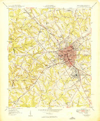
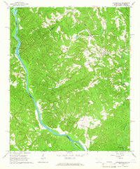
(25)- 1892 Map of Abbeville, 1900 Print
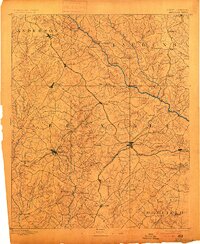 1892 Abbeville1900 Print · USGSCovers Abbeville County, including Greenwood, Laurens, and other nearby areas4 unique versions available
 - 1893 Map of Elberton
 1893 Elberton1893 Print · USGSCovers Abbeville County, including Anderson, Elberton, and other nearby areas5 unique versions available
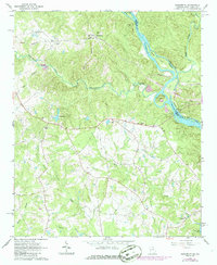
 - 1948 Map of Abbeville East
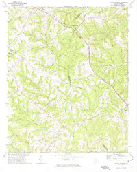
 1948 Abbeville East1948 Print · USGSCovers Abbeville County, including Abbeville, Darraugh, and other nearby areas
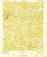
 - 1948 Map of Verdery, 1974 Print
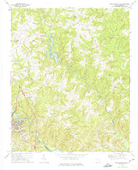
 1948 Verdery1974 Print · USGSCovers Abbeville County, including Clatworthy Crossroads, Cedar Springs, and other nearby areas
 - 1948 Map of Abbeville West, 1976 Print
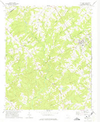
 1948 Abbeville West1976 Print · USGSCovers Abbeville County, including Abbeville, Sharon, and other nearby areas
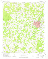
 - 1949 Map of Abbeville
 1949 Abbeville1949 Print · USGSCovers Abbeville County, including Abbeville, Sharon, and other nearby areas
 - 1949 Map of Calhoun Creek
 1949 Calhoun Creek1949 Print · USGSCovers Abbeville County, including Charleston Crossroads, Belcher Crossroads, and other nearby areas
 - 1949 Map of Greenwood
 1949 Greenwood1949 Print · USGSCovers Abbeville County, including Greenwood, Westover, and other nearby areas
 - 1950 Map of Verdery
 1950 Verdery1950 Print · USGSCovers Abbeville County, including Clatworthy Crossroads, Cedar Springs, and other nearby areas
 - 1950 Map of Abbeville East
 1950 Abbeville East1950 Print · USGSCovers Abbeville County, including Abbeville, Darraugh, and other nearby areas
 - 1954 Map of Greenville, 1965 Print
 1954 Greenville1965 Print · USGSCovers Abbeville County, including Athens, Greenville, and other nearby areas2 unique versions available
 - 1958 Map of Greenville
 1958 Greenville1958 Print · USGSCovers Abbeville County, including Athens, Greenville, and other nearby areas
 - 1964 Map of Iva
 1964 Iva1964 Print · USGSCovers Abbeville County, including Iva, Starr, and other nearby areas2 unique versions available
 - 1964 Map of Antreville, 1965 Print
 1964 Antreville1965 Print · USGSCovers Abbeville County, including Antreville, Lake Secession, and other nearby areas
 - 1964 Map of Lowndesville, 1965 Print
 1964 Lowndesville1965 Print · USGSCovers Abbeville County, including Lowndesville, Anderson County, and other nearby areas3 unique versions available
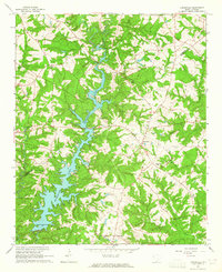
 - 1964 Map of Calhoun Falls, 1965 Print
 1964 Calhoun Falls1965 Print · USGSCovers Abbeville County, including Calhoun Falls, Mount Carmel, and other nearby areas3 unique versions available
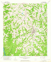
 - 1964 Map of Latimer, 1966 Print
 1964 Latimer1966 Print · USGSCovers Abbeville County, including Brownlee Crossroads, Latimer, and other nearby areas
 - 1964 Map of Heardmont, 1966 Print
 1964 Heardmont1966 Print · USGSCovers Abbeville County, including Pearl, Heardmont, and other nearby areas3 unique versions available
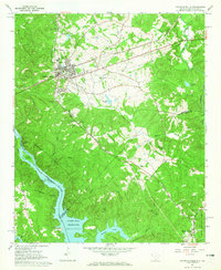
 - 1970 Map of Honea Path, 1975 Print
 1970 Honea Path1975 Print · USGSCovers Abbeville County, including Honea Path, Keowee, and other nearby areas
 - 1971 Map of Due West, 1975 Print
 1971 Due West1975 Print · USGSCovers Abbeville County, including Due West, Winona, and other nearby areas
 - 1971 Map of Ware Shoals East, 1975 Print
 1971 Ware Shoals East1975 Print · USGSCovers Abbeville County, including Ekom, Poplar Springs, and other nearby areas
 - 1971 Map of Shoals Junction, 1975 Print
 1971 Shoals Junction1975 Print · USGSCovers Abbeville County, including Due West, Donalds, and other nearby areas
 - 1971 Map of Ware Shoals West, 1975 Print
 1971 Ware Shoals West1975 Print · USGSCovers Abbeville County, including Honea Path, Donalds, and other nearby areas
 - 1978 Map of Greenwood, 1979 Print
 1978 Greenwood1979 Print · USGSCovers Abbeville County, including Greenwood, Westover, and other nearby areas
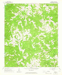
 - 1979 Map of Abbeville, 1980 Print
 1979 Abbeville1980 Print · USGSCovers Abbeville County, including Anderson, Greenwood, and other nearby areas2 unique versions available
End of results
Showing maps 1-25 of 25
Top cities of Abbeville County
- Abbeville historical maps
- Calhoun Falls historical maps
- Due West historical maps
- Donalds historical maps
- Lowndesville historical maps
Frequently asked questions
- What are the different types of historical maps available for Abbeville County?
- What is the oldest map of Abbeville County?
- Where can I purchase historical maps of Abbeville County for my home or office?
- Where can I download high-res historical maps of Abbeville County?
- Are there historical topographic maps available for Abbeville County?
- Is there historical aerial imagery available for Abbeville County?
- Where are historical maps of Abbeville County sourced from?