Old Maps of Abbeville County, South Carolina for Metal Detecting
Plan your next treasure hunt with 105 historic maps of Abbeville County. Find old homesites, ghost towns, trails, and gathering spots that may be lost to time — perfect for identifying promising metal detecting locations.
- Locate forgotten sites: Uncover places like long-lost settlements, abandoned rail lines, or gathering spots.
- Plan better hunts: Use map overlays combined with LiDAR or satellite views to narrow in on historically rich areas.
- Made for detectorists: Thousands of hobbyists use these maps to discover relics, coins, and hidden history.
Use these historic maps to boost your research and find new opportunities beneath the surface of Abbeville County.
Abbeville County, SC maps
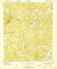
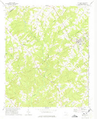
(105)- 1892 Map of Abbeville
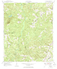
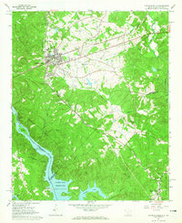
 1892 Abbeville1892 Print · USGSSouth Carolina’s Upstate during the late 1800s reveals a landscape defined by critical river crossings and the arrival of the steam era. Genealogists can trace family roots through localized sites like Smith Ferry, Maddox Mill, and the bustling rail hub of Greenwood.6 unique versions available
 - 1893 Map of Elberton
 1893 Elberton1893 Print · USGSThe Georgia-South Carolina borderlands come alive in the 1890s, centering on the river-and-rail economy of the Savannah Valley. Genealogists can trace family names and early community hubs through Browns Ferry, Coldwater Church, and Ruckersville.5 unique versions available
 - 1948 Map of Abbeville East
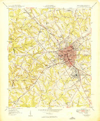
 1948 Abbeville East1948 Print · USGSAbbeville and its eastern rural fringes are documented here in the late 1940s before the continued growth of the national forest. Genealogists and local historians can trace family-named sites like Aiken Cem, the County Training Sch, and Millers Mill.
 - 1948 Map of Verdery, 1974 Print
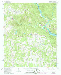
 1948 Verdery1974 Print · USGSThe rural Upstate during the late 1940s is detailed here as the timber and rail economy shaped the borderlands of Abbeville and Greenwood. Researchers can trace family sites near Clatworthy Crossroads or visit local landmarks like Long Cane Ch and the Bradley Bridge.
 - 1948 Map of Abbeville West, 1976 Print
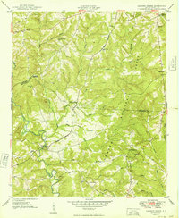
 1948 Abbeville West1976 Print · USGSAbbeville and its western rural surroundings are captured in the late 1940s, showing a landscape of small schools and country churches. Local researchers can locate historic family burial sites at Old Zion Cem and trace the path of the Seaboard Air Line railroad.
 - 1949 Map of Abbeville
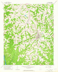
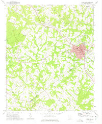
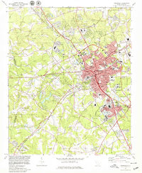
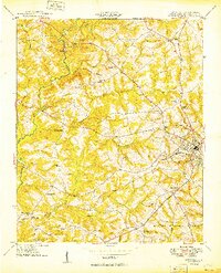 1949 Abbeville1949 Print · USGSAbbeville and its surrounding Piedmont countryside are captured here in the late 1940s, centered on the Seaboard Air Line railway. Genealogists and local historians can trace the locations of numerous rural landmarks, including Old Zion Cem, Upper Long Cane Ch, and Watts.2 unique versions available
 - 1949 Map of Calhoun Creek
 1949 Calhoun Creek1949 Print · USGSAbbeville and McCormick Counties are shown here just after the war, when the rural landscape was still dotted with one-room schoolhouses and local mills. Genealogists can trace family roots through sites like Calhoun Mill, Rock Buffalo Ch, and St Pauls Sch.
 - 1949 Map of Greenwood
 1949 Greenwood1949 Print · USGSGreenwood flourished as a major rail and textile crossroads in the late forties, its landscape defined by industrial villages and extensive trackage. Genealogists and historians can trace neighborhood roots through Lander College, the Connie Maxwell Childrens Home, and several mill villages.2 unique versions available
 - 1950 Map of Verdery
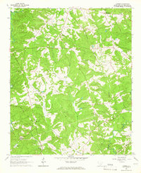
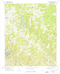
 1950 Verdery1950 Print · USGSMid-century Abbeville and Greenwood counties were defined by a dense network of country churches and forest management within the Sumter National Forest. Genealogists can trace family landmarks like Chisholm Cem, Cedar Springs Ch, and Clatworthy Crossroads.2 unique versions available
 - 1950 Map of Abbeville East
 1950 Abbeville East1950 Print · USGSAbbeville and the eastern Piedmont rural landscape are documented here at the midpoint of the century. Genealogists and local historians can trace family-named sites like Millers Mill, locate several rural schools such as Long Cane Sch, and find cemeteries including Aiken Cem and Big Adams Cem.2 unique versions available
 - 1954 Map of Greenville, 1965 Print
 1954 Greenville1965 Print · USGSThe Upstate and Northeast Georgia are captured here during a decade of massive transformation as new reservoirs reshaped the Piedmont. Genealogists and hikers can trace the Appalachian Trail over Brasstown Bald or locate old community centers like Demorest, Westminster, and Royston.3 unique versions available
 - 1958 Map of Greenville
 1958 Greenville1958 Print · USGSThe Piedmont and Blue Ridge foothills come alive in this mid-century survey of the Upstate and Northeast Georgia. Trace the regional rail-and-river economy through the Southern Railway corridors and early reservoir developments like Lake Sidney Lanier.
 - 1964 Map of Iva
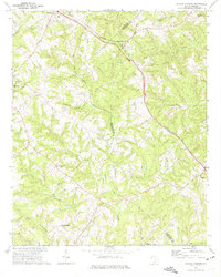
 1964 Iva1964 Print · USGSUpper South Carolina in the mid-sixties reveals a landscape of railroad towns and country congregations along the Georgia border. Genealogists can trace family footprints through numerous rural landmarks like Goodhope Cem, Barnes Station, and Pleasant Grove Ch.3 unique versions available
 - 1964 Map of Antreville, 1965 Print
 1964 Antreville1965 Print · USGSThe rural border of Abbeville and Anderson counties is captured here in the mid-sixties, centered on the winding waters of Secession Lake. Genealogists can locate numerous landmarks including the Antreville School, Hall-Cromer Cem, and Shiloh Ch.
 - 1964 Map of Lowndesville, 1965 Print
 1964 Lowndesville1965 Print · USGSThe South Carolina and Georgia borderlands near the Savannah River are captured here in the mid-1960s. Genealogists can trace family roots through numerous sites like Old McCalla Cemetery, Smyrna Church, and the Atlantic Coast Line rail corridor.3 unique versions available
 - 1964 Map of Calhoun Falls, 1965 Print
 1964 Calhoun Falls1965 Print · USGSCalhoun Falls and the Savannah River valley are documented here in the mid-sixties as the reservoir transformed the landscape. Trace rail history and family roots via the Atlantic Coast Line, McAllister Chapel, and the Ellison Sch.3 unique versions available
 - 1964 Map of Latimer, 1966 Print
 1964 Latimer1966 Print · USGSAbbeville County during the mid-1960s shows a landscape of established rail lines and quiet rural crossroads. Genealogists can trace family heritage through landmarks like Old Rocky River Cem and congregations at Brown Oaks Ch or Midway Ch.
 - 1964 Map of Heardmont, 1966 Print
 1964 Heardmont1966 Print · USGSElbert County, Georgia, and the South Carolina borderlands are captured here during a period of major infrastructure change in the mid-sixties. Genealogists and researchers can locate numerous country churches and schools like Hunters Chapel, Banks Sch, and New Hope Ch among the river shoals.3 unique versions available
 - 1970 Map of Honea Path, 1975 Print
 1970 Honea Path1975 Print · USGSHonea Path is shown at a period of transition in the early seventies, where rail lines and rural tradition meet. Genealogists can locate family landmarks like Garden of Memories, Jones Chapel, and the settlement of Craytonville.
 - 1971 Map of Due West, 1975 Print
 1971 Due West1975 Print · USGSThe Upstate South Carolina piedmont appears here in the early seventies, centered on the academic and historic hub of Due West. Genealogists and historians can trace deep-rooted community ties at Erskine College, Little River Ch, and the rural crossroads of Level Land.
 - 1971 Map of Ware Shoals East, 1975 Print
 1971 Ware Shoals East1975 Print · USGSLaurens County and the surrounding river country are documented here in the early seventies, centered on the industrial and community hubs of the Piedmont. Genealogists can trace family locations near Bethel Ch, Poplar Springs, and the Boyd Millpond shoreline.
 - 1971 Map of Shoals Junction, 1975 Print
 1971 Shoals Junction1975 Print · USGSThe rural Upstate South Carolina corridor comes into focus in the early seventies, centered on the Shoals Junction rail crossing. Genealogists can trace family roots at Gilgal Cem, Mt Zion Ch, and the growing communities of Due West and Arborville.
 - 1971 Map of Ware Shoals West, 1975 Print
 1971 Ware Shoals West1975 Print · USGSThe Saluda River valley in the early seventies shows a landscape defined by crossing county lines and rail connections. Researchers can trace family roots through the Turkey Creek Cem, visit the settlement of Blue Heaven, or locate the old Drive-in Theater.
 - 1978 Map of Greenwood, 1979 Print
 1978 Greenwood1979 Print · USGSGreenwood at the end of the 1970s shows a thriving regional hub where the SOUTHERN railroad meets a growing network of industrial and residential villages. Researchers can trace family sites at Promised Land, Lander College, and the Maxwell Childrens Home.
 - 1979 Map of Abbeville, 1980 Print
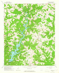
 1979 Abbeville1980 Print · USGSThe South Carolina and Georgia borderlands are captured here during a period of significant hydroelectric development and regional growth. Researchers can trace the rail-and-river economy through the Seaboard Coast Line and landmarks like Hartwell Dam or the Silk Mills.2 unique versions available
Showing maps 1-25 of 105
Top cities of Abbeville County
- Abbeville historical maps
- Calhoun Falls historical maps
- Due West historical maps
- Donalds historical maps
- Lowndesville historical maps
Frequently asked questions
- What are the different types of historical maps available for Abbeville County?
- What is the oldest map of Abbeville County?
- Where can I purchase historical maps of Abbeville County for my home or office?
- Where can I download high-res historical maps of Abbeville County?
- Are there historical topographic maps available for Abbeville County?
- Is there historical aerial imagery available for Abbeville County?
- Where are historical maps of Abbeville County sourced from?