1970s Maps of Barnwell County, South Carolina
Explore 10 historic maps of Barnwell County from the 1970s. These maps offer a rare glimpse into what life looked like during the 1970s — showing old roads, neighborhoods, homes, and landmarks that have changed or disappeared over time.
Whether you're researching your family's past, planning a metal detecting trip, or studying how Barnwell County's landscape evolved across the 1970s, these high-resolution maps are a powerful tool for exploring the history of this region.
- Focus on a specific era: All maps on this page are from the 1970s, giving you a focused view of this time period.
- See what’s changed: Compare century-old streets, trails, and buildings to today's modern landscape using overlays and satellite layers.
- Research with precision: Use these maps for genealogy, historical research, land use analysis, or educational projects.
- View, download, or print: Maps are fully viewable online in high resolution, and can be downloaded or printed for your own records.
Start exploring Barnwell County's history through authentic maps from the 1970s. This is your window into the past.
Barnwell County, SC maps
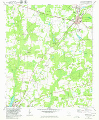
(10)- 1979 Map of Snelling
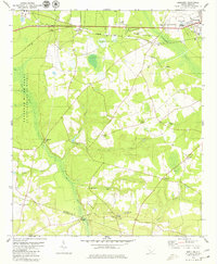 1979 Snelling1979 Print · USGSBarnwell County in the late seventies reveals the intersection of traditional lowcountry life and federal expansion. Genealogists and researchers can trace family landmarks like Holmes Cem, rural churches including Sweetwater Grove Ch, and the old crossroads at Boiling Springs.2 unique versions available
 - 1979 Map of Williston
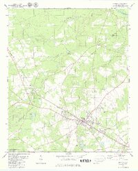 1979 Williston1979 Print · USGSBarnwell and Aiken Counties in the late seventies show a rural landscape shaped by the rail line and a strong network of country churches. Genealogists and local historians can trace legacy landmarks like Webb Millpond, Edwards Jr High Sch, and Rosemary Ch.2 unique versions available
 - 1979 Map of Martin
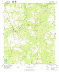 1979 Martin1979 Print · USGSThe Savannah River borderlands in the late 1970s reveal a landscape shaped by both federal energy operations and traditional rail-line settlements. Genealogists and local historians can trace rural community life through sites like Zion Hill Ch, Baldock, and the Seaboard Coast Line railroad.2 unique versions available
 - 1979 Map of Springfield
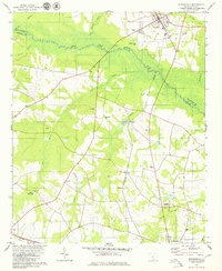 1979 Springfield1979 Print · USGSThe South Carolina Lowcountry comes into focus during the late seventies, centered on the tri-county junction of Aiken, Orangeburg, and Barnwell. Genealogists can locate family landmarks like Frost Branch Ch, the waters of Healing Springs, and the Southern rail corridor.
 - 1979 Map of Barnwell, 1980 Print
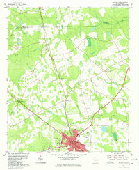
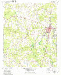
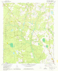
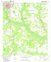 1979 Barnwell1980 Print · USGSBarnwell and the surrounding Lowcountry wetlands are documented here in the late seventies. Genealogists and historians can trace family locations near Hagoods Mill, small country churches like Friendship Ch, and the rural community of Yenome.2 unique versions available
 - 1979 Map of Allendale, 1980 Print
 1979 Allendale1980 Print · USGSAllendale and its surrounding Lowcountry farmland are captured here in the late seventies as the rail lines remained central to the region. Researchers can locate the University campus, rural crossroads like Appleton, and the Allen Chapel Cem.
 - 1979 Map of Denmark, 1980 Print
 1979 Denmark1980 Print · USGSBamberg County at the end of the 1970s reveals a landscape defined by crossing rail lines and rural education centers. Researchers can trace family roots through Voorhees College, Ghents Branch Ch, and the Honeyford Cem while following the SOUTHERN railroad through Lees.2 unique versions available
 - 1979 Map of Long Branch, 1980 Print
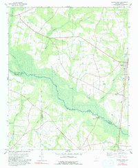
 1979 Long Branch1980 Print · USGSBarnwell County in the late seventies is captured here at the intersection of rural heritage and Cold War energy production. Researchers can trace family roots through numerous sites like Bates Cem and Rosemary Ch alongside the sprawling Savannah River Plant.2 unique versions available
 - 1979 Map of Blackville, 1980 Print
 1979 Blackville1980 Print · USGSBarnwell County in the late 1970s shows a landscape defined by traditional agriculture and established rail corridors. Genealogists can trace family landmarks and local institutions from Farrells Mill and Blackville Cem to St Albans Ch.2 unique versions available
 - 1979 Map of Norway West, 1991 Print
 1979 Norway West1991 Print · USGSThe rural landscape of South Carolina's low country is captured here in the late seventies, centered on the railroad town of Norway. Genealogists can trace local roots through numerous country churches and cemeteries like Bushy Pond Ch and Jericho Cem.
End of results
Showing maps 1-10 of 10
Top cities of Barnwell County
- Barnwell historical maps
- Williston historical maps
- Blackville historical maps
- Hilda historical maps
- Snelling historical maps
- Kline historical maps
See more
Frequently asked questions
- What are the different types of historical maps available for Barnwell County?
- What is the oldest map of Barnwell County?
- Where can I purchase historical maps of Barnwell County for my home or office?
- Where can I download high-res historical maps of Barnwell County?
- Are there historical topographic maps available for Barnwell County?
- Is there historical aerial imagery available for Barnwell County?
- Where are historical maps of Barnwell County sourced from?