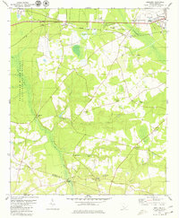
1979 Map of Snelling
USGS Topo · Published 1979About this map
Snelling and the surrounding Barnwell County countryside are defined by a complex network of blackwater streams and significant federal land use in the late 1970s. The western edge of the map is dominated by the Savannah River Plant, a massive restricted area that altered the traditional settlement patterns of the region. Outside the government boundary, rural life continues along the Seaboard Coast Line railroad, with numerous small congregations such as Union Ch and New Home Ch serving the local population. The landscape is crisscrossed by waterways like Gantts Mill Creek and Bodiford Mill Creek, which once powered local industry at sites like Patterson Mill. To the south, the map follows the swampy bottomlands of Three Runs toward the Barnwell Co Allendale Co border, providing a clear view of the area's transition from agricultural crossroads to a modern energy-sector buffer zone.
Find a feature on this map
34 named features on this map. Tap any name to fly to it.
Don’t see what you’re looking for? This feature index may not catch every label — zoom into the map to look around manually.
Map Details
Editions of this 1979 Snelling Map
2 editions found
Other maps of this area

1919 · Allendale
USGS Topo · 1:62,500

1920 · Ellenton
USGS Topo · 1:48,000

1920 · Talatha
USGS Topo · 1:48,000

1921 · Talatha
USGS Topo · 1:62,500

1921 · Ellenton
USGS Topo · 1:62,500

1923 · Williston
USGS Topo · 1:48,000

1927 · Williston
USGS Topo · 1:62,500

1943 · Allendale
USGS Topo · 1:62,500

1943 · Augusta East
USGS Topo · 1:125,000

1943 · Williston
USGS Topo · 1:62,500