1960s Maps of Barnwell County, South Carolina
Explore 10 historic maps of Barnwell County from the 1960s. These maps offer a rare glimpse into what life looked like during the 1960s — showing old roads, neighborhoods, homes, and landmarks that have changed or disappeared over time.
Whether you're researching your family's past, planning a metal detecting trip, or studying how Barnwell County's landscape evolved across the 1960s, these high-resolution maps are a powerful tool for exploring the history of this region.
- Focus on a specific era: All maps on this page are from the 1960s, giving you a focused view of this time period.
- See what’s changed: Compare century-old streets, trails, and buildings to today's modern landscape using overlays and satellite layers.
- Research with precision: Use these maps for genealogy, historical research, land use analysis, or educational projects.
- View, download, or print: Maps are fully viewable online in high resolution, and can be downloaded or printed for your own records.
Start exploring Barnwell County's history through authentic maps from the 1960s. This is your window into the past.
Barnwell County, SC maps
(10)- 1961 Map of Augusta
 1961 Augusta1961 Print · USGSThe South Carolina lowcountry and CSRA appear here in the early sixties, during a period of massive military and industrial growth. Researchers can trace the development of the Savannah River Plant or locate legacy landmarks like Nelson Ferry and Magnolia Cemetery.2 unique versions available
 - 1962 Map of Augusta
 1962 Augusta1962 Print · USGSThe South Carolina and Georgia borderlands are seen here in the early sixties, showing the rise of the Savannah River Plant and the expansion of Fort Jackson. Researchers can trace old rail lines like the Southern Railway and find landmarks such as St. Pauls Church or the Santee Canal.
 - 1963 Map of New Ellenton SE, 1967 Print
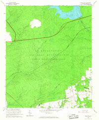
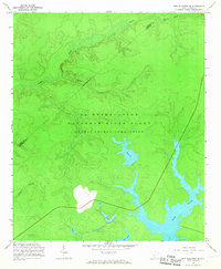 1963 New Ellenton SE1967 Print · USGSBarnwell County was undergoing a massive industrial transformation in the early sixties as federal operations expanded. Local researchers can trace the development of the Savannah River Plant and its impact on waterways like Par Pond and Tinker Creek.3 unique versions available
 - 1964 Map of Girard NW, 1965 Print
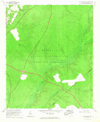
 1964 Girard NW1965 Print · USGSThe Savannah River valley during the mid-sixties reveals a landscape transformed by the Savannah River Plant. Researchers can trace the path of the Atlantic Coast Line and various waterways like Upper Three Runs and Pen Branch through this high-security zone.4 unique versions available
 - 1964 Map of Girard, 1965 Print
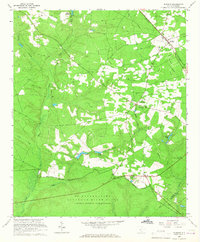
 1964 Girard1965 Print · USGSGirard and the Savannah River shoreline are captured here in the mid-1960s as rural Georgia life met the expanding atomic age. Researchers can locate numerous family burial sites like Heath Cem and historic river landings including Griffins Landing.3 unique versions available
 - 1964 Map of Millett, 1967 Print
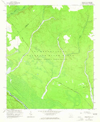
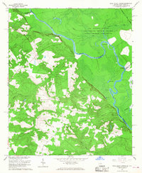
 1964 Millett1967 Print · USGSThe Savannah River valley in the early 1960s reveals a rural landscape adapting to the massive presence of the Savannah River Plant. Genealogists and historians can trace community hubs like Millett and Dunbar Store alongside landmarks like Zion Grove Ch.2 unique versions available
 - 1964 Map of Girard NE, 1967 Print
 1964 Girard NE1967 Print · USGSBarnwell and Allendale Counties are captured here during the mid-sixties, dominated by the high-security landscape of the Savannah River nuclear site. Researchers can trace the Atlantic Coast Line and locate the isolated Walker Cem near Par Pond.3 unique versions available
 - 1965 Map of New Ellenton SW, 1967 Print
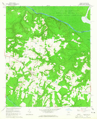
 1965 New Ellenton SW1967 Print · USGSAiken and Barnwell counties appear here during the mid-1960s height of the Cold War, dominated by federal restricted lands. Researchers can trace the intersection of old rural landmarks like Green Pond Ch with the massive U S Reservation.3 unique versions available
 - 1965 Map of Windsor, 1967 Print
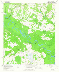
 1965 Windsor1967 Print · USGSWindsor and the rural communities of Aiken County appear here during the mid-1960s expansion of the nuclear age. Researchers can locate local landmarks like Beulah Grove Ch and Tarrants Millpond alongside the secured U S Reservation boundary.2 unique versions available
 - 1965 Map of Shell Bluff Landing, 1968 Print
 1965 Shell Bluff Landing1968 Print · USGSThe Savannah River borderlands in the 1960s reveal the intersection of federal atomic energy sites and rural Georgia life. Researchers can trace family history through sites like Daniel Grove Ch, Allens Chapel, and the historic Shell Bluff Landing.3 unique versions available
End of results
Showing maps 1-10 of 10
Top cities of Barnwell County
- Barnwell historical maps
- Williston historical maps
- Blackville historical maps
- Hilda historical maps
- Snelling historical maps
- Kline historical maps
See more
Frequently asked questions
- What are the different types of historical maps available for Barnwell County?
- What is the oldest map of Barnwell County?
- Where can I purchase historical maps of Barnwell County for my home or office?
- Where can I download high-res historical maps of Barnwell County?
- Are there historical topographic maps available for Barnwell County?
- Is there historical aerial imagery available for Barnwell County?
- Where are historical maps of Barnwell County sourced from?