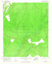
1965 Map of New Ellenton SW
USGS Topo · Published 1967About this map
The Savannah River Plant (Atomic Energy Commission) dominates this mid-1960s landscape, illustrating the cold-war era industrialization of the South Carolina backcountry. Classified as a U S Reservation, the terrain is defined by controlled access roads and the restricted nature of the Atomic Energy Commission's operations. Amidst the specialized infrastructure, remnants of older rural life appear at the periphery, such as Green Pond Ch near the northwestern boundary. The natural drainage system, including the serpentine path of Upper Three Runs, Tinker Cr, and Fourmile Branch, remains central to the geography even as the land was repurposed for nuclear materials production. This sheet captures a critical moment when Aiken and Barnwell counties were transformed by federal enterprise, showing where the Aiken Co Barnwell Co line meets the sprawling security perimeter.
Find a feature on this map
9 named features on this map. Tap any name to fly to it.
Don’t see what you’re looking for? This feature index may not catch every label — zoom into the map to look around manually.
Map Details
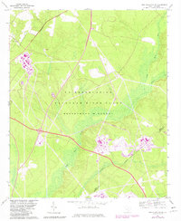
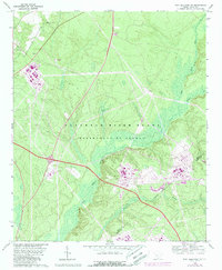
Editions of this 1965 New Ellenton SW Map
3 editions found
Other maps of this area

1920 · Ellenton
USGS Topo · 1:48,000

1920 · Greens Cut
USGS Topo · 1:62,500

1920 · Talatha
USGS Topo · 1:48,000

1921 · Augusta
USGS Topo · 1:62,500

1921 · Talatha
USGS Topo · 1:62,500

1921 · Ellenton
USGS Topo · 1:62,500

1943 · Greens Cut
USGS Topo · 1:62,500

1943 · Augusta East
USGS Topo · 1:125,000

1943 · Talatha
USGS Topo · 1:62,500

1943 · Augusta
USGS Topo · 1:62,500