Old Maps of Charleston, South Carolina for Academic Research
Study the evolution of Charleston with 86 high-resolution historic maps. Whether you're teaching, researching, or modeling changes in land use, these maps provide essential visual documentation of urban, environmental, and geographic change.
- Analyze long-term change: Track patterns in development, transportation, and natural features.
- Ideal for environmental or urban studies: Support academic projects with primary historical map data.
- Use in the classroom or lab: Educators and researchers rely on these maps to bring historical context to life.
These maps are a powerful tool for teaching, research, and visualizing how Charleston has changed over the decades.
Charleston, SC maps
(86)- 1919 Map of Johns Island
 1919 Johns Island1919 Print · USGSCoastal South Carolina at the end of the Great War reveals a landscape of riverfront estates and military remnants. Genealogists and historians can trace family-named stops and rural institutions like Drayton Hall, St Andrews School No 10, and the Bula Mines.2 unique versions available
 - 1919 Map of The Jetties
 1919 The Jetties1919 Print · USGSCoastal Charleston and the harbor entrance appear in this military-led survey from the era following the First World War. Maritime historians can trace the engineering of the North Jetty and South Jetty alongside the northern reaches of Morris Island.4 unique versions available
 - 1919 Map of Wadmelaw Island
 1919 Wadmelaw Island1919 Print · USGSCoastal South Carolina is mapped here just after the Great War, showing a landscape of sea island plantations and tidal waterways. Researchers can locate remote settlements like Rockville and Legareville, as well as rural landmarks like Crate Mill and St Johns Church.2 unique versions available
 - 1919 Map of Wando
 1919 Wando1919 Print · USGSCoastal Berkeley and Charleston Counties come alive in this survey from just after the Great War. Genealogists can locate family landmarks like St Matthews Church, trace the winding Lumber R. R., or find old river access at Lachicotte Landing.5 unique versions available
 - 1919 Map of Melgrove
 1919 Melgrove1919 Print · USGSThe South Carolina lowcountry emerges in detail during the post-WWI era as industry begins to touch the Cooper River. Genealogists can trace early neighborhood footprints in North Charleston or locate rural landmarks like St.Johns Church and Redbank Landing.3 unique versions available
 - 1919 Map of Charleston
 1919 Charleston1919 Print · USGSCoastal South Carolina thrives at the height of its naval and rail importance in the years following the Great War. Genealogists and historians can trace the development of the Navy Yard and local landmarks like Castle Pinckney and Magnolia Cem.3 unique versions available
 - 1919 Map of James Island
 1919 James Island1919 Print · USGSThe marshlands and small coastal communities of James Island are documented here at the end of the Great War. Genealogists and historians can trace old homesteads and roads through Centerville, find the Payne Chapel, and locate maritime landmarks like the Charleston LH.2 unique versions available
 - 1919 Map of Fort Moultrie
 1919 Fort Moultrie1919 Print · USGSThe Charleston coast at the end of the Great War reveals a landscape of strategic coastal fortifications and early island settlements. Genealogists and historians can trace the layouts of Moultrieville, Mt Pleasant, and the grounds of Fort Moultrie.3 unique versions available
 - 1919 Map of Legareville
 1919 Legareville1919 Print · USGSCoastal Charleston County comes to life in the years following the Great War, showing the intricate salt marshes and islands before modern development. Genealogists can locate family homes and community centers like Legareville, Sandhill School, and Mt Zion Church.2 unique versions available
 - 1920 Map of Ravenels
 1920 Ravenels1920 Print · USGSThe Ashley River and its surrounding swamps were the heart of this Lowcountry landscape just after the First World War. Researchers can trace the footprints of Old Dorchester, the operations at Bula Mines, and the unique Tyler Tea Farm.3 unique versions available
 - 1940 Map of Melgrove
 1940 Melgrove1940 Print · USGSThe South Carolina lowcountry near Charleston appears here just before the mid-century industrial boom. Researchers can locate community anchors like St Johns Ch, the No 6 School, and the rail stop at Inness Sta along the SOUTHERN line.
 - 1943 Map of Fort Moultrie
 1943 Fort Moultrie1943 Print · USGSThe Charleston coast at the height of the war reveals a landscape of tactical significance and growing seaside communities. Genealogists and historians can trace old homesteads near Porchers Bluff or locate the Atlanticville P O and Sevenmile Sch.2 unique versions available
 - 1943 Map of Legareville
 1943 Legareville1943 Print · USGSThe South Carolina lowcountry islands are captured here during the 1940s, showing a world of tidal creeks and rural island life. Genealogists can trace family footprints at Legareville, Miller Hill, and local landmarks like Sandhill School and Zion Church.2 unique versions available
 - 1943 Map of James Island
 1943 James Island1943 Print · USGSCoastal South Carolina comes alive in the mid-1940s, revealing a landscape of tidal marshes and early island settlements. Trace family roots and maritime history through Secessionville, Payne Chapel, and the Morris Island Coast Guard Station.2 unique versions available
 - 1943 Map of Wando
 1943 Wando1943 Print · USGSThe Lowcountry river system near Wando and Cainhoy is captured here during the mid-forties, showing the intricate tidal creeks and rural landings of the era. Genealogists and local historians can locate family landmarks like St Pauls Ch, Philips Sch, and the winding Lumber Railroad.3 unique versions available
 - 1944 Map of Ravenels
 1944 Ravenels1944 Print · USGSCoastal South Carolina just before the war's end reveals a landscape of tidal rivers and deep-rooted settlements. Trace the footprints of the past at Old Dorchester, locate family homesteads near Poppenheim Crossing, or find long-vanished industry at the Bula Mines.
 - 1944 Map of Wadmelaw Island
 1944 Wadmelaw Island1944 Print · USGSThe South Carolina Lowcountry islands are captured here in the early twentieth century, showing a landscape of tidal creeks and remote coastal settlements. Genealogists can locate family landmarks such as Rockville, Legareville, and several country schools like Bogle School.2 unique versions available
 - 1947 Map of Savannah
 1947 Savannah1947 Print · USGSCoastal Georgia and South Carolina are captured here in the mid-forties, showing the rail-and-river networks of the Lowcountry. Genealogists and researchers can trace old crossroads and river towns from Statesboro to Beaufort, alongside military sites like Camp Stewart and Parris Island.
 - 1948 Map of James Island
 1948 James Island1948 Print · USGSThe South Carolina coast around the harbor city appeared in this postwar period as a network of naval defenses and established sea island communities. Trace the roads and waterways connecting Charleston to Fort Sumter, Mt Pleasant, and the Isle of Palms.2 unique versions available
 - 1948 Map of Johns Island
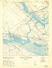 1948 Johns Island1948 Print · USGSThe Ashley and Stono River corridors appear here during the late 1940s, showing a landscape defined by historic estates and heavy rail traffic. Genealogists can trace family landmarks and early communities like Eightmile House, Drayton, and Bull Chapel.3 unique versions available
 - 1948 Map of Savannah
 1948 Savannah1948 Print · USGSThe Georgia and South Carolina Lowcountry comes alive in this post-war survey of the coast and its river-fed hinterlands. Genealogists and historians can trace rail lines like the Central of Georgia RR and find established settlements such as Isle of Hope and Sylvania.
 - 1948 Map of Charleston
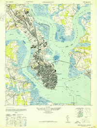 1948 Charleston1948 Print · USGSCharleston’s peninsula and harbor are shown at their mid-century industrial peak, from the historic city core to the sprawling naval works. Genealogists and historians can trace old settlements like Fourmile House, find the Horse Pond P O, or locate harbor defenses at Castle Pinckney.2 unique versions available
 - 1957 Map of Savannah, 1967 Print
 1957 Savannah1967 Print · USGSThe Lowcountry and Georgia coastal plain are shown here in the late fifties, prior to modern expansion. Researchers can trace the rail-and-river economy through the Central of Georgia lines and the Ogeechee River wetlands.4 unique versions available
 - 1958 Map of North Charleston, 1959 Print
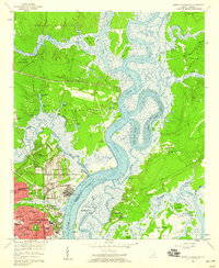 1958 North Charleston1959 Print · USGSNorth Charleston in the late fifties shows a booming industrial and military hub defined by its riverfront access. Researchers can trace the mid-century development of Park Circle, the massive Port Terminal, and community cornerstones like the Orphanage and Oak Terrace Sch.4 unique versions available
 - 1958 Map of Johns Island, 1959 Print
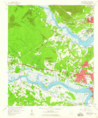 1958 Johns Island1959 Print · USGSThe Lowcountry landscape west of Charleston comes to life in the late fifties, showing a mix of historic river estates and postwar growth. Genealogists and historians can trace local landmarks like Drayton Hall, Fort Bull, and the Stono Sta rail stop.5 unique versions available
Showing maps 1-25 of 86
Top cities near Charleston
- North Charleston historical maps
- Mount Pleasant historical maps
- Summerville historical maps
- Goose Creek historical maps
- Hanahan historical maps
- Hollywood historical maps
See more
Top neighborhoods of Charleston
- Oakcrest historical maps
- Kings Acres historical maps
- Stono historical maps
- Riverpoint historical maps
- Three Trees historical maps
- Ashley Hall Manor historical maps
See more
Frequently asked questions
- What are the different types of historical maps available for Charleston?
- What is the oldest map of Charleston?
- Where can I purchase historical maps of Charleston for my home or office?
- Where can I download high-res historical maps of Charleston?
- Are there historical topographic maps available for Charleston?
- Is there historical aerial imagery available for Charleston?
- Where are historical maps of Charleston sourced from?