Old Maps of Dillon County, South Carolina for Hiking & Exploration
Hike through history with 101 historic maps of Dillon County. Explore old trails, ghost towns, and forgotten backroads — perfect for outdoor adventurers and local explorers.
- Rediscover forgotten places: Map out old mining camps, roads, and footpaths that no longer exist on modern maps.
- Layer with modern tools: Combine with LiDAR or satellite views to plan hikes through historical terrain.
- Made for exploration: Popular among hikers, overlanders, and local history lovers.
Use these maps to find adventure and explore the hidden past of Dillon County.
Dillon County, SC maps
(101)- 1940 Map of Florence East, 1971 Print
 1940 Florence East1971 Print · USGSThe Pee Dee region just before the Second World War shows a landscape defined by riverside landings and rural rail stops. Genealogists can locate family-named landmarks and community hubs like Browns Old Mill, Tabernacle Sch, and Hewitt Cem.
 - 1942 Map of Rockingham, 1944 Print
 1942 Rockingham1944 Print · USGSThe North Carolina and South Carolina borderlands come alive in this wartime survey of the Pee Dee River valley. Researchers can trace historic mill sites like Burnt Factory Pond or locate family landmarks such as Roberdell and Old Sneedsboro.
 - 1943 Map of Pages Mill
 1943 Pages Mill1943 Print · USGSThe Carolina borderlands come alive in the 1940s, showing a landscape shaped by the Lumber River and the Atlantic Coast Line railroad. Genealogists can trace family names through numerous rural landmarks like Oliver Cross Roads, Tabernacle Ch, and White Pond Ch & Sch.
 - 1943 Map of Gum Swamp
 1943 Gum Swamp1943 Print · USGSCoastal plain settlements and river islands define the Pee Dee region during the early years of World War II. Researchers can locate rural hubs like Bethea Cross Roads and trace family history through landmarks like Lower Marlboro High School and Annarate Church.2 unique versions available
 - 1945 Map of Florence East
 1945 Florence East1945 Print · USGSThe Pee Dee region of South Carolina was a web of rail lines and river landings in the years following the second World War. Researchers can trace the heritage of local communities at Browns Old Mill, Mars Bluff, and rural schoolhouses like Red Hill Sch.2 unique versions available
 - 1953 Map of Florence, 1964 Print
 1953 Florence1964 Print · USGSThe Carolina borderlands in the mid-fifties were a landscape of vast river swamps and rising rail towns. Trace the legacy of the Seaboard Air Line through Florence or explore the wetlands surrounding Lake Waccamaw and the Green Swamp.3 unique versions available
 - 1954 Map of Florence
 1954 Florence1954 Print · USGSThe Carolinas borderlands come alive in the early fifties, showing the vital rail-and-river networks of the coastal plain. Genealogists can trace family footprints across the Green Swamp or through settlements like Red Springs, Chadbourn, and McColl.
 - 1959 Map of Fork, 1961 Print
 1959 Fork1961 Print · USGSThe rural lowcountry of the Pee Dee region is captured here in the late fifties, showing a landscape of small farming communities and timbered wetlands. Genealogists can trace family footprints near Floydale, Spring Grove Ch, and the Watson Cem.
 - 1960 Map of Latta, 1961 Print
 1960 Latta1961 Print · USGSDillon and Marion Counties are captured here in the early 1960s, showing a rural landscape defined by the Atlantic Coast Line railroad. Genealogists can trace family landmarks like Magnolia Cem, Sardis Ch, and the outlying settlement of Temperance Hill.2 unique versions available
 - 1960 Map of Dillon East, 1961 Print
 1960 Dillon East1961 Print · USGSDillon and its rural hinterlands sat at a vital railway junction just as the mid-century era was transforming the Carolina coastal plain. Researchers can trace family sites from Rose Hill Cem to Carmichael Crossroads and locate schools like Gordon High School.2 unique versions available
 - 1960 Map of Dillon West, 1961 Print
 1960 Dillon West1961 Print · USGSDillon and its western rural hinterland are captured here in the early sixties as the railroad era met the growing highway network. Genealogists can locate family landmarks like Afford Cem, Mt Holly Cem, and old country schools like Maple Sch.2 unique versions available
 - 1962 Map of Fair Bluff, 1964 Print
 1962 Fair Bluff1964 Print · USGSThe borderlands of the Carolinas come alive in the early sixties as the Lumber River and Atlantic Coast Line Railroad define the local economy. Researchers can trace rural lineages through Powell Cem, Turner Chapel, and the vanished tracks near Marietta.2 unique versions available
 - 1962 Map of Lake View, 1964 Print
 1962 Lake View1964 Print · USGSThe South Carolina and North Carolina borderlands are captured here in the early sixties, showing the transition from old rail corridors to a landscape of millponds and rural crossroads. Genealogists can trace family landmarks like High Hill Crossroads, Pages Millpond, and Squires Pork Church.
 - 1962 Map of Gaddysville, 1964 Print
 1962 Gaddysville1964 Print · USGSThe North Carolina and South Carolina borderlands in the early sixties reveal a landscape of family farms and wetland bays. Trace ancestral roots at Piney Grove Indian Ch or explore the rural hubs of Gaddysville and Hammond Crossroads.
 - 1962 Map of Fair Bluff, 1965 Print
 1962 Fair Bluff1965 Print · USGSThe Carolina borderlands near the Lumber River are captured here in the early sixties, showing a landscape defined by elliptical bays and winding swamp systems. Genealogists can trace family names and local sites like Piney Grove Indian Ch, Pages Millpond, and the Atlantic Coast Line Railroad.
 - 1971 Map of Minturn, 1975 Print
 1971 Minturn1975 Print · USGSThe Carolina borderlands near the start of the 1970s show a landscape shaped by river crossings and rural parish life. Genealogists and historians can trace family locations through landmarks like Minturn, Sinclair Crossroads, and the Seaboard Coast Line railroad.
 - 1972 Map of Clio, 1975 Print
 1972 Clio1975 Print · USGSCoastal plain agriculture and rail-side commerce define this South Carolina landscape during the early seventies. Genealogists can trace family footprints through numerous rural landmarks like Old Clio Ch, Lucas Cem, and the crossroads at Five Forks.
 - 1972 Map of Oak Grove, 1975 Print
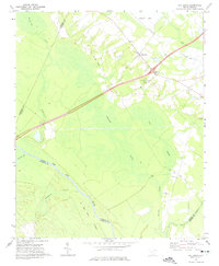 1972 Oak Grove1975 Print · USGSDillon County at the start of the 1970s is a landscape of expansive wetlands and river-bottom timber defined by the winding Pee Dee River. Researchers can trace old transportation corridors along the Old RR Grade and locate rural landmarks like Bethesda Ch or Haselden Cem.2 unique versions available
 - 1972 Map of Bingham, 1975 Print
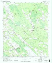 1972 Bingham1975 Print · USGSThe wetlands and rural settlements of the Marlboro and Dillon county border are detailed here during the early seventies. Genealogists and local historians can trace the Old Railroad Grade and locate family landmarks like Victory Temple and Bingham.2 unique versions available
 - 1972 Map of Rowland, 1976 Print
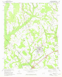 1972 Rowland1976 Print · USGSThe North Carolina and South Carolina borderlands were a patchwork of tobacco fields and swampy timberlands in the early seventies. Genealogists can trace family footprints through numerous rural landmarks like Alfordsville, Salem Ch, and the Baker Cem.2 unique versions available
 - 1972 Map of Witherspoon Island, 1976 Print
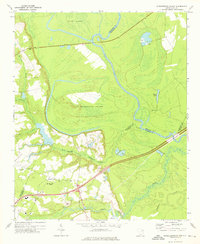 1972 Witherspoon Island1976 Print · USGSThe Pee Dee River lowlands come to life in the early 1970s, showcasing the intricate water systems surrounding Witherspoon Island. Researchers can trace local family landmarks near Blacks, including Century Ch and Cem, or locate industrial sites like the Fish Hatchery.2 unique versions available
 - 1976 Map of Dillon East
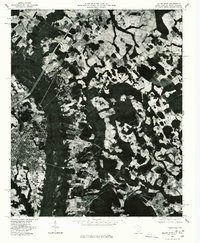 1976 Dillon East1976 Print · USGSDillon and the surrounding Carolina borderlands are captured from the air during the mid-seventies, showing the region's agricultural and industrial patterns. Local historians can trace the development of Dillon or locate smaller settlements like Hamer and Stewarts Crossroads.2 unique versions available
 - 1976 Map of Gaddysville, 1978 Print
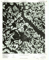 1976 Gaddysville1978 Print · USGSRobeson County near the South Carolina line is seen here in the mid-seventies through detailed aerial orthophotography. Researchers can trace rural settlement patterns and field boundaries around Gaddysville, Five Forks, and White Pond.
 - 1976 Map of Minturn, 1978 Print
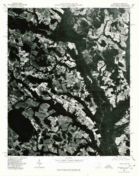 1976 Minturn1978 Print · USGSThe Carolina borderlands come into focus in the mid-seventies through this detailed aerial orthophoto. Local historians and genealogists can trace property lines and land use patterns around Minturn, Crossroads, and the Little Pee Dee River.
 - 1976 Map of Fair Bluff, 1978 Print
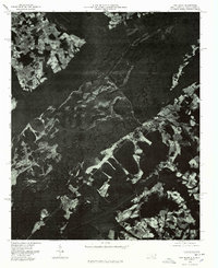 1976 Fair Bluff1978 Print · USGSThe Lumber River basin comes into sharp focus during the mid-seventies, showing the intersection of North and South Carolina. Researchers can trace the river's path past Fair Bluff or locate smaller outposts like Marietta and Causey.
Showing maps 1-25 of 101
Top cities of Dillon County
Frequently asked questions
- What are the different types of historical maps available for Dillon County?
- What is the oldest map of Dillon County?
- Where can I purchase historical maps of Dillon County for my home or office?
- Where can I download high-res historical maps of Dillon County?
- Are there historical topographic maps available for Dillon County?
- Is there historical aerial imagery available for Dillon County?
- Where are historical maps of Dillon County sourced from?