1910s Maps of Dorchester County, South Carolina
Explore 5 historic maps of Dorchester County from the 1910s. These maps offer a rare glimpse into what life looked like during the 1910s — showing old roads, neighborhoods, homes, and landmarks that have changed or disappeared over time.
Whether you're researching your family's past, planning a metal detecting trip, or studying how Dorchester County's landscape evolved across the 1910s, these high-resolution maps are a powerful tool for exploring the history of this region.
- Focus on a specific era: All maps on this page are from the 1910s, giving you a focused view of this time period.
- See what’s changed: Compare century-old streets, trails, and buildings to today's modern landscape using overlays and satellite layers.
- Research with precision: Use these maps for genealogy, historical research, land use analysis, or educational projects.
- View, download, or print: Maps are fully viewable online in high resolution, and can be downloaded or printed for your own records.
Start exploring Dorchester County's history through authentic maps from the 1910s. This is your window into the past.
Dorchester County, SC maps
(5)- 1918 Map of Cottageville
 1918 Cottageville1918 Print · USGSThe Lowcountry river basins of Colleton and Dorchester counties are shown here just after the Great War, when the Edisto River was a central geographic divider. Researchers can trace rural life through dozens of named landmarks like Sullivans Church, Metz Store, and Burnt Church Crossroads.3 unique versions available
 - 1919 Map of Ladson
 1919 Ladson1919 Print · USGSThe South Carolina lowcountry is captured here just after the Great War, showing a landscape of riverfront estates and rail-connected settlements. Researchers can trace the grounds of Magnolia Gardens or locate rural centers like Ladson and Otranto.2 unique versions available
 - 1919 Map of Summerville
 1919 Summerville1919 Print · USGSSummerville and the surrounding Lowcountry wetlands are captured here just after the Great War, during a period of established rail reliance and rural growth. Genealogists and researchers can trace local landmarks like St Johns Church, the Clemson Coast Express Station, and numerous early school sites including Barrow School.
 - 1919 Map of Ridgeville
 1919 Ridgeville1919 Print · USGSCoastal South Carolina at the end of the Great War era reveals a landscape of dense swamps and rail-side settlements. Genealogists can trace family roots through numerous local landmarks like Cypress Camp Meeting Grounds, Mudville School, and Limestone Church.
 - 1919 Map of Lodge, 1974 Print
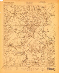
 1919 Lodge1974 Print · USGSCoastal plain life in the early twentieth century is mapped here through its river-reliant settlements and extensive swamp networks. Genealogists can trace family footprints across dozens of local landmarks like Lodge, Smoaks, and Zion Church.
End of results
Showing maps 1-5 of 5
Top cities of Dorchester County
- Summerville historical maps
- Ridgeville historical maps
- Harleyville historical maps
- Reevesville historical maps
Frequently asked questions
- What are the different types of historical maps available for Dorchester County?
- What is the oldest map of Dorchester County?
- Where can I purchase historical maps of Dorchester County for my home or office?
- Where can I download high-res historical maps of Dorchester County?
- Are there historical topographic maps available for Dorchester County?
- Is there historical aerial imagery available for Dorchester County?
- Where are historical maps of Dorchester County sourced from?